
Viewpoints · East Midlands
Bennerley Viaduct
In or near West Hallam.
Bennerley Viaduct is a viewpoint in the United Kingdom.

Christine Johnstone — CC BY-SA 2.0 via Wikimedia Commons licence

Plan your visit
- Typical visit
- 20 min–45 min
- Best time of year
- Clear days year-round
- Nearest railway station
- Ilkeston · 1.2 km
- Free entry
- Dog-friendly
Getting there & planning your visit
To visit Bennerley Viaduct, the nearest railway station is Ilkeston, located 1.2 km away. The postcode for sat-nav is NG16 2AE, and entry is free.
About
Bennerley Viaduct is a named viewpoint in Nottinghamshire, the East Midlands, marked on Ordnance Survey maps for its outlook. It sits within the Broxtowe parliamentary constituency. The nearest railway station is Ilkeston, about 1.2 km away. Postcode area NG16.
Photo gallery
From the Wikipedia article
Bennerley Viaduct (originally Ilkeston Viaduct and known informally as the Iron Giant) is a former railway bridge, now a foot and cycle bridge, between Ilkeston, Derbyshire, and Awsworth, Nottinghamshire, in central England. It was completed in 1877 and carried the Great Northern Railway's (GNR) Derbyshire Extension over the River Erewash, which forms the county boundary, and its wide, flat valley. The engineer was Samuel Abbott, who worked under Richard Johnson, the GNR's chief engineer. The site required a bespoke design as the ground would not support a traditional masonry viaduct due to extensive coal mining. The viaduct consists of 16 spans of wrought iron, lattice truss girders, carried on 15 wrought iron piers which are not fixed to the ground but are supported by brick and ashlar bases. The viaduct is 60 feet (18 metres) high, 26 feet (8 metres) wide between the parapets, and over a quarter of a mile (400 metres) long. It was once part of a chain of bridges and embankments carrying the railway for around two miles (three kilometres) across the valley but most of its supporting structures were demolished when the line closed in 1968. The only similar surviving bridge in the United Kingdom is Meldon Viaduct in Devon. The viaduct opened in January 1878. Its working life was uneventful except for minor damage inflicted by a Zeppelin bombing raid during the First World War. Plans to demolish the viaduct failed because of the cost of dismantling the ironwork and it became a listed building in 1974. After closure, the viaduct received little maintenance and fell into disrepair. Railway Paths, a walking and cycling charity, acquired it for preservation in 2001 but work faltered due to a lack of funding. The viaduct was listed on the Heritage at Risk Register in 2007 and the 2020 World Monuments Watch for its condition and lack of use. A detailed survey was undertaken in 2016 and funding for restoration work was secured in 2019. The work included rebuilding an…
Excerpt from Wikipedia under CC BY-SA 4.0. See the source article linked in Sources below.
Background
History
Construction on the viaduct began with the foundations in May 1876 and the work was completed 18 months later in November 1877. The railway line opened in January 1878. The viaduct's operational life was largely uneventful. In the 1960s, the British railway industry, which had been nationalised in 1948, was in decline and the Derbyshire Extension was considered unnecessarily duplicative. Passenger services were withdrawn in 1964 and Bennerley Viaduct closed altogether, along with the rest of the line, in 1968 as a result of the Beeching cuts. Most of the other structures carrying the line across the valley were demolished. A contractor was appointed to demolish Bennerley Viaduct but wrought…
Description
According to Graeme Bickerdike, writing in 2016 in the magazine Rail Engineer, the design was based on the , opened in 1864, in central France. Because of the corrugated surface provided by the troughs, the volume of track ballast required was half that of a traditional flat-decked bridge. The rails were not fixed to the bridge deck, instead lying directly on the ballast. The bridge deck is enclosed by low wrought-iron latticework parapets. It was once the central (and longest) part of a roughly 2 mile section of raised line over the Erewash Valley. The valley was approached on embankments at each end. At the western (Ilkeston) end, another iron bridge, supported on Bennerley Viaduct's…
Sourced from Wikipedia under CC BY-SA 4.0.
- Coordinates
- 52.9900, -1.2937
- County
- Nottinghamshire
- District
- Broxtowe
- Parish
- Awsworth
- Postcode
- NG16 2AE
- Parliamentary constituency
- Broxtowe
- Nearest railway station
- Ilkeston — 1.2 km
- Opening
- January 1878
Sources
- osm: n9439864688 (ODbL)
- wikipedia: Bennerley Viaduct (CC BY-SA 4.0)
Other places nearby

Bennerley Viaduct
Historic bridges · 0.2 km

Awsworth War Memorial
Memorials & monuments · 0.8 km

Cossall
Villages · 1.5 km

Lt Colonel Brian Duncan Shaw MM BSc PhD DSc (Hon) 1898-1999
Memorials & monuments · 1.6 km

King's Picture House
Theatres · 1.7 km

Cossall War Memorial
Memorials & monuments · 1.8 km
Cossall Waterloo Memorial
Memorials & monuments · 1.8 km
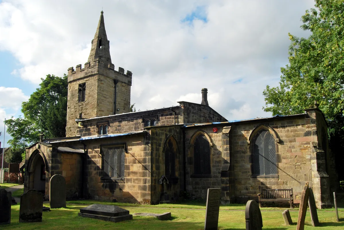
St Catherine's Church, Cossall
Historic churches · 1.8 km

Canal Bridge At Shipley Gate Sk 463 454
Historic bridges · 1.9 km
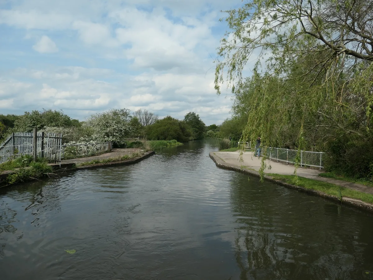
Aqueduct Over The River Erewash And Under Erewash Canal At Sk 462 455
Aqueducts · 2.1 km

NatWest Hole
Natural landmarks · 2.1 km

Potters Lock Bridge
Historic bridges · 2.2 km
Nearby
📷 4Historic bridges · East Midlands
Bennerley Viaduct
Bennerley Viaduct is a historic bridge in the United Kingdom.
📷 3Memorials & monuments · East Midlands
Awsworth War Memorial
Awsworth War Memorial — Grade II listed building-listed memorial in england-east-midlands, United Kingdom.
📷 5📷 3Memorials & monuments · East Midlands
Lt Colonel Brian Duncan Shaw MM BSc PhD DSc (Hon) 1898-1999
Lt Colonel Brian Duncan Shaw MM BSc PhD DSc (Hon) 1898-1999 — a memorial in england-east-midlands, United Kingdom.
📷 3Theatres · East Midlands
King's Picture House
King's Picture House in England East Midlands, United Kingdom.
📷 3Memorials & monuments · East Midlands
Cossall War Memorial
Cossall War Memorial — Grade II listed building-listed memorial in england-east-midlands, United Kingdom.
Where to eat & stay near Bennerley Viaduct
Places to stay
 📷 5
📷 5Hotels · East Midlands
Delta Hotels by Marriott Nottingham Belfry
Delta Hotels by Marriott Nottingham Belfry — a hotel in england east midlands. 4-star. Brand: Delta Hotels.
 📷 7
📷 7Hotels · East Midlands
DoubleTree by Hilton Hotel Nottingham - Gateway
DoubleTree by Hilton Hotel Nottingham - Gateway — a hotel in england east midlands. 4-star. Brand: DoubleTree.
 📷 5
📷 5Campsites · East Midlands
Meadow View Glamping
Meadow View Glamping — a campsite in england east midlands.
 📷 5
📷 5Hotels · East Midlands
Horsley Lodge Hotel
Horsley Lodge Hotel — a hotel in england east midlands.
 📷 5
📷 5Campsites · East Midlands
Golden Valley Caravan Park
Golden Valley Caravan Park — a campsite in england east midlands.
 📷 7
📷 7Hotels · East Midlands
The Walton Hotel
The Walton Hotel — a hotel in england east midlands.
Places to eat & drink
 📷 5
📷 5 📷 5
📷 5Historic pubs · East Midlands
Old Pear Tree Public House And Attached Garden Wall
Old Pear Tree Public House And Attached Garden Wall in England East Midlands, United Kingdom.
 📷 5
📷 5Restaurants · East Midlands
Turquoise
Turquoise — a restaurant in england east midlands.
 📷 7
📷 7 📷 7
📷 7Historic pubs · East Midlands
The Five Ways Public House
The Five Ways Public House in England East Midlands, United Kingdom.
 📷 7
📷 7Historic pubs · East Midlands
Golden Fleece Public House
Golden Fleece Public House in England East Midlands, United Kingdom.
More viewpoints in this region
 📷 3
📷 3Viewpoints · East Midlands
ast view (Boston - Grimsby)
ast view (Boston - Grimsby) is a viewpoint in the United Kingdom.
 📷 3
📷 3 📷 3
📷 3 📷 3
📷 3Frequently asked questions
- Where is Bennerley Viaduct?
- Bennerley Viaduct is in Nottinghamshire, the East Midlands, United Kingdom (postcode NG16 2AE), in the parish of Awsworth.
- What is Bennerley Viaduct?
- Bennerley Viaduct is a viewpoint in the United Kingdom.
- How do I get to Bennerley Viaduct?
- The nearest railway station is Ilkeston, about 1.2 km away. Drivers can use postcode NG16 2AE.
- Is Bennerley Viaduct free to visit?
- Yes, Bennerley Viaduct is free to enter.
- How do I get to Bennerley Viaduct?
- The nearest railway station is Ilkeston, about 1.2 km away. Drivers can navigate to postcode NG16 2AE.