Historic churches · South East England
Addington, Kent
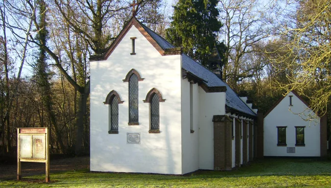
In or near Trottiscliffe.
Addington is a village in the English county of Kent. It is close to the M20 motorway, and between the villages of Wrotham Heath and West Malling. In the Domesday Book of 1086 it is called Eddintune.

David Anstiss — CC BY-SA 2.0 via Wikimedia Commons licence
Plan your visit
- Typical visit
- 30 min–1 h
- Nearest railway station
- Borough Green & Wrotham · 3.2 km
- Free entry
Getting there & planning your visit
To visit Addington, Kent, you can take a train to Borough Green & Wrotham station, which is 3.2 km away. The postcode for your sat-nav is ME19 5BT, and entry to the church is free. The site is accessible, but please check local resources for specific accessibility details.
About
Addington is a village in the English county of Kent. It is close to the M20 motorway, and between the villages of Wrotham Heath and West Malling. In the Domesday Book of 1086 it is called Eddintune. The meaning of the village's name is "Æddi's (or Eadda's) estate". The village is notable for the long barrows, Neolithic chamber tombs. Its parish covers a little under 700 acres (2.8 km2), containing 291 houses. Addington Brook runs through the parish.
Photo gallery
See it from the streetimagery from 2025
Imagery © Mapillary contributors, CC BY-SA 4.0
Protected designations
- Area of Outstanding Natural Beauty: Kent Downs
Designations sourced from Natural England open data under OGL v3.
From the Wikipedia article
Addington is a village in the English county of Kent. It is close to the M20 motorway, and between the villages of Wrotham Heath and West Malling. In the Domesday Book of 1086 it is called Eddintune. The meaning of the village's name is "Æddi's (or Eadda's) estate". The village is notable for the long barrows, Neolithic chamber tombs. Its parish covers a little under 700 acres (2.8 km2), containing 291 houses. Addington Brook runs through the parish.
Excerpt from Wikipedia under CC BY-SA 4.0. See the source article linked in Sources below.
Background
History
Addington has been continuously inhabited for over 5,000 years. Many Neolithic artifacts have been extracted from the village, but much archaeological evidence has been lost to mechanical digging. Some sites were excavated during the building of the motorway. It had two mills at the time of the Domesday survey. There was a watermill powered by the Addington Brook (TQ 656 587 ), demolished in the nineteenth century; the site now lies within West Malling Golf Course. The remains of an old structure named the Addington Place were visible until the early 21st century, now beneath a golf course and stables. During the Black Death, Addington was severely affected, and four of the church rectors…
Description
The village has one pub, the Angel. There are rumours of a tunnel running from the pub's basement to the church, located 750 m away. Addington does not have a school, so children attend schools in nearby villages. Addington is divided by the M20 and M26 motorways. There are sandpits and quarries on both sides of the motorways, which are now almost entirely worked out. The village is home to Addington Village Cricket Club, which has two Saturday teams and a 1st XI that plays in Division 2 of the Kent League (1st XI). The parish church is dedicated to St. Margaret, and dates back to 1403. It is part of a combined benefice with All Saints Birling, St. Martin Ryarsh and St. Peter & St. Paul…
Sourced from Wikipedia under CC BY-SA 4.0.
- Coordinates
- 51.2980, 0.3520
- County
- Kent
- District
- Tonbridge and Malling
- Parish
- Addington
- Postcode
- ME19 5BT
- Parliamentary constituency
- Tonbridge
- Nearest railway station
- Borough Green & Wrotham — 3.2 km
Sources
- wikipedia: Addington, Kent (CC BY-SA 4.0)
Other places nearby

Gate House Wood Touring Park
Campsites · 0.6 km

Richard Hochfeld
Public art & sculpture · 1.1 km

Nepicar House
Historic houses · 1.2 km

Obelisk 20 Yards To East Of Addington Church
Forts · 1.6 km

Chestnuts Long Barrow
Burial mounds & barrows · 1.6 km
Chestnuts Long Barrow
Archaeological sites · 1.6 km

Addington Long Barrow
Burial mounds & barrows · 1.6 km
Addington Long Barrow
Archaeological sites · 1.6 km
Tonbridge and Malling
Historic churches · 1.7 km

Quintain House
Historic houses · 1.8 km

Offham, Kent
Historic churches · 1.8 km

Offham
Villages · 1.8 km
Nearby
📷 5Campsites · South East England
Gate House Wood Touring Park
Gate House Wood Touring Park — a campsite in england london.
📷 5Public art & sculpture · South East England
Richard Hochfeld
Richard Hochfeld — a public art in england-london, United Kingdom.
📷 5Historic houses · South East England
Nepicar House
Nepicar House — house in Platt, Tonbridge and Malling, England, UK.
📷 5Forts · South East England
Obelisk 20 Yards To East Of Addington Church
Obelisk 20 Yards To East Of Addington Church — a martello broad in england-london, United Kingdom.
📷 5Burial mounds & barrows · South East England
Chestnuts Long Barrow
Chestnuts Long Barrow — a burial mound in england-london, United Kingdom.
📷 5Archaeological sites · South East England
Chestnuts Long Barrow
Chestnuts Long Barrow — archaeological in england london.
Where to eat & stay near Addington, Kent
Places to stay
📷 5Campsites · South East England
Gate House Wood Touring Park
Gate House Wood Touring Park — a campsite in england london.
 📷 7
📷 7 📷 5
📷 5Campsites · South East England
Badgells Wood Camping
Badgells Wood Camping — a campsite in england london.
 📷 5
📷 5Campsites · South East England
Hopehill Scout Campsite
Hopehill Scout Campsite — a campsite in england london.
 📷 5
📷 5 📷 5
📷 5Campsites · London
Oldbury Hill Camping and Caravanning Club Site
Oldbury Hill Camping and Caravanning Club Site — a campsite in england london.
Places to eat & drink
 📷 5
📷 5Historic pubs · South East England
Five Pointed Star Public House
Five Pointed Star Public House in England South East, United Kingdom.
 📷 5
📷 5Historic pubs · South East England
The Joiners Arms Public House
The Joiners Arms Public House in England South East, United Kingdom.
 📷 5
📷 5 📷 5
📷 5Restaurants · South East England
Pad Thai Restaurant
Pad Thai Restaurant — a restaurant in england london.
 📷 7
📷 7 📷 5
📷 5More places in this region
 📷 5
📷 5Historic churches · South East England
All Saints Church, Frindsbury
All Saints Church, Frindsbury — church in Medway, UK.
 📷 5
📷 5Historic churches · South East England
All Saints Church, Maidstone
All Saints Church, Maidstone — parish church associated with the Archbishop's Palace, Maidstone, Kent, England, UK.
 📷 5
📷 5Historic churches · South East England
All Saints Church, West Farleigh
All Saints Church, West Farleigh — Grade I listed church in West Farleigh, Maidstone, Kent, England, UK.
 📷 5
📷 5Historic churches · South East England
All Souls' Church, Sutton Green
All Souls' Church, Sutton Green — church in Guildford, England.
Frequently asked questions
- Where is Addington, Kent?
- Addington, Kent is in Kent, London, United Kingdom (postcode ME19 5BT), in the parish of Addington.
- What is Addington, Kent?
- Addington is a village in the English county of Kent. It is close to the M20 motorway, and between the villages of Wrotham Heath and West Malling. In the Domesday Book of 1086 it is called Eddintune.
- How do I get to Addington, Kent?
- The nearest railway station is Borough Green & Wrotham, about 3.2 km away. Drivers can use postcode ME19 5BT.
- Is Addington, Kent a protected site?
- Yes — Addington, Kent is part of the Kent Downs National Landscape (AONB).
- Is Addington, Kent free to visit?
- Yes, Addington, Kent is free to enter.
- How do I get to Addington, Kent?
- The nearest railway station is Borough Green & Wrotham, about 3.2 km away. Drivers can navigate to postcode ME19 5BT.