Other places · North East England
A68 road
In or near Rochester.
A68 road in England North East, United Kingdom.

Russel Wills — CC BY-SA 2.0 via Wikimedia Commons licence
Plan your visit
- Typical visit
- 1 h–2 h
About
A68 road is a place of interest in England North East, United Kingdom — drawn from open-data sources for visitor reference. See the linked Wikipedia article for the full description.
Photo gallery
See it from the streetimagery from 2022
Imagery © Mapillary contributors, CC BY-SA 4.0
Protected designations
- Site of Special Scientific Interest: River Coquet and Coquet Valley Woodlands SSSI
Designations sourced from Natural England open data under OGL v3.
From the Wikipedia article
The A68 is a major road in the United Kingdom, running from Darlington in England to the A720 in Edinburgh, the capital of Scotland. It crosses the Anglo-Scottish border at Carter Bar and is the only road to do so for some distance either way; the next major crossings are the A697 from Coldstream to Cornhill-on-Tweed in the east, and the A7 near Canonbie to the west.
Excerpt from Wikipedia under CC BY-SA 4.0. See the source article linked in Sources below.
Background
History
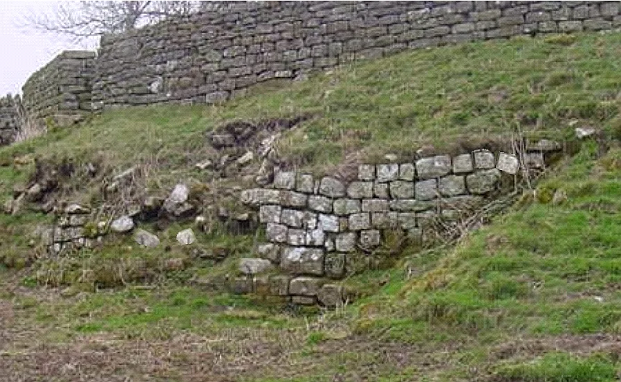
The A68 follows the Roman Dere Street north of Corbridge, crossing Hadrian's Wall, and shares its route as far as the historic camps of Habitancum and Bremenium. The area contains numerous Roman forts. The current route across Carter Bar was proposed by John Loudon McAdam in 1828. It was constructed over the following decade, and featured bridges designed by James Jardine.
Sourced from Wikipedia under CC BY-SA 4.0.
- Coordinates
- 55.2927, -2.3114
- District
- Northumberland
- Parish
- Rochester
- Postcode
- NE19 1TE
- Parliamentary constituency
- Hexham
Sources
Other places nearby

Hindhope Linn
Waterfalls · 2.2 km
Hindhope Linn
Waterfalls · 2.2 km

Birdhope Camps
Archaeological sites · 2.6 km

Border Forest Caravan Park
Caravan parks · 2.8 km

Cottonshopeburnfoot
Other places · 2.9 km

Three Kings Stone Circle
Stone circles · 3.1 km
Bremenium
Hill forts · 3.2 km

Redefest Site (Former Brigantium Site)
Natural landmarks · 3.2 km

Rochester
Towns & cities · 3.5 km

Rochester War Memorial
Memorials & monuments · 3.7 km

Bremenium Roman tumulus
Burial mounds & barrows · 3.9 km

Bremenium Roman tumulus
Archaeological sites · 3.9 km
Nearby
📷 5📷 5📷 3Archaeological sites · North East England
Birdhope Camps
Birdhope Camps — a archaeological in scotland-lowlands, United Kingdom.
📷 5Caravan parks · North East England
Border Forest Caravan Park
Border Forest Caravan Park — a caravan park in scotland lowlands.
📷 4Other places · North East England
Cottonshopeburnfoot
Cottonshopeburnfoot in England North East, United Kingdom.
📷 3Stone circles · North East England
Three Kings Stone Circle
Three Kings Stone Circle — a stone circle in scotland-lowlands, United Kingdom.
Where to eat & stay near A68 road
Places to stay
📷 5Caravan parks · North East England
Border Forest Caravan Park
Border Forest Caravan Park — a caravan park in scotland lowlands.
 📷 5
📷 5Hotels · North East England
William de Percy
William de Percy — a hotel in scotland lowlands.
 📷 5
📷 5Hostels · North East England
Tarset Tor bunkhouse
Tarset Tor bunkhouse — a hostel in scotland lowlands.
 📷 5
📷 5 📷 5
📷 5 📷 5
📷 5Campsites · North East England
Firing Point - Farm
Firing Point - Farm — a campsite in scotland lowlands.
Places to eat & drink
 📷 5
📷 5Historic pubs · North East England
The Redesdale Arms
The Redesdale Arms in Scotland Lowlands, United Kingdom.
 📷 7
📷 7More places in this region
 📷 5
📷 5Other places · North East England
Appleby Horse Fair
The Appleby Horse Fair, previously known as Appleby New Fair, is an annual gathering of Romani people (Gypsies) and Travellers in Appleby-in-Westmorland in Cumbria, England. The horse fair is held eac
 📷 5
📷 5Other places · North East England
Crosby Garrett
Crosby Garrett in England North East, United Kingdom.
 📷 5
📷 5Other places · North East England
Ravenstonedale
Ravenstonedale in England North East, United Kingdom.
 📷 5
📷 5Frequently asked questions
- Where is A68 road?
- A68 road is in North-East England, United Kingdom (postcode NE19 1TE), in the parish of Rochester.
- What is A68 road?
- A68 road in England North East, United Kingdom.
- How do I get to A68 road?
- Drivers can use postcode NE19 1TE.
- Is A68 road a protected site?
- Yes — A68 road is part of the River Coquet and Coquet Valley Woodlands SSSI Site of Special Scientific Interest.
- How do I get to A68 road?
- Drivers can navigate to postcode NE19 1TE. It sits within the Hexham parliamentary constituency.