
Mountains & hills · North Wales
Y Garn
Also known as: Y Garn (Rhinogydd)
Y Garn — Named summit at 477 m.

Wikimedia Commons contributors — see linked file page for photographer and licence licence

Plan your visit
- Typical visit
- 3 h–8 h
- Best time of year
- Late spring – early autumn (May–Oct)
- Nearest railway station
- Dduallt · 9.0 km
- Free entry
- Dog-friendly
Getting there & planning your visit
Y Garn is located in North Wales, with the nearest railway station being Dduallt, approximately 9 km away. The postcode for navigation is LL41 4TR, and entry to the mountain is free.
About
Y Garn is a named summit in the United Kingdom. Wikidata describes it as: "Named summit at 477 m.". Coordinates: 52.9247°, -3.8472°.
Photo gallery
Heritage listing
http://cadwpublic-api.azurewebsites.net/reports/listedbuilding/FullReport?lang=en&id=26806
From Cadw under OGL v3.
From the Wikipedia article
Y Garn is a mountain in the southern Snowdonia, Wales, north of Dolgellau. It is an outlier of the Rhinogydd range, rising above the Coed-y-Brenin forest and the Rhaeadr Du waterfalls. An abandoned gold mine lies on its eastern slopes and Diffwys (750m) can be seen to the north from the summit.
Excerpt from Wikipedia under CC BY-SA 4.0. See the source article linked in Sources below.
- Coordinates
- 52.9247, -3.8472
- District
- Gwynedd
- Parish
- Trawsfynydd
- Postcode
- LL41 4TR
- Parliamentary constituency
- Dwyfor Meirionnydd
- Nearest railway station
- Dduallt — 9 km
Sources
- osm: n3755217912 (ODbL)
- wikipedia: Y Garn (Rhinogydd) (CC BY-SA 4.0)
- commons: Y Garn - geograph.org.uk - 1099128.jpg (CC BY-SA 4.0)
Other places nearby

Y Garn South Top
Mountains & hills · 0.4 km
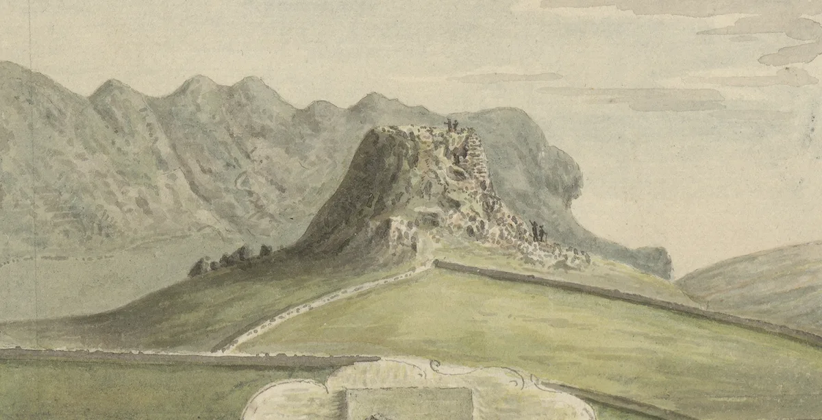
Castell Prysor
Castles · 1.1 km

Castle Prysor
Castles · 1.1 km

Moel y Croesau
Mountains & hills · 1.2 km

Moel Uchaf Dol-haidd
Mountains & hills · 1.5 km

Pen y Foel-ddu
Mountains & hills · 1.6 km

Nant Gefail-y-Meinars Copper Mine
Archaeological sites · 1.8 km

Foel Cynfal
Mountains & hills · 1.8 km

Pen Llyn Hiraethlyn
Mountains & hills · 2.0 km

Roman Practice Camp
Archaeological sites · 2.1 km

Dolddinas Camp I
Archaeological sites · 2.3 km
Dolddinas Camp III
Archaeological sites · 2.4 km
Nearby
📷 3Mountains & hills · North Wales
Y Garn South Top
Y Garn South Top — a mountain in wales-north, United Kingdom, 474 m.
📷 3📷 3📷 3Mountains & hills · North Wales
Moel y Croesau
Moel y Croesau — a mountain in wales-north, United Kingdom, 490 m.
📷 5Mountains & hills · North Wales
Moel Uchaf Dol-haidd
Moel Uchaf Dol-haidd — mountain in wales north. Elevation: 462 m.
📷 5Mountains & hills · North Wales
Pen y Foel-ddu
Pen y Foel-ddu — mountain in wales north. Elevation: 532 m.
Where to eat & stay near Y Garn
Places to stay
 📷 5
📷 5Hostels · North Wales
Treks Bunkhouse
Treks Bunkhouse — a hostel in wales north.
 📷 5
📷 5 📷 5
📷 5Hostels · North Wales
Rhiw Goch Bunkhouse
Rhiw Goch Bunkhouse — a hostel in wales north.
 📷 5
📷 5Caravan parks · North Wales
Trawsfynydd Holiday Village
Trawsfynydd Holiday Village — a caravan park in wales north.
 📷 5
📷 5Caravan parks · North Wales
Coed-y-Llwyn Caravan and Motorhome Club Site
Coed-y-Llwyn Caravan and Motorhome Club Site — a caravan park in wales north.
 📷 5
📷 5Places to eat & drink
 📷 5
📷 5 📷 7
📷 7 📷 7
📷 7 📷 7
📷 7 📷 7
📷 7 📷 7
📷 7Restaurants · North Wales
Palé Hall Hotel Restaurant
Palé Hall Hotel Restaurant — a restaurant in wales north. Cuisine: welsh;british;fine dining. 5-star.
More mountains in this region
 📷 5
📷 5Mountains & hills · North Wales
Cemlyn Bay and lagoon
Cemlyn Bay and lagoon — Site of Special Scientific Interest in Wales.
 📷 3
📷 3Mountains & hills · North Wales
Aberffraw Bay
Aberffraw Bay — bay on the west coast of Anglesey, in Wales, UK.
 📷 3
📷 3 📷 3
📷 3Mountains & hills · North Wales
Aran Benllyn
Aran Benllyn — Named summit at 884 m.
Frequently asked questions
- Where is Y Garn?
- Y Garn is in North Wales, United Kingdom (postcode LL41 4TR), in the parish of Trawsfynydd.
- What is Y Garn?
- Y Garn — Named summit at 477 m.
- How do I get to Y Garn?
- The nearest railway station is Dduallt, about 9.0 km away. Drivers can use postcode LL41 4TR.
- Is Y Garn a listed building?
- Y Garn is officially recognised as II listed.
- Is Y Garn free to visit?
- Yes, Y Garn is free to enter.
- How do I get to Y Garn?
- Drivers can navigate to postcode LL41 4TR. It sits within the Dwyfor Meirionnydd parliamentary constituency.