Wildlife reserves · West Midlands
Woodford Bottom and Lamb's Pool
Woodford Bottom and Lamb's Pool is a wildlife reserve in the United Kingdom.
.jpg?width=1200)
Wikimedia Commons licence
Plan your visit
- Typical visit
- 2 h–4 h
- Best time of year
- Autumn & winter (migration & wildfowl)
- Free entry
- Dog-friendly
About
Woodford Bottom and Lamb's Pool is a wildlife reserve in the United Kingdom. Coordinates: 52.0220°, -1.4840°. This entry is part of The Great Britain Guide, a free, ad-free, open-data tourist directory.
Photo gallery
Protected designations
- Area of Outstanding Natural Beauty: Cotswolds
Designations sourced from Natural England open data under OGL v3.
From the Wikipedia article
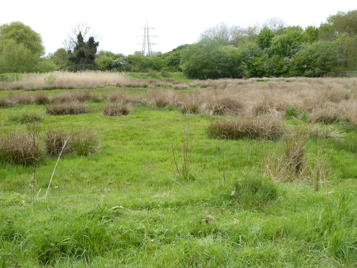
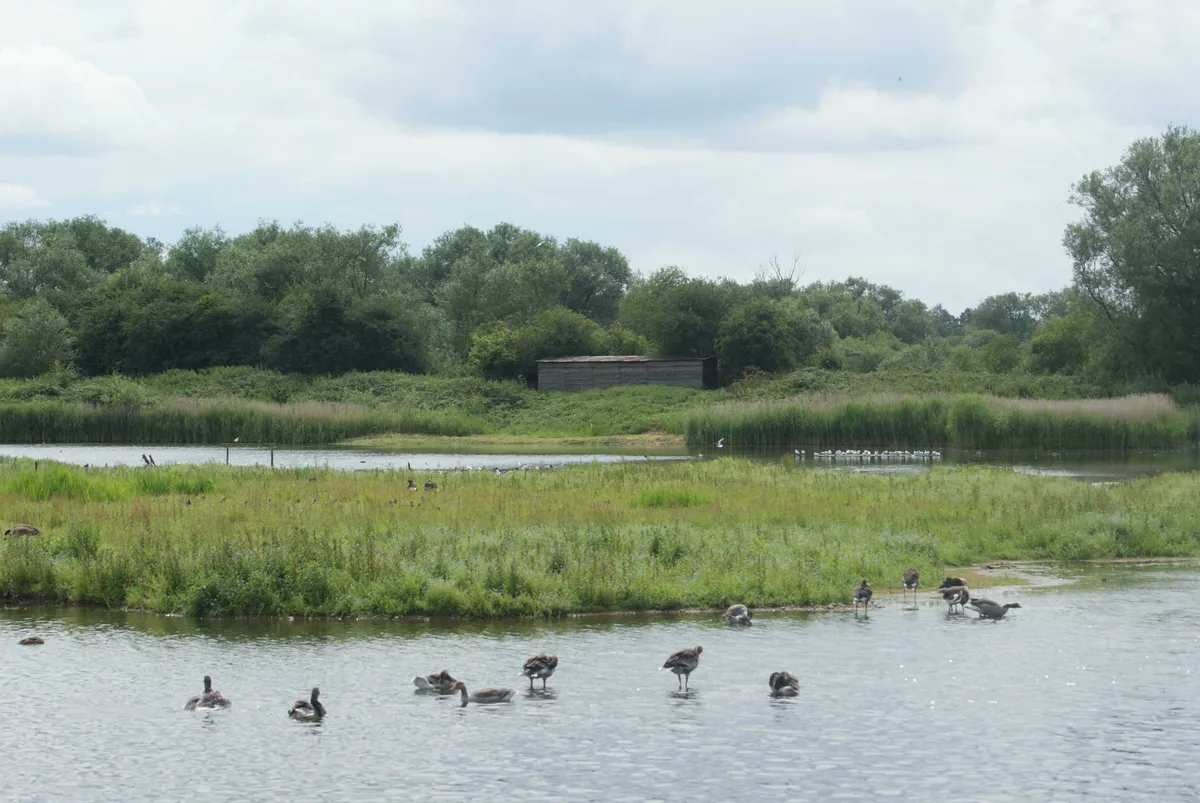
Woodford Bottom and Lamb's Pool is a 3-hectare (7.4-acre) nature reserve south of Sibford Ferris in Oxfordshire. It is managed by the Berkshire, Buckinghamshire and Oxfordshire Wildlife Trust. This site has an artificial pool, marshes and grassland. Pipistrelle, Daubenton's and noctule bats hunt over the lake and an island in the middle is used by breeding birds such as coots and tufted ducks. There is Reed sweet-grass and common reedmace in the marsh.
Excerpt from Wikipedia under CC BY-SA 4.0. See the source article linked in Sources below.
- Coordinates
- 52.0220, -1.4840
- County
- Oxfordshire
- District
- Cherwell
- Parish
- Hook Norton
- Postcode
- OX15 5DJ
- Parliamentary constituency
- Banbury
- Official site
- www.bbowt.org.uk
Sources
- wikidata: Q90102973 (CC0)
- wikipedia: Woodford Bottom and Lamb's Pool (CC BY-SA 4.0)
Other places nearby
Loading nearby places…
Nearby
 📷 5
📷 5Natural landmarks · West Midlands
Sibford School
Sibford School — a school heritage in england-west-midlands, United Kingdom.
 📷 3
📷 3Quarries · West Midlands
Sharp's Hill Quarry
Sharp's Hill Quarry is a quarry in the United Kingdom.
 📷 3
📷 3Historic houses · West Midlands
Stickleys House
Stickleys House — house in Sibford Gower, Cherwell, Oxfordshire, England, UK.
 📷 4
📷 4Natural landmarks · West Midlands
Traitor's Ford
Traitor's Ford is a ford on the River Stour, in the English county of Warwickshire close to its border with Oxfordshire. It is about 2 miles (3.2 km) outside Brailes and half a mile from the village o
 📷 3
📷 3Heritage railways · West Midlands
Hook Norton ironstone quarries
Hook Norton ironstone quarries — ironstone quarries in Oxfordshire, England.
 📷 5
📷 5Museums · West Midlands
Hook Norton
Hook Norton — a museum in england-west-midlands, United Kingdom.
More places in this region
 Flagship📷 3
Wildlife reserves · West Midlands
Abington Meadows
Abington Meadows — nature reserve in the United Kingdom.
 📷 5
📷 5Wildlife reserves · West Midlands
Brandon Marsh
Brandon Marsh — nature reserve in the United Kingdom.
 📷 5
📷 5Wildlife reserves · West Midlands
Bugbrooke Meadows
Bugbrooke Meadows — nature reserve in the United Kingdom.
 📷 5
📷 5Wildlife reserves · West Midlands
Chorleywood Common
Chorleywood Common — nature reserve in Hertfordshire, England.
Frequently asked questions
- Where is Woodford Bottom and Lamb's Pool?
- Woodford Bottom and Lamb's Pool is in Oxfordshire, the West Midlands, United Kingdom (postcode OX15 5DJ), in the parish of Hook Norton.
- Who owns Woodford Bottom and Lamb's Pool?
- Woodford Bottom and Lamb's Pool is owned by Berkshire, Buckinghamshire and Oxfordshire Wildlife Trust.
- Is Woodford Bottom and Lamb's Pool a protected site?
- Yes — Woodford Bottom and Lamb's Pool is part of the Cotswolds National Landscape (AONB).
- Is Woodford Bottom and Lamb's Pool free to visit?
- Yes, Woodford Bottom and Lamb's Pool is free to enter.
- How do I get to Woodford Bottom and Lamb's Pool?
- Drivers can navigate to postcode OX15 5DJ. It sits within the Banbury parliamentary constituency.
- Are dogs allowed at Woodford Bottom and Lamb's Pool?
- Most wildlife reserves allow dogs on lead only, with restrictions during ground-nesting bird season (March-July). Check signage at the reserve.