
Historic houses · East of England
Wolterton Hall
In or near Wickmere.
Wolterton Hall — a Grade I-listed historic house in england-east-midlands, United Kingdom.

Evelyn Simak — CC BY-SA 2.0 via Wikimedia Commons licence

Plan your visit
- Typical visit
- 1 h–2 h
- Nearest railway station
- Aylsham · 6.3 km
- Free entry
- Family-friendly
- Limited wheelchair access
Getting there & planning your visit
Wolterton Hall is located in North Norfolk, postcode NR11 7LY, and the nearest railway station is Aylsham, which is 6.3 km away. Entry is paid, and wheelchair accessibility is limited.
About
Wolterton Hall is a Grade I-listed building in england-east-midlands, United Kingdom. Grade I status is conferred by Historic England (or Cadw, Historic Environment Scotland or NIEA equivalents) on buildings of exceptional national interest. See the linked Wikipedia article for full historical and architectural details.
Photo gallery
Official information
Wolterton Hall is primarily known for the remains of St Margaret's Church, which features a round tower and dates back to the Late Saxon period. The church was abandoned in the 18th century as the village of Wolterton diminished, and it is now recognized as a listed building and scheduled monument.
Protected designations
- Area of Outstanding Natural Beauty: Norfolk Coast
Designations sourced from Natural England open data under OGL v3.
From the Wikipedia article
Wolterton Hall, is a large country house in the ecclesiastical parish of Wickmere with Wolterton and the civil parish of Wickmere in the county of Norfolk, England, United Kingdom. The present hall was commissioned by Horatio Walpole, 1st Baron Walpole of Wolterton and completed in 1742. It was designed by the architect Thomas Ripley who was a protégé of Lord Walpole and his brother Sir Robert Walpole.
Excerpt from Wikipedia under CC BY-SA 4.0. See the source article linked in Sources below.
Background
History
The present hall and estate was once occupied by an early manor house, owned by Sir Henry Spelman, and the village of Wolterton which was abandoned leaving only the remains of the parish church tower which stands a short distance north of the present hall. Evidence shown on a map produced in 1733 shows that the deserted settlement of Wolterton lay a little north of the church and consisted of several houses clustered around a village green. The village of Wolterton is mentioned in the Domesday Book where it is listed under the names Ultertuna and Wivetuna. The survey shows main landholder of Wolterton was the Norman nobleman William de Warenne. The listing shows 4 smallholders on the land…
Architecture
Responsibility for the design and construction of the new hall was given to Thomas Ripley. He had previously been engaged by Horatio's brother Robert to re-develop the Great House at Houghton. The ground floor was faced with Portland stone, with the upper storeys faced in pale red brick which were produced locally. Sash windows were installed surrounded by eared and shouldered stone architraves. The window heads were of plain stone pediments with cornice. The main entrance was on the north elevation of the house was flanked either side with Tuscan columns and headed with a plain stone cornice and pediment and was accessed by means of an exterior staircase (removed in the 19th century). This…
Description
The interior designs for the hall included a marble hall which was formally the entrance hall before Repton's alterations to the entrance in 1828. The room has four mahogany doors which were a gift of Queen Caroline, the wife of George II. The room also contains a fireplace with an overmantel of white marble and coloured agate by Richard Fisher of Ripon. The room has a classical motif stucco ceiling. The house has a central domed full height stairwell with a stone cantilevered staircase with a lyre-shaped wrought iron balustrade topped with a banded mahogany handrail. Horace Walpole's study was decorated and designed by Italian painter Jacopo Amigoni in the late-Baroque/Rococo style. Other…
Sourced from Wikipedia under CC BY-SA 4.0.
- Coordinates
- 52.8406, 1.2105
- County
- Norfolk
- District
- North Norfolk
- Parish
- Wickmere
- Postcode
- NR11 7LY
- Parliamentary constituency
- North Norfolk
- Established
- 1725
- Nearest railway station
- Aylsham — 6.3 km
- Official site
- www.heritage.norfolk.gov.uk
Sources
- wikidata: Q8030449 (CC0)
- wikipedia: Wolterton Hall (CC BY-SA 4.0)
Other places nearby

Saint Margaret
Archaeological sites · 0.2 km

Saracen's Head
Historic pubs · 0.9 km

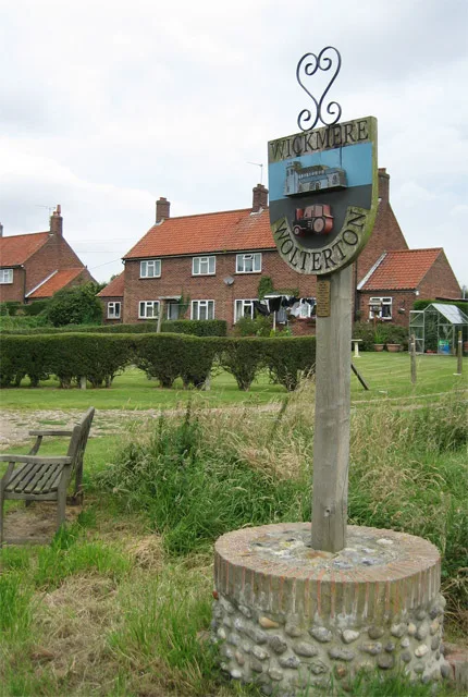
Wickmere with Wolterton Village Sign
Public art & sculpture · 1.7 km
Wickmere
Towns & cities · 1.8 km

Draw Bridge At Mannington Hall
Historic bridges · 2.0 km

Itteringham
Villages · 2.0 km

Itteringham War Memorial
Memorials & monuments · 2.0 km

The Heritage Rose Garden, Mannington Hall
Botanic gardens · 2.0 km

Arch Circa 9 Metres South West Of Nave Of Mannington Church
Memorials & monuments · 2.1 km
Mannington Hall
Caravan parks · 2.2 km

Calthorpe Village Sign
Public art & sculpture · 2.3 km

Little Barningham War Memorial
Memorials & monuments · 2.6 km
Nearby
📷 5Archaeological sites · East of England
Saint Margaret
Saint Margaret — archaeological in england east midlands.
📷 5Historic pubs · East of England
Saracen's Head
Saracen's Head in England East, United Kingdom.
📷 3Public art & sculpture · East of England
Wickmere with Wolterton Village Sign
Wickmere with Wolterton Village Sign — a public art in england-east-midlands, United Kingdom.
Flagship📷 4📷 3Historic bridges · East of England
Draw Bridge At Mannington Hall
Draw Bridge At Mannington Hall — Grade II listed building-listed bridge in england-east-midlands, United Kingdom.
📷 5Where to eat & stay near Wolterton Hall
Places to stay
📷 5Caravan parks · East of England
Mannington Hall
Mannington Hall — a caravan park in england east midlands.
 📷 5
📷 5 📷 5
📷 5Campsites · East of England
Downtide Caravans
Downtide Caravans — a campsite in england east midlands.
 📷 5
📷 5 📷 2
📷 2 📷 5
📷 5Campsites · East of England
Deer's Glade Car. & Camp. Park
Deer's Glade Car. & Camp. Park — a campsite in england east midlands.
Places to eat & drink
📷 5Historic pubs · East of England
Saracen's Head
Saracen's Head in England East, United Kingdom.
 📷 5
📷 5Historic pubs · East of England
Black Boys Public House
Black Boys Public House in England East, United Kingdom.
 📷 5
📷 5Historic pubs · East of England
Buckinghamshire Arms Public House
Buckinghamshire Arms Public House in England East, United Kingdom.
 📷 5
📷 5 📷 5
📷 5Historic pubs · East of England
Vernon Arms
Vernon Arms in England East, United Kingdom.
 📷 5
📷 5More historic houses in this region
 📷 5
📷 5Historic houses · East of England
41 and 41a, Broad Street
41 and 41a, Broad Street — Grade II* listed house in Ely, East Cambridgeshire, England, UK.
 📷 5
📷 5Historic houses · East of England
Abbey Gate House
Abbey Gate House — house in St Albans, Hertfordshire, England, UK.
 📷 5
📷 5Historic houses · East of England
Abbey House
Abbey House — house in Cambridge, Cambridgeshire, England, UK.
.jpg?width=1200) 📷 5
📷 5Historic houses · East of England
Amores Including Outbuildings
Amores Including Outbuildings — architectural structure in Hertford, East Hertfordshire, England, UK.
Frequently asked questions
- Where is Wolterton Hall?
- Wolterton Hall is in Norfolk, the East Midlands, United Kingdom (postcode NR11 7LY), in the parish of Wickmere.
- What is Wolterton Hall?
- Wolterton Hall — a Grade I-listed historic house in england-east-midlands, United Kingdom.
- How do I get to Wolterton Hall?
- The nearest railway station is Aylsham, about 6.3 km away. Drivers can use postcode NR11 7LY.
- When was Wolterton Hall built?
- Built or established in 1725. Designed by Thomas Ripley.
- Who owns Wolterton Hall?
- Wolterton Hall is owned by | current_tenants =.
- Is Wolterton Hall a listed building?
- Wolterton Hall is officially recognised as Grade I listed.
- Is Wolterton Hall a protected site?
- Yes — Wolterton Hall is part of the Norfolk Coast National Landscape (AONB).
- How do I get to Wolterton Hall?
- The nearest railway station is Aylsham, about 6.3 km away. Drivers can navigate to postcode NR11 7LY.