
Public art & sculpture · London
Wimbledon Logo
In or near City of Westminster.
Wimbledon Logo — a public art in england-london, United Kingdom.

Rod Allday — CC BY-SA 2.0 via Wikimedia Commons licence

Plan your visit
- Typical visit
- 1 h–2 h
- Nearest railway station
- Wimbledon Park · 1.2 km
- Free entry
- Dog-friendly
Getting there & planning your visit
Wimbledon Logo is located in Merton, London, with the postcode SW19 5JA. The nearest railway station is Wimbledon Park, which is 1.2 km away. Entry to the site is free.
About
Wimbledon Logo is a public art located in england-london, United Kingdom. Sourced from OpenStreetMap (ODbL licence); see local listings for visitor information, opening hours and admission details.
Photo gallery
From the Wikipedia article
Wimbledon () is a suburb of southwest London, England, 7.0 miles (11.3 km) southwest of Charing Cross; it is the main commercial centre of the London Borough of Merton. Wimbledon had a population of 68,189 in 2011 which includes the electoral wards of Abbey, Wimbledon Town and Dundonald, Hillside, Wandle, Village, Raynes Park and Wimbledon Park. It is home to the Wimbledon Championships and New Wimbledon Theatre, and contains Wimbledon Common, one of the largest areas of common land in London. The residential and retail area is split into two sections known as the "village" and the "town", with the High Street being the rebuilding of the original medieval village, and the "town" having first developed gradually after the building of the railway station in 1838. Wimbledon has been inhabited since at least the Iron Age when the hill fort on Wimbledon Common is thought to have been constructed. In 1086 when the Domesday Book was compiled, Wimbledon was part of the manor of Mortlake. The ownership of the manor of Wimbledon changed between various wealthy families many times during its history, and the area also attracted other wealthy families who built large houses such as Eagle House, Wimbledon Manor House and Warren House. The village developed with a stable rural population coexisting with nobility and wealthy merchants from the city. In the 18th century the Dog and Fox public house became a stop on the stagecoach run from London to Portsmouth, then in 1838 the London and South Western Railway (L&SWR) opened a station to the southeast of the village at the bottom of Wimbledon Hill. The location of the station shifted the focus of the town's subsequent growth away from the original village centre. Wimbledon was a municipal borough in the county of Surrey from 1905 to 1965, when it became part of the London Borough of Merton as part of the creation of Greater London. Wimbledon has established minority groups; among the prominent ones being British Asians (mainly British Pakistanis and British Sri Lankans), British Ghanaians, Poles and Irish people. Nearby major settlements include Morden, Mitcham, Colliers Wood, Raynes Park, Roehampton, Southfields, Putney, Wimbledon Chase, Merton Park, New Malden and South Wimbledon.
Excerpt from Wikipedia under CC BY-SA 4.0. See the source article linked in Sources below.
Background
History
Wimbledon has been inhabited since at least the Iron Age when the hill fort on Wimbledon Common, the second-largest in London, is thought to have been constructed. The original nucleus of Wimbledon was at the top of the hill close to the common – the area now known locally as "the village". The village is referred to as "Wimbedounyng" in a charter signed by King Edgar the Peaceful in 967. The name Wimbledon means "Wynnman's hill", with the final element of the name being the Celtic "dun" (hill). The name is shown on J. Cary's 1786 map of the London area as "Wimbleton", and the current spelling appears to have been settled on relatively recently in the early 19th century, the last in a long…
Description
In the 1870s, at the bottom of the hill on land between the railway line and Worple Road, the All-England Croquet Club had begun to hold its annual championships. But the popularity of croquet was waning as the new sport of lawn tennis began to spread, and after initially setting aside just one of its lawns for tennis, the club decided to hold its first Lawn Tennis Championship in July 1877. By 1922, the popularity of tennis had grown to the extent that the club's small ground could no longer cope with the numbers of spectators and the renamed All England Lawn Tennis and Croquet Club moved to new grounds close to Wimbledon Park. Wimbledon historian Richard Milward recounts how King George V…
Sourced from Wikipedia under CC BY-SA 4.0.
- Coordinates
- 51.4355, -0.2162
- District
- Merton
- Parish
- Merton, unparished area
- Postcode
- SW19 5JA
- Parliamentary constituency
- Wimbledon
- Nearest railway station
- Wimbledon Park — 1.2 km
- Official site
- www.wimbledon.com
Sources
- osm: way/1193582902 (ODbL)
- wikipedia: Wimbledon, London (CC BY-SA 4.0)
Other places nearby

Henman Hill
Viewpoints · 0.0 km

All England Lawn Tennis & Croquet Club
Stadiums · 0.2 km
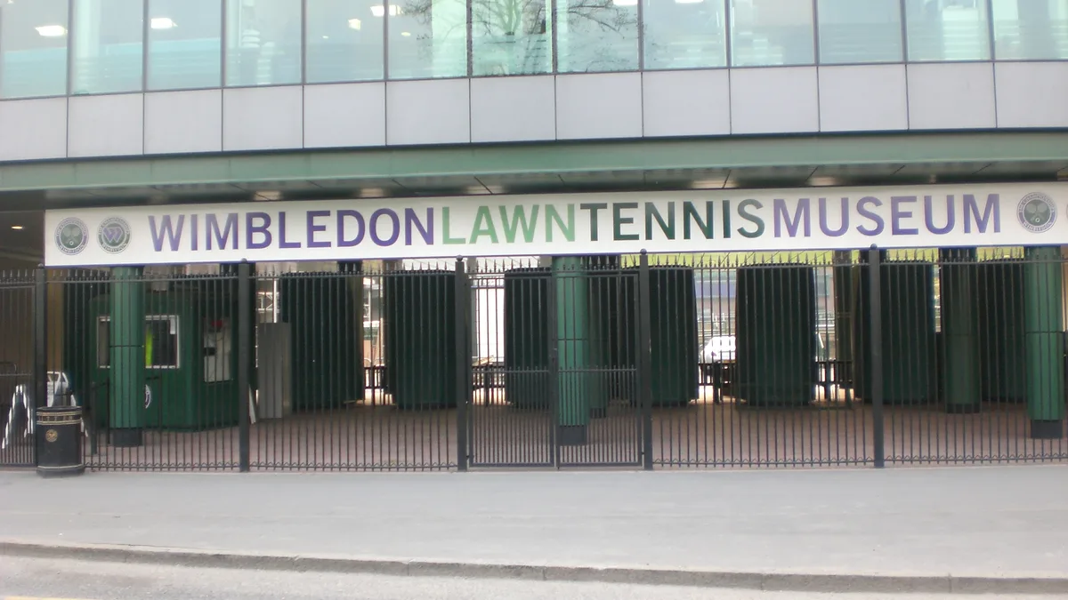
Wimbledon Lawn Tennis Museum
Museums · 0.2 km

Joseph and Arnold Toynbee
Memorials & monuments · 0.6 km
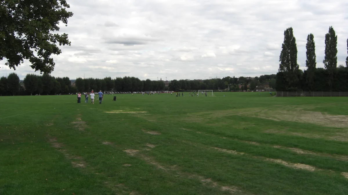
Wimbledon Park
Country parks · 0.6 km

Buddhapadipa Temple
Historic churches · 0.6 km

The Wimbledon Synagogue
Historic churches · 0.7 km

Lionel Tertis
Memorials & monuments · 0.7 km
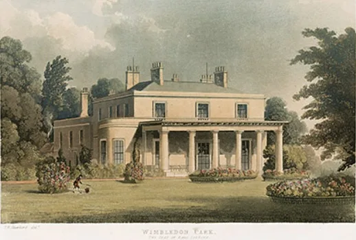
Wimbledon Manor House
Stately homes · 0.8 km

Wimbledon Park War Memorial
Memorials & monuments · 0.9 km
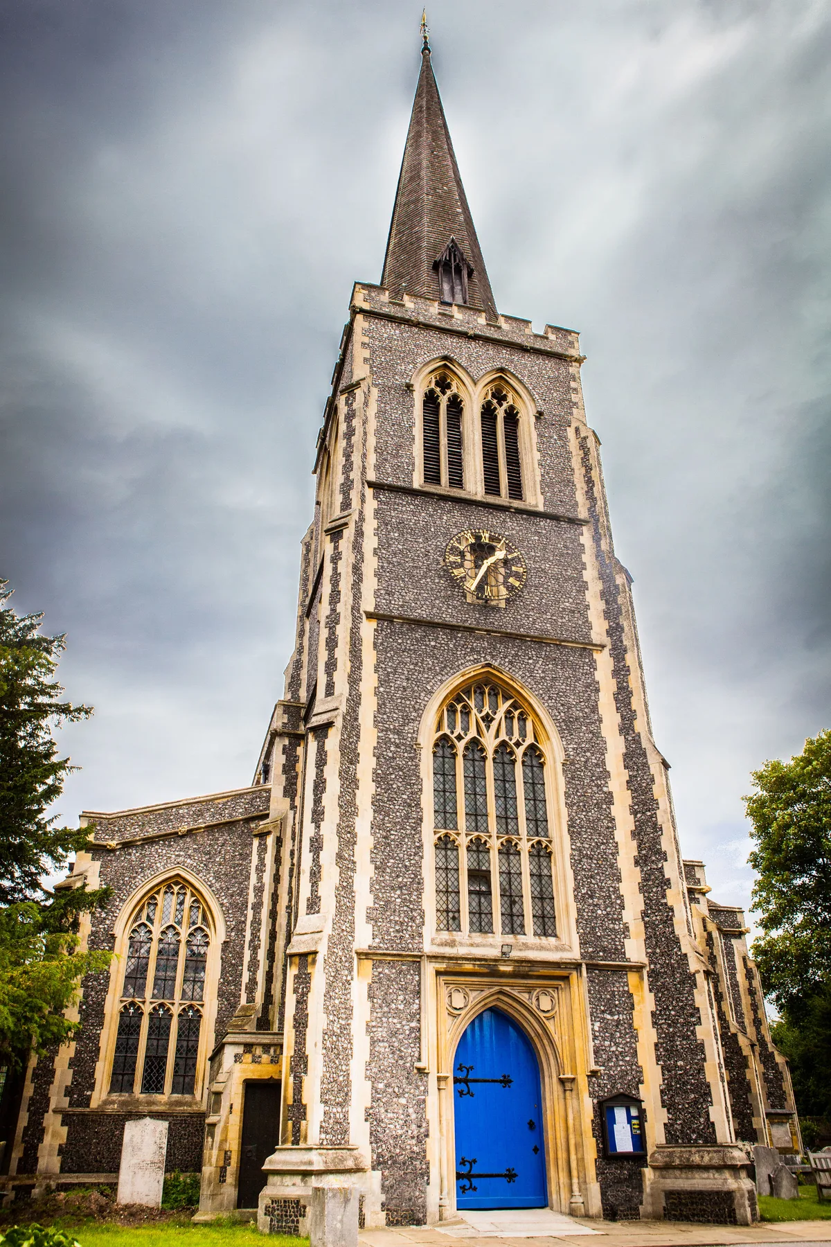
St Mary's Church, Wimbledon
Historic churches · 0.9 km

Linden Lodge School
Natural landmarks · 0.9 km
Nearby
📷 5★ Iconic📷 10Stadiums · London
All England Lawn Tennis & Croquet Club
The world's most famous tennis venue, hosting Wimbledon since 1877.
📷 5Museums · London
Wimbledon Lawn Tennis Museum
Wimbledon Lawn Tennis Museum is a museum in the United Kingdom.
📷 5Memorials & monuments · London
Joseph and Arnold Toynbee
Joseph and Arnold Toynbee — a memorial in england-london, United Kingdom.
Flagship📷 10Country parks · London
Wimbledon Park
Wimbledon Park — area and park in the London Borough of Merton, England.
📷 5Historic churches · London
Buddhapadipa Temple
Buddhapadipa Temple — a church in england-london, United Kingdom.
Where to eat & stay near Wimbledon Logo
Places to stay
 📷 7
📷 7Hotels · London
Spread Eagle
Spread Eagle — a hotel in england london.
 📷 5
📷 5 📷 5
📷 5 📷 5
📷 5Hotels · London
DoubleTree by Hilton Hotel London - Chelsea
DoubleTree by Hilton Hotel London - Chelsea — a hotel in england london. 4-star. Brand: DoubleTree.
 📷 5
📷 5Campsites · London
1st Malden Scout Group Grounds
1st Malden Scout Group Grounds — a campsite in england london.
 📷 5
📷 5Campsites · London
Girl Guides Marion Hill House Group Grounds
Girl Guides Marion Hill House Group Grounds — a campsite in england london.
Places to eat & drink
 📷 5
📷 5Historic pubs · London
Leather Bottle
Leather Bottle in England London, United Kingdom.
 📷 5
📷 5Historic pubs · London
Green Man, Putney
Green Man, Putney in England London, United Kingdom.
 📷 5
📷 5 📷 5
📷 5 📷 7
📷 7 📷 5
📷 5Historic pubs · London
Bricklayer’s Arms
Bricklayer’s Arms in England London, United Kingdom.
More places in this region
 📷 5
📷 5Public art & sculpture · London
33
33 — Public artwork (architecture) by Studio Weave.
 📷 5
📷 5Public art & sculpture · London
A Conversation with Oscar Wilde
A Conversation with Oscar Wilde — Public artwork (sculpture).
 📷 5
📷 5Public art & sculpture · London
A Sculpture for Mary Wollstonecraft
A Sculpture for Mary Wollstonecraft — Public artwork (sculpture) by Maggi Hambling.
 📷 5
📷 5Public art & sculpture · London
A Slice of Reality
A Slice of Reality — Public artwork (installation) by Richard Wilson.
Frequently asked questions
- Where is Wimbledon Logo?
- Wimbledon Logo is in London, United Kingdom (postcode SW19 5JA), in the parish of Merton, unparished area.
- What is Wimbledon Logo?
- Wimbledon Logo — a public art in england-london, United Kingdom.
- How do I get to Wimbledon Logo?
- The nearest railway station is Wimbledon Park, about 1.2 km away. Drivers can use postcode SW19 5JA.
- Is Wimbledon Logo free to visit?
- Yes, Wimbledon Logo is free to enter.
- How do I get to Wimbledon Logo?
- The nearest railway station is Wimbledon Park, about 1.2 km away. Drivers can navigate to postcode SW19 5JA.