
Military museums · Mid Wales
Wild Edric's Way
In or near Priestweston.
Wild Edric's Way in Wales Mid, United Kingdom.

Jeremy Bolwell — CC BY-SA 2.0 via Wikimedia Commons licence

Plan your visit
- Typical visit
- 2 h–4 h
- Wheelchair accessible
About
Wild Edric's Way is a place of interest in Wales Mid, United Kingdom — drawn from open-data sources for visitor reference. See the linked Wikipedia article for the full description.
Photo gallery
Protected designations
- Site of Special Scientific Interest: The Stiperstones & The Hollies SSSI
- National Nature Reserve: STIPERSTONES LANDSCAPE
- Area of Outstanding Natural Beauty: Shropshire Hills
Designations sourced from Natural England open data under OGL v3.
From the Wikipedia article
Wild Edric's Way is a waymarked long distance footpath running wholly within the county of Shropshire in England. The path runs for 49 miles (79 km), mostly sharing the route of the Shropshire Way.
Excerpt from Wikipedia under CC BY-SA 4.0. See the source article linked in Sources below.
Background
Description
The route runs from Church Stretton in the Shropshire Hills AONB to Ludlow. It is named for Eadric the Wild. From Stretton it climbs up the Long Mynd, and Stiperstones descending to Bishops Castle using both a medieval drovers' road, the Portway and Offa's Dyke Path to reach quiet Clun and Norman Clun Castle before traversing the Iron Age hillfort at Bury Ditches and heading to Craven Arms and finally Ludlow, the centre of the Welsh Marches.
Sourced from Wikipedia under CC BY-SA 4.0.
- Coordinates
- 52.5833, -2.9342
- District
- Shropshire
- Parish
- Worthen with Shelve
- Postcode
- SY5 0NF
- Parliamentary constituency
- South Shropshire
Sources
- wikidata: Q8000624 (CC0)
- wikipedia: Wild Edric's Way (CC BY-SA 4.0)
Other places nearby
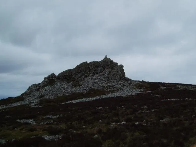
Stiperstones
Mountains & hills · 0.2 km

Manstone Rock
Natural landmarks · 0.2 km
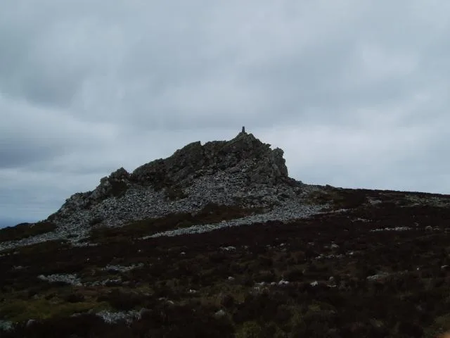
Stiperstones
Natural landmarks · 0.2 km

Devil's Chair
Natural landmarks · 0.3 km

Cranberry Rock
Natural landmarks · 0.7 km

Shepherd's Rock
Natural landmarks · 1.3 km

Tankerville Pottery and Gallery
Galleries · 1.4 km

The Bog Visitor Centre
Natural landmarks · 1.5 km

The Bog
Museums · 1.5 km

Nant Isa
Caravan parks · 1.5 km

The Bog Mine
Natural landmarks · 1.5 km
Pennerley
Castles · 1.8 km
Nearby
📷 4📷 3Natural landmarks · Mid Wales
Manstone Rock
Manstone Rock — a other in wales-mid, United Kingdom.
📷 4📷 3Natural landmarks · Mid Wales
Devil's Chair
Devil's Chair — a other in wales-mid, United Kingdom.
📷 3Natural landmarks · Mid Wales
Cranberry Rock
Cranberry Rock — a other in wales-mid, United Kingdom.
📷 3Natural landmarks · Mid Wales
Shepherd's Rock
Shepherd's Rock — a other in wales-mid, United Kingdom.
Where to eat & stay near Wild Edric's Way
Places to stay
📷 5 📷 5
📷 5 📷 5
📷 5Caravan parks · Mid Wales
Runnis Meadow Campsite
Runnis Meadow Campsite — a caravan park in wales mid.
 📷 5
📷 5 📷 5
📷 5Caravan parks · West Midlands
Woodville Caravan Site
Woodville Caravan Site — a caravan park in wales mid.
 📷 5
📷 5Caravan parks · Mid Wales
Daisy Bank Touring Caravan Park
Daisy Bank Touring Caravan Park — a caravan park in wales mid.
Places to eat & drink
 📷 5
📷 5 📷 7
📷 7Historic pubs · West Midlands
Yew Tree Inn Public House
Yew Tree Inn Public House in Wales North, United Kingdom.
 📷 5
📷 5 📷 5
📷 5Historic pubs · West Midlands
The Bucks Head Public House
The Bucks Head Public House in Wales Mid, United Kingdom.
 📷 5
📷 5 📷 7
📷 7More places in this region
 📷 3
📷 3 📷 5
📷 5Military museums · Mid Wales
Glyndŵr's Way
Glyndŵr's Way — a military museum in wales mid.

 📷 5
📷 5Frequently asked questions
- Where is Wild Edric's Way?
- Wild Edric's Way is in Mid Wales, United Kingdom (postcode SY5 0NF), in the parish of Worthen with Shelve.
- What is Wild Edric's Way?
- Wild Edric's Way in Wales Mid, United Kingdom.
- How do I get to Wild Edric's Way?
- Drivers can use postcode SY5 0NF.
- Is Wild Edric's Way a protected site?
- Yes — Wild Edric's Way is part of the The Stiperstones & The Hollies SSSI Site of Special Scientific Interest and the STIPERSTONES LANDSCAPE National Nature Reserve.
- How do I get to Wild Edric's Way?
- Drivers can navigate to postcode SY5 0NF. It sits within the South Shropshire parliamentary constituency.