
Islands · Scottish Islands
Wiay
Wiay — island of the Outer Hebrides, Scotland, UK, south-east of Benbecula.

Wikimedia Commons contributors — see linked file page for photographer and licence licence

Plan your visit
- Typical visit
- 4 h–12 h
- Free entry
- Dog-friendly
About
Wiay is a island in the United Kingdom. Part of Outer Hebrides. Wikidata describes it as: "island of the Outer Hebrides, Scotland, UK, south-east of Benbecula". Coordinates: 57.4014°, -7.2039°.
Photo gallery
Official information
Wiay is an uninhabited island located off the southeast coast of Benbecula in the Outer Hebrides. The island is known for its rocky terrain and historical significance, including a cave associated with Prince Charles Edward Stuart. It has been used for sheep grazing and sporting activities such as shooting and fishing.
From the Wikipedia article
Wiay (Scottish Gaelic: Bhuia or Fuidheigh) is an uninhabited island in the Outer Hebrides. It lies south-east of Benbecula and measures approximately 375 hectares (927 acres). The island is very flat with fertile ground and sandy beaches to the west whilst the east is predominantly peat moorland with a rocky coastline incorporating many small islands and inlets. The highest point on the island is Beinn a’ Tuath which rises to 102 m (335 ft). On the west side of the island are the ruins of an old cottage overlooking Bagh na Murla. The Eileanan Chearabhaigh lie to the north beyond Loch a' Laip. In the 18th century Bonnie Prince Charlie is said to have hidden in a cave on the island after the Battle of Culloden. The cave, known as Prince Charlie's Rest, is found to the east of the island at the foot of Beinn a Tuath and has clear views over the Minch and to Skye. Wiay was reported to have six inhabitants in 1861, but has been deserted since 1901. In 2013 the island was put up for sale at a reported price of £500,000.
Excerpt from Wikipedia under CC BY-SA 4.0. See the source article linked in Sources below.
- Coordinates
- 57.4014, -7.2039
- Official site
- www.scottish-places.info
Sources
- wikidata: Q3057442 (CC0)
- wikipedia: Wiay, Outer Hebrides (CC BY-SA 4.0)
- commons: Wiay from the air.jpg (CC BY-SA 4.0)
Other places nearby

Beinn a Tuath
Mountains & hills · 0.5 km

Eileanan Chearabhaigh
Islands · 1.3 km

Peters Port
Marinas · 2.8 km

Loch Leiravagh
Natural landmarks · 3.2 km

Eilean na Cille
Piers · 3.5 km
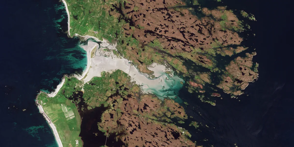
Bàgh nam Faoileann
Mountains & hills · 4.4 km

Bàgh nam Faoileann
Natural landmarks · 5.2 km

Loch Langavat
Lakes · 5.2 km

Loch Uskavagh
Natural landmarks · 5.4 km
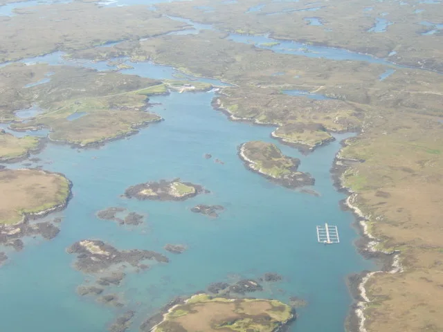
Loch Càrnan
Mountains & hills · 5.6 km

Loch Sheilavaig
Natural landmarks · 6.0 km

Rueval
Mountains & hills · 6.8 km
Nearby
📷 5Mountains & hills · Scottish Islands
Beinn a Tuath
Beinn a Tuath — mountain in scotland highlands. Elevation: 102 m.
📷 3Islands · Scottish Islands
Eileanan Chearabhaigh
Eileanan Chearabhaigh — group of small uninhabited tidal islands off the south east coast of Benbecula in the Outer Hebrides of Scotland.
📷 5📷 5Natural landmarks · Scottish Islands
Loch Leiravagh
Loch Leiravagh — a natural feature in scotland highlands.
📷 5📷 5Mountains & hills · Scottish Islands
Bàgh nam Faoileann
Bàgh nam Faoileann — bay in the Outer Hebrides, Scotland, UK; eastern part of the channel between South Uist and Benbecula.
Where to eat & stay near Wiay
Places to stay
 📷 5
📷 5Campsites · Scottish Islands
The Creel Yard Camp site and Bunk Houses
The Creel Yard Camp site and Bunk Houses — a campsite in scotland highlands.
 📷 5
📷 5Campsites · Scottish Islands
Shellbay Caravan & Camping Park
Shellbay Caravan & Camping Park — a campsite in scotland highlands.
 📷 5
📷 5Hostels · Scottish Islands
Ostail Bhaile nan Cailleach
Ostail Bhaile nan Cailleach — a hostel in scotland highlands.
 📷 5📷 5
Campsites · Scottish Islands
Moorcroft Campsite and Bunkhouse
Moorcroft Campsite and Bunkhouse — a campsite in scotland highlands.
 📷 5
📷 5Places to eat & drink
 📷 5
📷 5More places in this region
 📷 5
📷 5Islands · Scottish Islands
Bac Beag
Bac Beag — Scottish island, part of the Treshnish Isles in the Inner Hebrides.
 📷 5
📷 5Islands · Scottish Islands
Bac Mòr
Bac Mòr — island in Argyll and Bute, Scotland, UK, one of the Treshnish Isles.
 Flagship📷 3
Islands · Scottish Islands
Baleshare
Baleshare — flat tidal island in the Outer Hebrides, Scotland, UK.
 Flagship📷 5
Islands · Scottish Islands
Barra
Barra — island in Outer Hebrides, Scotland, UK.
Frequently asked questions
- Where is Wiay?
- Wiay is in the Scottish Islands, United Kingdom.
- What is Wiay?
- Wiay — island of the Outer Hebrides, Scotland, UK, south-east of Benbecula.
- How do I get to Wiay?
- Its coordinates are 57.4014°, -7.2039°.
- Is Wiay free to visit?
- Yes, Wiay is free to enter.