
Mountains & hills · South East England
White Horse Hill
Also known as: Ceffyl Gwyn Uffington
In or near Compton Beauchamp.
White Horse Hill — Named summit at 259 m.

Wikimedia Commons contributors — see linked file page for photographer and licence licence

Plan your visit
- Typical visit
- 3 h–8 h
- Best time of year
- Late spring – early autumn (May–Oct)
- Free entry
- Dog-friendly
About
White Horse Hill is a named summit in the United Kingdom. Records date its origin to AD -1000. Wikidata describes it as: "Named summit at 259 m.". Coordinates: 51.5754°, -1.5673°.
Photo gallery
Protected designations
- Site of Special Scientific Interest: Whitehorse Hill SSSI
- Area of Outstanding Natural Beauty: Cotswolds
- Area of Outstanding Natural Beauty: North Wessex Downs
Designations sourced from Natural England open data under OGL v3.
From the Wikipedia article
The Uffington White Horse is a prehistoric hill figure, 110 m (360 ft) long, formed from deep trenches filled with crushed white chalk. The figure is situated on the upper slopes of Whitehorse Hill in the English civil parish of Uffington in Oxfordshire, some 16 km (10 mi) east of Swindon, 8 km (5.0 mi) south of the town of Faringdon and a similar distance west of the town of Wantage; or 2.5 km (1.6 mi) south of Uffington. The hill forms a part of the scarp of the Berkshire Downs and overlooks the Vale of White Horse to the north. The best views of the figure are obtained from the air, or from directly across the Vale, particularly around the villages of Great Coxwell, Longcot, and Fernham. The Uffington White Horse was created some time between 1380 and 550 BC, during the late Bronze Age or early Iron Age. The site is owned and managed by the National Trust and is a scheduled monument. The Guardian stated in 2003 that "for more than 3,000 years, the Uffington White Horse has been jealously guarded as a masterpiece of minimalist art." The Uffington Horse is by far the oldest of the white horse figures in Britain; the others inspired by it have an entirely different design.
Excerpt from Wikipedia under CC BY-SA 4.0. See the source article linked in Sources below.
Background
History
Until the late 19th century, the horse was scoured every seven years as part of a more general local fair held on the hill. Francis Wise wrote in 1736: "The ceremony of scouring the Horse, from time immemorial, has been solemnized by a numerous concourse of people from all the villages roundabout." After the work was done a rural festival was held sponsored by the lord of the manor. During the Second World War the figure, easily recognisable from the air, was covered over with turf and hedge trimmings so that Luftwaffe pilots could not use it for navigation during bombing raids. While the horse is annually re-chalked and restored by volunteers, there have been some alterations over the…
Sourced from Wikipedia under CC BY-SA 4.0.
- Coordinates
- 51.5754, -1.5673
- County
- Oxfordshire
- District
- Vale of White Horse
- Parish
- Uffington
- Postcode
- SN7 7QJ
- Parliamentary constituency
- Didcot and Wantage
- Established
- 1380
- Official site
- nationaltrust.org.uk
Sources
- osm: n249836029 (ODbL)
- wikipedia: Uffington White Horse (CC BY-SA 4.0)
- commons: White horse from air.jpg (CC BY-SA 4.0)
Other places nearby

Whitehorse Hill
Mountains & hills · 0.0 km
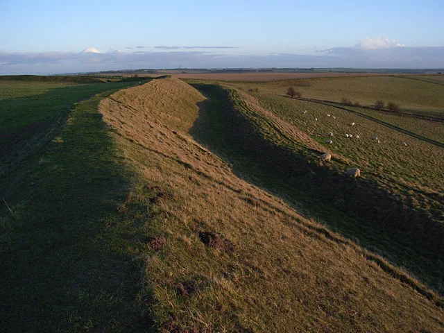
Uffington Castle
Hill forts · 0.1 km
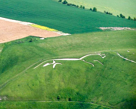
Uffington White Horse
Hill forts · 0.3 km
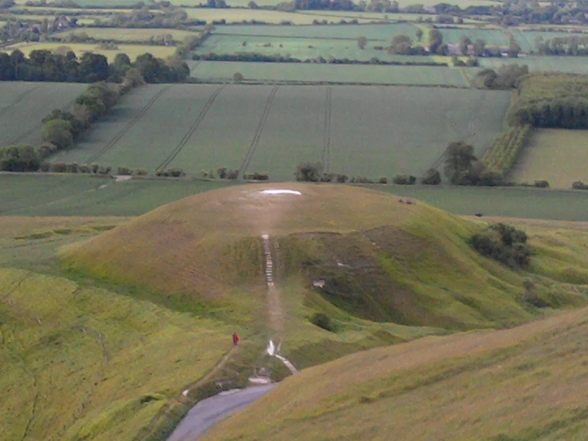
Dragon Hill
Mountains & hills · 0.5 km

Uffington Dragon Hill
Castles · 0.5 km

The Giant's Stair
Archaeological sites · 0.5 km

Woolstone Hill
Mountains & hills · 1.0 km

Rams Hill
Mountains & hills · 1.3 km

Hardwell Camp
Vineyards · 1.4 km

Hardwell Castle
Castles · 1.4 km

Rams Hill
Mountains & hills · 1.5 km

Woolstone
Villages · 1.6 km
Nearby
📷 5Mountains & hills · South East England
Whitehorse Hill
Whitehorse Hill — a hill or mountain in england south east.
📷 5Hill forts · South East England
Uffington Castle
Uffington Castle — hillfort in Oxfordshire, England, UK.
📷 5Hill forts · South East England
Uffington White Horse
Uffington White Horse — prehistoric carving in Uffington, England.
📷 5📷 5Castles · South East England
Uffington Dragon Hill
Uffington Dragon Hill — a castle in england south east.
📷 5Archaeological sites · South East England
The Giant's Stair
The Giant's Stair — a archaeological in england-south-east, United Kingdom.
Where to eat & stay near White Horse Hill
Places to stay
 📷 5
📷 5Campsites · South East England
Oxford Oak Camping
Oxford Oak Camping — a campsite in england west midlands.
📷 5 📷 5
📷 5Caravan parks · South East England
Woodhill Lane Caravan Park
Woodhill Lane Caravan Park — a caravan park in england south east.
 📷 5
📷 5Campsites · South East England
Farncombe Farm Campsite
Farncombe Farm Campsite — a campsite in england south east.
 📷 7
📷 7B&Bs · South East England
The Old Crown Coaching Inn
The Old Crown Coaching Inn — a bed-and-breakfast in england west midlands.
 📷 5
📷 5Places to eat & drink
 📷 7
📷 7Cafés · South East England
Goodies Café, Lambourn
Goodies Café, Lambourn — a café in england south east.
 📷 5
📷 5Historic pubs · South East England
The Pound Public House
The Pound Public House in England South East, United Kingdom.
 📷 7
📷 7 📷 5
📷 5Historic pubs · South East England
The Wheatsheaf Public House
The Wheatsheaf Public House in England South East, United Kingdom.
 📷 7
📷 7Historic pubs · South East England
The Duke Of Wellington Public House
The Duke Of Wellington Public House in England South East, United Kingdom.
 📷 6
📷 6Historic pubs · South East England
King Alfred's Head Public House
King Alfred's Head Public House in England South East, United Kingdom.
More mountains in this region
 📷 5
📷 5 📷 5
📷 5Mountains & hills · South East England
Reigate Caves
Reigate Caves is a mountain or hill in the United Kingdom.
 📷 5
📷 5Mountains & hills · South East England
North Downs
North Downs — a hill or mountain in england london.
 📷 5
📷 5Mountains & hills · South East England
Blue Bell Hill
Blue Bell Hill — a hill or mountain in england london.
Frequently asked questions
- Where is White Horse Hill?
- White Horse Hill is in Oxfordshire, South-East England, United Kingdom (postcode SN7 7QJ), in the parish of Uffington.
- What is White Horse Hill?
- White Horse Hill — Named summit at 259 m.
- How do I get to White Horse Hill?
- Drivers can use postcode SN7 7QJ.
- When was White Horse Hill built?
- Built or established in 1380.
- Who owns White Horse Hill?
- White Horse Hill is owned by National Trust.
- Is White Horse Hill a protected site?
- Yes — White Horse Hill is part of the Whitehorse Hill SSSI Site of Special Scientific Interest and the Cotswolds National Landscape (AONB).
- Is White Horse Hill free to visit?
- Yes, White Horse Hill is free to enter.
- How do I get to White Horse Hill?
- Drivers can navigate to postcode SN7 7QJ. It sits within the Didcot and Wantage parliamentary constituency.