
Mountains & hills · North West England
Whernside
In or near Ingleton.
Whernside — Named summit at 736 m.

Wikimedia Commons contributors — see linked file page for photographer and licence licence

Plan your visit
- Typical visit
- 3 h–8 h
- Best time of year
- Late spring – early autumn (May–Oct)
- Nearest railway station
- Ribblehead · 3.7 km
- Free entry
- Dog-friendly
Getting there & planning your visit
Whernside is located in North West England, with the nearest railway station being Ribblehead, approximately 3.7 km away. Entry to Whernside is free. There are no specific accessibility details provided.
About
Whernside is a named summit in the United Kingdom. Wikidata describes it as: "Named summit at 736 m.". Coordinates: 54.2278°, -2.4026°.
Photo gallery
See it from the streetimagery from 2022
Imagery © Mapillary contributors, CC BY-SA 4.0
Protected designations
- Site of Special Scientific Interest: Whernside SSSI
Designations sourced from Natural England open data under OGL v3.
From the Wikipedia article
Whernside is a mountain in the Yorkshire Dales in Northern England. It is the highest of the Yorkshire Three Peaks, the other two being Ingleborough and Pen-y-ghent. It is the highest point in the ceremonial county of North Yorkshire and the historic West Riding of Yorkshire with the summit lying on the county boundary with Cumbria. It is the fifteenth most prominent hill in England. In shape Whernside forms a long ridge, running roughly north-north-east to south-south-west. The mountain is 6 miles (10 km) north west of Ingleton and 6 miles (10 km) north of Horton-in-Ribblesdale.
Excerpt from Wikipedia under CC BY-SA 4.0. See the source article linked in Sources below.
- Coordinates
- 54.2278, -2.4026
- Address
- Chichester |publisher= Summersdale |isbn= 978-1-84-953239-6 |pages= 250–255}}</ref>
- Nearest railway station
- Ribblehead — 3.7 km
Sources
- osm: n82424124 (ODbL)
- wikipedia: Whernside (CC BY-SA 4.0)
- commons: Whernside and Ribblehead Viaduct.jpg (CC BY-SA 4.0)
Other places nearby
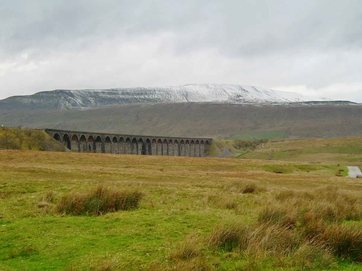
Whernside
Natural landmarks · 0.0 km
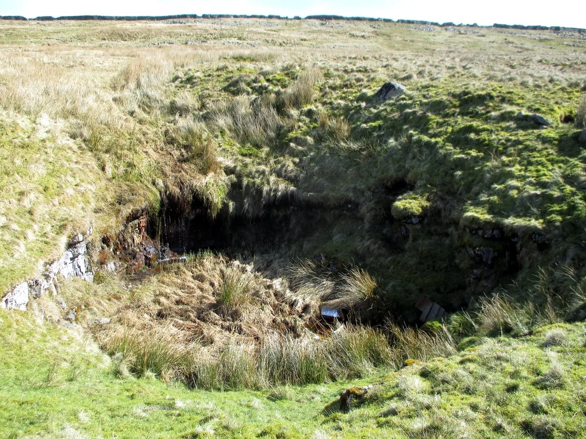
Langcliffe Pot
Mountains & hills · 0.8 km

Greensett Cave
Caves · 1.2 km

Greensett Cave
Caves · 1.2 km

High Force
Waterfalls · 1.8 km

Daimler Hole
Caves · 1.9 km

High Force
Waterfalls · 2.0 km
High Force
Waterfalls · 2.1 km

Low Force
Waterfalls · 2.1 km

Little Dale Aqueduct
Historic bridges · 2.2 km

Gunnerfleet Cave
Caves · 2.5 km

Gatekirk Cave
Caves · 2.7 km
Nearby
📷 5Natural landmarks · North West England
Whernside
Whernside — mountain in Cumbria, United Kingdom; one of the "Yorkshire Three Peaks".
📷 3Mountains & hills · North West England
Langcliffe Pot
Langcliffe Pot — cave system in North Yorkshire.
📷 5Caves · North West England
Greensett Cave
Greensett Cave — a cave broad in england-north-west, United Kingdom.
📷 5📷 5📷 5Caves · North West England
Daimler Hole
Daimler Hole — a cave broad in england-north-west, United Kingdom.
Where to eat & stay near Whernside
Places to stay
 📷 5
📷 5Hostels · North West England
The Station Inn Bunkhouse
The Station Inn Bunkhouse — a hostel in england north west.
 📷 5
📷 5Campsites · North West England
Philpin Farm Campsite
Philpin Farm Campsite — a campsite in england north west.
 📷 5
📷 5 📷 5
📷 5 📷 5
📷 5Campsites · North West England
Conder Farm Camp Site
Conder Farm Camp Site — a campsite in england north west.
 📷 5
📷 5Caravan parks · North West England
High Laning Farm Caravan & Camping Park
High Laning Farm Caravan & Camping Park — a caravan park in england north west.
Places to eat & drink
 📷 5
📷 5Cafés · North West England
Lakehouse Food & Drink
Lakehouse Food & Drink — a café in england north west.
 📷 5
📷 5Historic pubs · North West England
Punch Bowl Hotel
Punch Bowl Hotel in England North West, United Kingdom.
 📷 5
📷 5Restaurants · North West England
The Game Cock Inn
The Game Cock Inn — a restaurant in england north west. Cuisine: french;english.
 📷 5
📷 5Cafés · North West England
Gun Dog Coffee Shop
Gun Dog Coffee Shop — a café in england north west.
 📷 5
📷 5Historic pubs · North West England
Horse And Farrier Inn
Horse And Farrier Inn in England North West, United Kingdom.
 📷 5
📷 5More mountains in this region
 📷 5
📷 5Mountains & hills · North West England
Appleton Park
Appleton Park — a hill or mountain in england west midlands.
 📷 5
📷 5Mountains & hills · North West England
High Warren
High Warren — mountain in england west midlands. Elevation: 105 m.
 📷 5
📷 5Mountains & hills · North West England
Alderley Edge
Alderley Edge — mountain in england west midlands. Elevation: 194 m.
 📷 3
📷 3Frequently asked questions
- Where is Whernside?
- Whernside is in North-West England, United Kingdom.
- What is Whernside?
- Whernside — Named summit at 736 m.
- How do I get to Whernside?
- The nearest railway station is Ribblehead, about 3.7 km away. Its coordinates are 54.2278°, -2.4026°.
- Is Whernside a protected site?
- Yes — Whernside is part of the Whernside SSSI Site of Special Scientific Interest.
- Is Whernside free to visit?
- Yes, Whernside is free to enter.
- How do I get to Whernside?
- The nearest railway station is Ribblehead, about 3.7 km away.