
Public art & sculpture · North East England
Wheel Cross
In or near City of Durham.
Wheel Cross — a public art in scotland-lowlands, United Kingdom.

Anthony Parkes — CC BY-SA 2.0 via Wikimedia Commons licence

Plan your visit
- Typical visit
- 1 h–2 h
- Nearest railway station
- Durham · 1.6 km
- Free entry
- Dog-friendly
Getting there & planning your visit
To visit Wheel Cross, the nearest railway station is Durham, located 1.6 km away. Entry is free, and the location is accessible. The postcode for sat-nav is DH1 3TQ.
About
Wheel Cross is a public art located in scotland-lowlands, United Kingdom. Sourced from OpenStreetMap (ODbL licence); see local listings for visitor information, opening hours and admission details.
Photo gallery
From the Wikipedia article
A sun cross, solar cross, or wheel cross is a solar symbol consisting of an equilateral cross inside a circle. The design is frequently found in the symbolism of prehistoric cultures, particularly during the Neolithic to Bronze Age periods of European prehistory. The symbol's ubiquity and apparent importance in prehistoric religion have given rise to its interpretation as a solar symbol, whence the modern English term "sun cross" (a calque of German: Sonnenkreuz). The symbol means village in Ancient Egyptian (Gardiner symbol O49). Prehistoric rock carvings at Madsebakke, on Bornholm Island, Denmark, depict multiple sun crosses with cup marks. These petroglyphs date to the Bronze Age (c. 1800–500 BCE) and are among the best-preserved in Scandinavia. The big wheel sun cross, carved directly into granite bedrock, is a circular motif with radial arms – often interpreted as a solar symbol representing the movement of the sun or the cycle of seasons. Around it are cup marks, small carved indentations believed to hold ritual significance, possibly linked to offerings or celestial events. Other locations with similar sun cross motifs and cup-marked stones include: Bohuslän, Sweden – home to thousands of Bronze Age carvings with solar boats, warriors, and sun wheels. Alta, Norway – UNESCO World Heritage site with symbolic carvings, including solar imagery. Götaland and Östergötland, Sweden – known for petroglyphs featuring sun crosses and animal figures. These carvings are part of a shared Nordic symbolic tradition, emphasizing sun worship, cycles of life, and ancestral rituals. The same symbol is in use as a modern astronomical symbol representing the Earth rather than the sun. In pharmacy, the sun cross symbol represents various/miscellaneous drugs. After World War II, variants of the symbol became associated with neo-Nazi and white supremacist movements.
Excerpt from Wikipedia under CC BY-SA 4.0. See the source article linked in Sources below.
- Coordinates
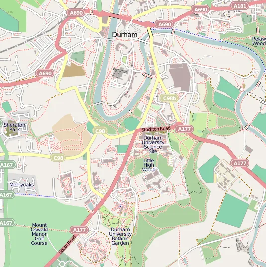
- 54.7654, -1.5835
- District
- County Durham
- Parish
- City of Durham
- Postcode
- DH1 3TQ
- Parliamentary constituency
- City of Durham
- Nearest railway station
- Durham — 1.6 km
Sources
- osm: node/4585251074 (ODbL)
- wikipedia: Wheel cross (CC BY-SA 4.0)
Other places nearby

British Society for Middle Eastern Studies
Other places · 0.1 km

St Aidan's College
Historic churches · 0.1 km
Bow Cemetery
Cemeteries · 0.2 km
Durham University, Oriental Museum
Museums · 0.2 km
Durham University Business School
Other places · 0.2 km

Observatory Hill
Mountains & hills · 0.2 km

Teikyo University of Japan in Durham
Other places · 0.2 km

Oriental Museum
Museums · 0.2 km
Trevelyan College
Other places · 0.3 km

John Snow College
Other places · 0.3 km

Van Mildert College
Other places · 0.3 km
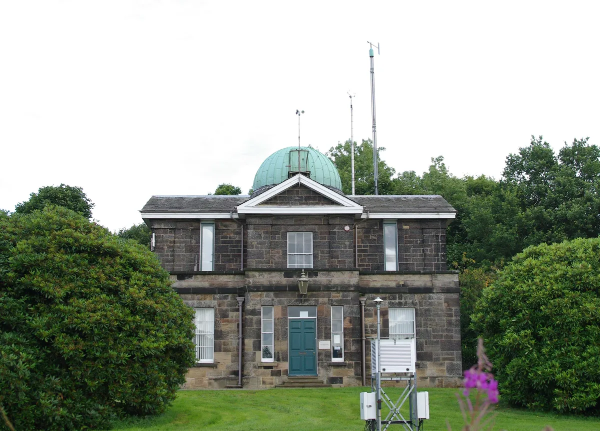
Durham University Observatory
Observatories · 0.4 km
Nearby
📷 3Other places · North East England
British Society for Middle Eastern Studies
British Society for Middle Eastern Studies in England North East, United Kingdom.
📷 4Historic churches · North East England
St Aidan's College
St Aidan's College in England North East, United Kingdom.
📷 3📷 3Museums · North East England
Durham University, Oriental Museum
Durham University, Oriental Museum — museum in England, United Kingdom.
📷 4Other places · North East England
Durham University Business School
Durham University Business School in England North East, United Kingdom.
📷 5Mountains & hills · North East England
Observatory Hill
Observatory Hill — mountain in scotland lowlands. Elevation: 101 m.
Where to eat & stay near Wheel Cross
Places to stay
 📷 5
📷 5B&Bs · North East England
The Georgian Town House
The Georgian Town House — a bed-and-breakfast in scotland lowlands.
 📷 5
📷 5B&Bs · North East England
Castle View Guest House
Castle View Guest House — a bed-and-breakfast in scotland lowlands.
 📷 5
📷 5Hotels · North East England
Hotel Indigo Durham
Hotel Indigo Durham — a hotel in scotland lowlands.
 📷 5
📷 5Hotels · North East England
Durham Marriott Hotel Royal County
Durham Marriott Hotel Royal County — a hotel in scotland lowlands.
 📷 5
📷 5Hotels · North East England
Radisson Blu
Radisson Blu — a hotel in scotland lowlands.
 📷 5
📷 5Caravan parks · North East England
Baxter Wood Farm Caravan Site
Baxter Wood Farm Caravan Site — a caravan park in scotland lowlands.
Places to eat & drink
 📷 4
📷 4Historic pubs · North East England
The Victoria
The Victoria in England North East, United Kingdom.
 📷 5
📷 5Historic pubs · North East England
Colpitts Hotel
Colpitts Hotel in England North East, United Kingdom.
 📷 7
📷 7Restaurants · North East England
Shaheen's Indian
Shaheen's Indian — a restaurant in scotland lowlands.
 📷 5
📷 5 📷 5
📷 5Restaurants · North East England
Happiness 2 Barbeque
Happiness 2 Barbeque — a restaurant in scotland lowlands.
 📷 5
📷 5More places in this region
 📷 3
📷 3Public art & sculpture · North East England
Crossing Points
Crossing Points — a public art in england-yorkshire, United Kingdom.
.jpg?width=1200) 📷 3
📷 3Public art & sculpture · North East England
Stockton Flyer
Stockton Flyer — Public artwork (installation).
 📷 3
📷 3Public art & sculpture · North East England
Temenos
Temenos — Public artwork (sculpture) by Anish Kapoor.
 📷 4
📷 4Public art & sculpture · North East England
Apollo Pavilion
Apollo Pavilion in England North East, United Kingdom.
Frequently asked questions
- Where is Wheel Cross?
- Wheel Cross is in North-East England, United Kingdom (postcode DH1 3TQ), in the parish of City of Durham.
- What is Wheel Cross?
- Wheel Cross — a public art in scotland-lowlands, United Kingdom.
- How do I get to Wheel Cross?
- The nearest railway station is Durham, about 1.6 km away. The nearest town is City of Durham. Drivers can use postcode DH1 3TQ.
- Is Wheel Cross free to visit?
- Yes, Wheel Cross is free to enter.
- How do I get to Wheel Cross?
- The nearest railway station is Durham, about 1.6 km away. Drivers can navigate to postcode DH1 3TQ.