
National landscapes (AONB) · East of England
Weybourne, Norfolk
In or near Beeston Regis.
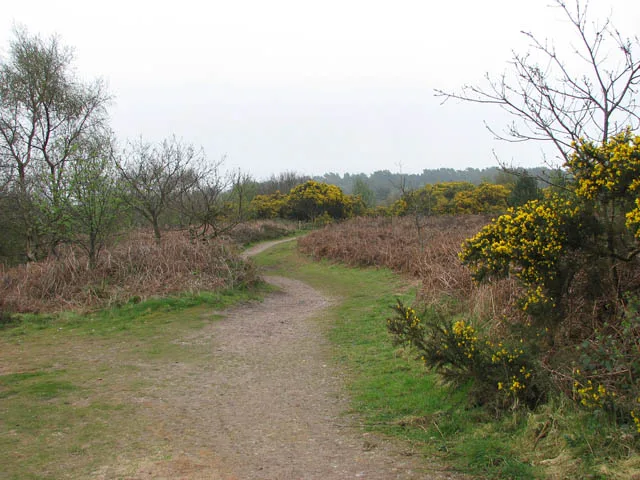
Weybourne is a village on the coast of North Norfolk, England. The village is surrounded by arable fields, woodland and heathland; it straddles the A149 coast road, 3 miles (5 km) west of Sheringham,

Gordon Brown — CC BY-SA 2.0 via Wikimedia Commons licence

Plan your visit
- Typical visit
- 3 h–6 h
- Nearest railway station
- Kelling Heath Park · 1.1 km
- Free entry
- Dog-friendly
Getting there & planning your visit
To visit Weybourne in Norfolk, the nearest railway station is Kelling Heath Park, located 1.1 km away. The postcode for navigation is NR25 7TD. Entry to the area is free.
About
Weybourne is a village on the coast of North Norfolk, England. The village is surrounded by arable fields, woodland and heathland; it straddles the A149 coast road, 3 miles (5 km) west of Sheringham, within the Norfolk Coast AONB. The area is popular for its local countryside and coastline, particularly for walking, wildlife and bird-watching. In local dialect, Weybourne may be pronounced "Webburn" or "Webbun". The second element of the name refers to a stream, or burn.
Photo gallery
Official information
All Saints' Church in Weybourne features the ruins of the former Weybourne Priory, founded in the early 13th century. Visitors can explore the impressive remains of the Norman tower and the outlines of the priory, along with various architectural elements from different periods, including a Jacobean pulpit and medieval benches.
Protected designations
- Area of Outstanding Natural Beauty: Norfolk Coast
Designations sourced from Natural England open data under OGL v3.
From the Wikipedia article
Weybourne is a village on the coast of North Norfolk, England. The village is surrounded by arable fields, woodland and heathland; it straddles the A149 coast road, 3 miles (5 km) west of Sheringham, within the Norfolk Coast AONB. The area is popular for its local countryside and coastline, particularly for walking, wildlife and bird-watching. In local dialect, Weybourne may be pronounced "Webburn" or "Webbun". The second element of the name refers to a stream, or burn.
Excerpt from Wikipedia under CC BY-SA 4.0. See the source article linked in Sources below.
Background
History
Weybourne is mentioned in the Domesday Book of 1086, where it is called Wabrume. The remains of the Augustinian priory, founded around 1200 AD by Sir Ralph de Meyngaren (Mainwearing), stand on the site of a simpler Anglo-Saxon church. By 1494 one prior and three canons lived there: one canon complained that the priory was so poor it was unable to pay him his 20 shillings of annual pocket money. At a visitation in 1514, there was only one prior and one canon and this situation remained until King Henry VIII ordered the dissolution of monasteries and priories.
Description
At Weybourne, the coast has an unusually steep shingle beach which was regarded as vulnerable to the threat of the Spanish Armada in 1588. The village was also a well-used location for smuggling items such as over-proof gin and pressed bales of tobacco. The coast between Sheringham and Weybourne was popular for landing goods because ships could anchor closer to the shore than anywhere else in the area. There was also a convenient gap in the cliffs through which goods could be easily transported. Local folklore says that the miller would stop the Weybourne Windmill's sails in the form of a cross to warn the smugglers that the customs or coastguards were on to them; when the coast was clear…
Sourced from Wikipedia under CC BY-SA 4.0.
- Coordinates
- 52.9420, 1.1380
- County
- Norfolk
- District
- North Norfolk
- Parish
- Weybourne
- Postcode
- NR25 7TD
- Parliamentary constituency
- North Norfolk
- Nearest railway station
- Kelling Heath Park — 1.1 km
- Official site
- www.heritage.norfolk.gov.uk
Sources
- wikipedia: Weybourne, Norfolk (CC BY-SA 4.0)
Other places nearby

Weybourne Village Sign
Public art & sculpture · 0.2 km

Weybourne
Villages · 0.2 km

Weybourne War Memorial, Norfolk
Memorials & monuments · 0.2 km

Weybourne Priory
Abbeys & priories · 0.3 km

Foxhills Camping
Campsites · 0.4 km

ZSU-23-4 Shilka Anti-aircraft
Memorials & monuments · 0.5 km

Muckleburgh Collection
Museums · 0.6 km
The Muckleburgh Military Collection
Museums · 0.6 km

SS Rosalie
Museums · 1.1 km
Kelling Heath
Wildlife reserves · 1.1 km

The Pheasant
Hotels · 1.2 km

North Norfolk Railway
Museums · 1.4 km
Nearby
📷 3Public art & sculpture · East of England
Weybourne Village Sign
Weybourne Village Sign — a public art in england-east-midlands, United Kingdom.
📷 5📷 3Memorials & monuments · East of England
Weybourne War Memorial, Norfolk
Weybourne War Memorial, Norfolk — Grade II listed building-listed memorial in england-east-midlands, United Kingdom.
📷 3Abbeys & priories · East of England
Weybourne Priory
Weybourne Priory — a abbey in england-east-midlands, United Kingdom.
📷 5Campsites · East of England
Foxhills Camping
Foxhills Camping — a campsite in england east midlands.
📷 3Memorials & monuments · East of England
ZSU-23-4 Shilka Anti-aircraft
ZSU-23-4 Shilka Anti-aircraft — a memorial in england-east-midlands, United Kingdom.
Where to eat & stay near Weybourne, Norfolk
Places to stay
📷 5Campsites · East of England
Foxhills Camping
Foxhills Camping — a campsite in england east midlands.
📷 5 📷 5
📷 5Caravan parks · East of England
Kelling Heath Holiday Park
Kelling Heath Holiday Park — a caravan park in england east midlands.
 📷 5
📷 5Campsites · East of England
Breck Farm
Breck Farm — a campsite in england east midlands.
 📷 5
📷 5 📷 5
📷 5Places to eat & drink
 📷 5
📷 5Historic pubs · East of England
White Horse Public House
White Horse Public House in England East, United Kingdom.
 📷 5
📷 5 📷 5
📷 5 📷 5
📷 5Historic pubs · East of England
The White Horse Public House
The White Horse Public House in England East, United Kingdom.
 📷 5
📷 5Historic pubs · East of England
The Wellington Public House
The Wellington Public House in England East, United Kingdom.
 📷 5
📷 5Historic pubs · East of England
Black Boys Public House
Black Boys Public House in England East, United Kingdom.
More national landscapes in this region
 📷 3
📷 3National landscapes (AONB) · East of England
Dragon
Dragon — Public artwork (sculpture).
 📷 3
📷 3National landscapes (AONB) · East of England
Queen Victoria
Queen Victoria — Public artwork (sculpture).
 📷 3
📷 3National landscapes (AONB) · East of England
The Scallop
The Scallop — Public artwork (sculpture) by Maggi Hambling.
 📷 3
📷 3National landscapes (AONB) · East of England
The Sisters
The Sisters — Public artwork (sculpture) by Andrew Baldwin.
Frequently asked questions
- Where is Weybourne, Norfolk?
- Weybourne, Norfolk is in Norfolk, East of England, United Kingdom (postcode NR25 7TD), in the parish of Weybourne.
- What is Weybourne, Norfolk?
- Weybourne is a village on the coast of North Norfolk, England. The village is surrounded by arable fields, woodland and heathland; it straddles the A149 coast road, 3 miles (5 km) west of Sheringham,
- How do I get to Weybourne, Norfolk?
- The nearest railway station is Kelling Heath Park, about 1.1 km away. Drivers can use postcode NR25 7TD.
- Is Weybourne, Norfolk a protected site?
- Yes — Weybourne, Norfolk is part of the Norfolk Coast National Landscape (AONB).
- Is Weybourne, Norfolk free to visit?
- Yes, Weybourne, Norfolk is free to enter.
- How do I get to Weybourne, Norfolk?
- The nearest railway station is Kelling Heath Park, about 1.1 km away. Drivers can navigate to postcode NR25 7TD.