
Forests & woodlands · South Wales
Weston Big Wood
In or near Weston in Gordano.
Weston Big Wood is a forest or woodland in the United Kingdom.

Wikimedia Commons contributors — see linked file page for photographer and licence licence

Plan your visit
- Typical visit
- 1 h–3 h
- Nearest railway station
- Nailsea and Backwell · 6.3 km
- Free entry
- Family-friendly
- Dog-friendly
About
Weston Big Wood is a named forest, woodland or nature reserve in the United Kingdom. Coordinates: 51.4723°, -2.7846°. This entry is part of The Great Britain Guide, a free, ad-free, open-data tourist directory.
Photo gallery
Protected designations
- Site of Special Scientific Interest: Weston Big Wood SSSI
- Site of Special Scientific Interest: Severn Estuary SSSI
- Ramsar wetland: Severn Estuary
Designations sourced from Natural England open data under OGL v3.
From the Wikipedia article
Weston Big Wood (grid reference ST455750) is a 37.48 hectare woodland west of the town of Portishead, North Somerset, England. It is a nature reserve and biological Site of Special Scientific Interest, notified in 1971. The wood takes its name from the nearby village of Weston-in-Gordano.
Excerpt from Wikipedia under CC BY-SA 4.0. See the source article linked in Sources below.
Background
History
The wood itself dates at least from Iron Age times, with some evidence that there has been woodland here since trees began to recolonise after the last ice age some 10,000 years ago. Some of its internal features e.g. old stones, ditches and banks are thought to be medieval boundaries, dating from the Middle Ages and used to divide the wood into sectors. More recently, after the manor of North Weston was sold to the City of Bristol in 1637, marker stones were placed to mark a boundary across the woodland. These stones, marked with C.B. (City of Bristol), remain in place and can be found by looking at the old OS maps of the 19th century. Adjacent to the wood on its southern side is the…
Visiting
There are four main entry points to the woodland. The first (at 51.471456,-2.790383) is from a minor road which leads north from the Portishead to Weston in Gordano road; just past the civic amenity site. It enters the north west side of the wood and leads up a set of steps to the main circular path through the woods. The second entrance (at 51.467293,-2.783898) leads past the old quarries along a pathway which leads along the south eastern side of the wood. The third entrance is off Underwood Road in Portishead (at 51.472967,-2.777782) and enters the eastern side of the wood. The final entrance (at 51.4750278, -2.7835127) is from the fields adjacent to the northern side of the woods. A…
Sourced from Wikipedia under CC BY-SA 4.0.
- Coordinates
- 51.4723, -2.7846
- District
- North Somerset
- Parish
- Portishead
- Postcode
- BS20 8PL
- Parliamentary constituency
- North Somerset
- Nearest railway station
- Nailsea and Backwell — 6.3 km
Sources
- osm: r1239715 (ODbL)
- wikipedia: Weston Big Wood (CC BY-SA 4.0)
- commons: Westonbigwood.jpg (CC BY-SA 4.0)
Other places nearby

view of quarry
Viewpoints · 0.8 km
Raven Ubertop
Viewpoints · 1.0 km

Weston Down
Mountains & hills · 1.0 km

Weston in Gordano
Towns & cities · 1.0 km

ROC Post Portishead
Historic houses · 1.1 km

Church of St Peter, Portishead
Historic churches · 1.4 km
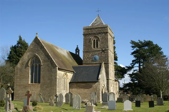
Church of SS Peter & Paul, Weston in Gordano
Historic churches · 1.5 km

Perceval
Memorials & monuments · 1.5 km

Clapton Moor Nature Reserve
Forests & woodlands · 1.6 km

Remains Of Former Windmill In The Golf Club
Windmills · 1.6 km

Sugar Loaf Beach old tidal pool
Lidos & outdoor pools · 1.6 km
Sugar Loaf Bay Cave
Caves · 1.6 km
Nearby
📷 3📷 3📷 5📷 3Towns & cities · South Wales
Weston in Gordano
Weston in Gordano — village in Somerset, UK.
📷 3Historic houses · South Wales
ROC Post Portishead
ROC Post Portishead — a historic house in wales-south, United Kingdom.
📷 3Historic churches · South Wales
Church of St Peter, Portishead
Church of St Peter, Portishead — church in Portishead, North Somerset, England, UK.
Where to eat & stay near Weston Big Wood
Places to stay
 📷 7
📷 7Hotels · South Wales
ibis budget Portishead Marina
ibis budget Portishead Marina — a hotel in wales south. 2-star. Brand: Ibis Budget.
 📷 5
📷 5Campsites · South Wales
Glenny Wood Scout Camp Site
Glenny Wood Scout Camp Site — a campsite in wales south.
 📷 5
📷 5Caravan parks · South Wales
Coast Caravan Park
Coast Caravan Park — a caravan park in wales south.
 📷 5
📷 5Caravan parks · South Wales
Colehouse Farm Caravan Park
Colehouse Farm Caravan Park — a caravan park in wales south.
 📷 5
📷 5 📷 5
📷 5Campsites · South Wales
Bullock Farm Camping
Bullock Farm Camping — a campsite in wales south.
Places to eat & drink
 📷 5
📷 5Historic pubs · South Wales
The White Lion Public House And Section Of Former Sea Wall To North End Of West Front
The White Lion Public House And Section Of Former Sea Wall To North End Of West Front in Wales South, United Kingdom.
 📷 7
📷 7 📷 5
📷 5Historic pubs · South Wales
The Old Farmhouse
The Old Farmhouse in Wales South, United Kingdom.
 📷 5
📷 5 📷 5
📷 5 📷 5
📷 5More forests in this region
 📷 3
📷 3Forests & woodlands · South Wales
Aberbargoed Grasslands National Nature Reserve
Aberbargoed Grasslands National Nature Reserve is a forest or woodland in the United Kingdom.
 📷 3
📷 3Forests & woodlands · South Wales
Beaufort Hill Ponds & Woodlands
Beaufort Hill Ponds & Woodlands is a forest or woodland in the United Kingdom.
.jpg?width=1200) 📷 3
📷 3Forests & woodlands · South Wales
Blake's Pools Nature Reserve
Blake's Pools Nature Reserve is a forest or woodland in the United Kingdom.
 📷 5
📷 5Forests & woodlands · South Wales
Cardiff Bay Wetlands Reserve
Cardiff Bay Wetlands Reserve is a forest or woodland in the United Kingdom.
Frequently asked questions
- Where is Weston Big Wood?
- Weston Big Wood is in South Wales, United Kingdom (postcode BS20 8PL), in the parish of Portishead.
- What is Weston Big Wood?
- Weston Big Wood is a forest or woodland in the United Kingdom.
- How do I get to Weston Big Wood?
- The nearest railway station is Nailsea and Backwell, about 6.3 km away. The nearest town is Weston in Gordano. Drivers can use postcode BS20 8PL.
- Is Weston Big Wood a protected site?
- Yes — Weston Big Wood is part of the Weston Big Wood SSSI Site of Special Scientific Interest and the Severn Estuary SSSI Site of Special Scientific Interest.
- Is Weston Big Wood free to visit?
- Yes, Weston Big Wood is free to enter.
- How do I get to Weston Big Wood?
- The nearest railway station is Nailsea and Backwell, about 6.3 km away. Drivers can navigate to postcode BS20 8PL.