
Historic houses · North East England
Westhall
In or near Belford.
Westhall in England North East, United Kingdom.

Graham Robson — CC BY-SA 2.0 via Wikimedia Commons licence

Plan your visit
- Typical visit
- 1 h–2 h
- Family-friendly
- Limited wheelchair access
About
Westhall is a place of interest in England North East, United Kingdom — drawn from open-data sources for visitor reference. See the linked Wikipedia article for the full description.
Photo gallery
Protected designations
- Site of Special Scientific Interest: Northumberland Shore SSSI
- Area of Outstanding Natural Beauty: Northumberland Coast
Designations sourced from Natural England open data under OGL v3.
From the Wikipedia article
Westhall is a privately owned 19th-century castellated house at Belford in Northumberland, England now in use as a farm. It is on a site with older historical associations.
Excerpt from Wikipedia under CC BY-SA 4.0. See the source article linked in Sources below.
Background
History
Westhall Farm, a little to the north-west of the town and approached by a lane from the Wooler road, is the site of a fortified house that was surrounded by a moat, mentioned in a 15th-century document as the Castrum de Belford. The present house was built in 1837 in a castellated Gothic style.
Sourced from Wikipedia under CC BY-SA 4.0.
- Coordinates
- 55.5997, -1.8370
- District
- Northumberland
- Parish
- Belford
- Postcode
- NE70 7QQ
- Parliamentary constituency
- North Northumberland
- Established
- 1837
Sources
- wikidata: Q26527225 (CC0)
- wikipedia: Westhall, Northumberland (CC BY-SA 4.0)
Other places nearby

Belford Westhall Motte
Castles · 0.1 km

Belford War Memorial
Memorials & monuments · 0.3 km

The Blue Bell Hotel
Hotels · 0.5 km

Market Cross
Memorials & monuments · 0.5 km
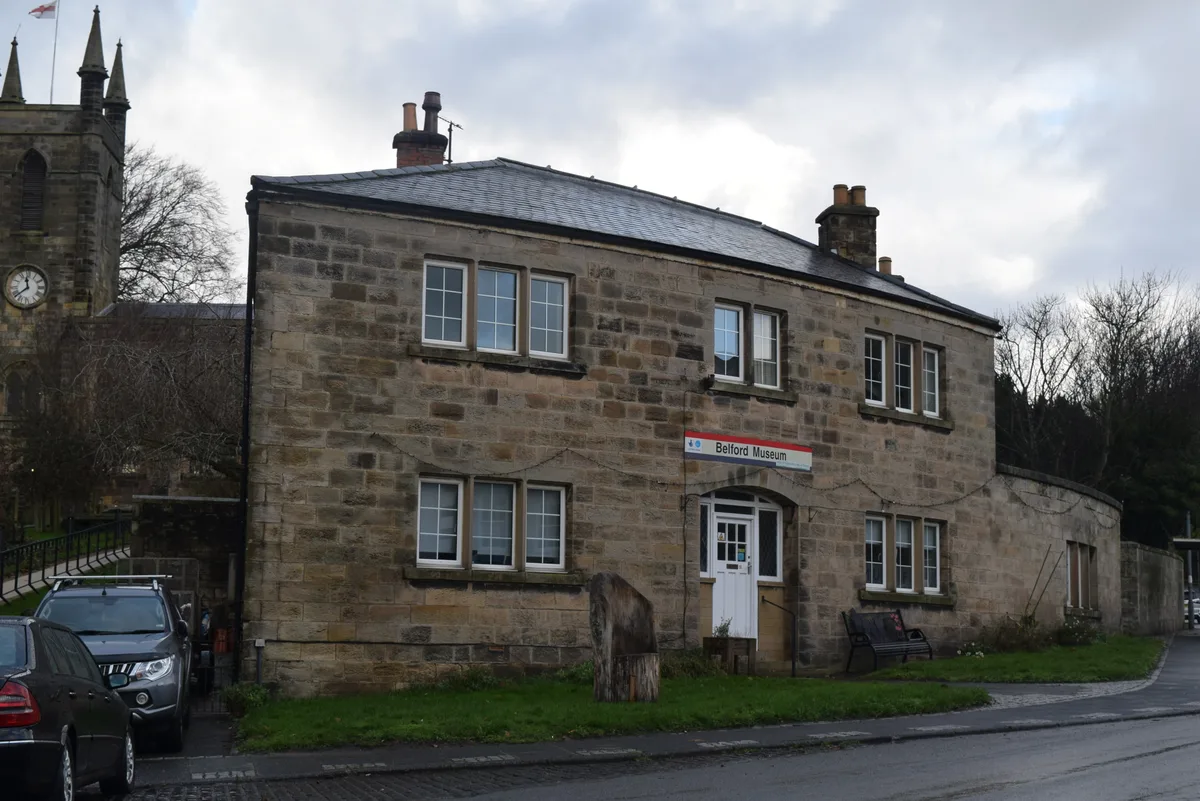
Belford Hidden History Museum
Museums · 0.5 km

Belford
Towns & cities · 0.6 km

Chester's Hill camps
Vineyards · 0.7 km

Belford Hall
Historic houses · 0.8 km

South Meadows Caravan Park
Caravan parks · 1.3 km

The Lodge
Campsites · 1.4 km

Derry Dykes
Vineyards · 1.4 km

Crag Mill railway station
Heritage railway stations · 1.5 km
Nearby
📷 5Castles · North East England
Belford Westhall Motte
Belford Westhall Motte — a castle in scotland central.
📷 3Memorials & monuments · North East England
Belford War Memorial
Belford War Memorial — Grade II listed building-listed memorial in scotland-central, United Kingdom.
📷 5Hotels · North East England
The Blue Bell Hotel
The Blue Bell Hotel — a hotel in scotland central.
📷 4Memorials & monuments · North East England
Market Cross
Market Cross is a memorial in the United Kingdom.
📷 3Museums · North East England
Belford Hidden History Museum
Belford Hidden History Museum — museum in Belford, England, UK.
📷 5Towns & cities · North East England
Belford
Belford — village and civil parish in Northumberland, England, UK.
Where to eat & stay near Westhall
Places to stay
📷 5Hotels · North East England
The Blue Bell Hotel
The Blue Bell Hotel — a hotel in scotland central.
📷 5Caravan parks · North East England
South Meadows Caravan Park
South Meadows Caravan Park — a caravan park in scotland central.
📷 5 📷 5
📷 5Hotels · North East England
Middleton Hall
Middleton Hall — a hotel in scotland central.
 📷 5
📷 5Campsites · North East England
Budle Bay Campsite
Budle Bay Campsite — a campsite in scotland central.
 📷 5
📷 5Caravan parks · North East England
Waren Caravan & Camping Park
Waren Caravan & Camping Park — a caravan park in scotland central.
Places to eat & drink
 📷 7
📷 7 📷 7
📷 7Historic pubs · North East England
Plough Inn With Outbuilding To North
Plough Inn With Outbuilding To North in Scotland Lowlands, United Kingdom.
 📷 7
📷 7Historic pubs · North East England
59 And 61, Bridge Street
59 And 61, Bridge Street in Scotland Lowlands, United Kingdom.
 📷 5
📷 5Historic pubs · North East England
The Berwick Arms
The Berwick Arms in Scotland Lowlands, United Kingdom.
 📷 7
📷 7Historic pubs · North East England
Red Lion Public House
Red Lion Public House in Scotland Lowlands, United Kingdom.
 📷 7
📷 7Historic pubs · North East England
Bridge Of Aln Hotel
Bridge Of Aln Hotel in Scotland Lowlands, United Kingdom.
More historic houses in this region
 📷 3
📷 3Historic houses · North East England
Wayside cross known as Jenny Bradley 1000m north west of Bloworth Crossing on Greenhow Moor
Wayside cross known as Jenny Bradley 1000m north west of Bloworth Crossing on Greenhow Moor — a Grade II*-listed historic house in england-yorkshire, United Kingdom.
 📷 3
📷 3Historic houses · North East England
Crackpot Hall
Crackpot Hall — a historic house in england-north-west, United Kingdom.
 📷 3
📷 3Historic houses · North East England
Bunton Mine shop
Bunton Mine shop — a historic house in england-north-west, United Kingdom.
 📷 3
📷 3Historic houses · North East England
Blakethwaite Mine
Blakethwaite Mine — a historic house in england-north-west, United Kingdom.
Frequently asked questions
- Where is Westhall?
- Westhall is in North-East England, United Kingdom (postcode NE70 7QQ), in the parish of Belford.
- What is Westhall?
- Westhall in England North East, United Kingdom.
- How do I get to Westhall?
- Drivers can use postcode NE70 7QQ.
- When was Westhall built?
- Built or established in 1837.
- Is Westhall a protected site?
- Yes — Westhall is part of the Northumberland Shore SSSI Site of Special Scientific Interest and the Northumberland Coast National Landscape (AONB).
- How do I get to Westhall?
- Drivers can navigate to postcode NE70 7QQ. It sits within the North Northumberland parliamentary constituency.