
Battlefields & battle sites · South West England
West Woods
In or near Wootton Rivers.
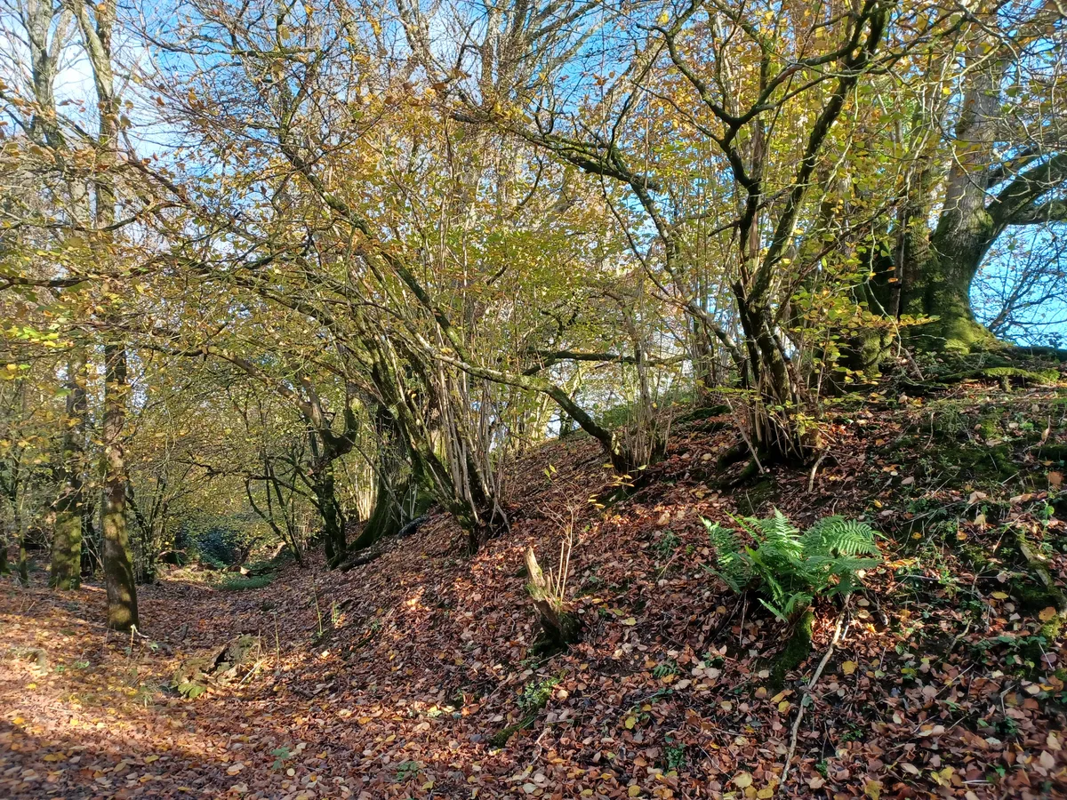
West Woods in England South West, United Kingdom.

Brian Robert Marshall — CC BY-SA 2.0 via Wikimedia Commons licence

Plan your visit
- Typical visit
- 1 h–2 h
- Nearest railway station
- Pewsey · 6.0 km
- Free entry
- Dog-friendly
About
West Woods is a registered historic battlefield in England South West, United Kingdom. Britain's battlefields range from the medieval clashes of the Wars of the Roses to the Civil War sieges and the 1745 Jacobite Rising at Culloden — most are open landscapes with interpretive trails and battle-monument markers.
Photo gallery
Protected designations
- Area of Outstanding Natural Beauty: Cotswolds
- Area of Outstanding Natural Beauty: North Wessex Downs
Designations sourced from Natural England open data under OGL v3.
From the Wikipedia article
West Woods is a wood about 2+1⁄2 miles (4 km) southwest of the market town of Marlborough in the English county of Wiltshire, United Kingdom. Its area is approximately 957 acres (387 ha). It is open to the public, and is popular with visitors in the Spring, when bluebells cover the forest floor.
Excerpt from Wikipedia under CC BY-SA 4.0. See the source article linked in Sources below.
Background
History
West Woods was once part of the Royal hunting forest of Savernake until the bounds were changed in the 1330s. West Woods is approximately one fifth of the size of Savernake and was clear felled in 1928 then replanted, mainly with beech. The woods have been visited since before the Bronze Age, supplying flints and later charcoal facilities. ]]
Sourced from Wikipedia under CC BY-SA 4.0.
- Coordinates
- 51.3964, -1.7767
- District
- Wiltshire
- Parish
- West Overton
- Postcode
- SN8 4EG
- Parliamentary constituency
- East Wiltshire
- Nearest railway station
- Pewsey — 6 km
Sources
- wikidata: Q97933111 (CC0)
- wikipedia: West Woods (CC BY-SA 4.0)
Other places nearby
Wansdyke: section from S of Furze Hill to Marlborough-Pewsey road
Archaeological sites · 1.7 km

Lockeridge House
Historic houses · 2.0 km

Vaisey And Walter Monuments In Churchyard, 2 Metres South Of South Wall Of Nave, Church Of St Nicholas
Memorials & monuments · 2.4 km

Huish Down
Mountains & hills · 2.4 km

Manton
Villages · 2.5 km

Wymans Hill
Mountains & hills · 2.7 km

Medieval settlement remains immediately west of The Vicarage
Vineyards · 2.8 km

West Overton War Memorial
Memorials & monuments · 2.8 km

Granham Hill
Mountains & hills · 2.8 km

Martinsell Hill Camp
Vineyards · 3.0 km

Draycott Hill
Mountains & hills · 3.0 km
_-_geograph.org.uk_-_5335424.jpg?width=1200)
Preshute War Memorial
Memorials & monuments · 3.2 km
Nearby
📷 5Archaeological sites · South East England
Wansdyke: section from S of Furze Hill to Marlborough-Pewsey road
Wansdyke: section from S of Furze Hill to Marlborough-Pewsey road — archaeological site in West Overton, Wiltshire, England, UK.
📷 5Historic houses · South East England
Lockeridge House
Lockeridge House — house in West Overton, Wiltshire, England, UK.
📷 5Memorials & monuments · South East England
Vaisey And Walter Monuments In Churchyard, 2 Metres South Of South Wall Of Nave, Church Of St Nicholas
Vaisey And Walter Monuments In Churchyard, 2 Metres South Of South Wall Of Nave, Church Of St Nicholas — Grade II listed building-listed memorial in england-south-east, United Kingdom.
📷 5Mountains & hills · South East England
Huish Down
Huish Down — mountain in england south east. Elevation: 261 m.
📷 5📷 5Mountains & hills · South East England
Wymans Hill
Wymans Hill — mountain in england south east. Elevation: 208 m.
Where to eat & stay near West Woods
Places to stay
 📷 7
📷 7Hotels · South East England
Castle & Ball Hotel
Castle & Ball Hotel — a hotel in england south east.
 📷 7
📷 7 📷 5
📷 5 📷 5
📷 5Campsites · South East England
Totteridge Farm
Totteridge Farm — a campsite in england south east.
 📷 5
📷 5 📷 5
📷 5Places to eat & drink
 📷 7
📷 7Cafés · South East England
St Peter's and St Paul's
St Peter's and St Paul's — a café in england south east.
 📷 7
📷 7 📷 7
📷 7Historic pubs · South West England
The Queens Head Inn
The Queens Head Inn in England South West, United Kingdom.
_(geograph_6422891).jpg?width=1200) 📷 5
📷 5Historic pubs · South East England
The White Hart
The White Hart — Historic pub — listed building or notable heritage status.
 📷 5
📷 5Historic pubs · South West England
Mason Arms Public House West Street House
Mason Arms Public House West Street House in England South West, United Kingdom.
 📷 7
📷 7Historic pubs · South East England
The Pelican Public House
The Pelican Public House in England South East, United Kingdom.
More places in this region
 📷 5
📷 5Battlefields & battle sites · South West England
Wistman's Wood
Wistman's Wood in England South West, United Kingdom.
 📷 3
📷 3Battlefields & battle sites · South West England
Cardinham Woods
Cardinham Woods in England South West, United Kingdom.
 📷 3
📷 3Battlefields & battle sites · South West England
Kingswood
Kingswood in England South West, United Kingdom.
 📷 3
📷 3Battlefields & battle sites · South West England
Levalsa Meor
Levalsa Meor in England South West, United Kingdom.
Frequently asked questions
- Where is West Woods?
- West Woods is in South-West England, United Kingdom (postcode SN8 4EG), in the parish of West Overton.
- What is West Woods?
- West Woods in England South West, United Kingdom.
- How do I get to West Woods?
- The nearest railway station is Pewsey, about 6.0 km away. The nearest town is Wootton Rivers. Drivers can use postcode SN8 4EG.
- Is West Woods a protected site?
- Yes — West Woods is part of the Cotswolds National Landscape (AONB) and the North Wessex Downs National Landscape (AONB).
- Is West Woods free to visit?
- Yes, West Woods is free to enter.
- How do I get to West Woods?
- The nearest railway station is Pewsey, about 6.0 km away. Drivers can navigate to postcode SN8 4EG.