Long-distance walking trails · Central Scotland
West Highland Way
Also known as: Slighe na Gàidhealtacht an Iar, Slighe na Gàidhealtachd an Iar
In or near Bridge of Orchy.
Scotland's classic 96-mile long-distance walk — Milngavie to Fort William.

Richard Webb — CC BY-SA 2.0 via Wikimedia Commons licence
Plan your visit
- Typical visit
- 1 h–2 h
- Nearest railway station
- Bridge of Orchy · 4.3 km
- Free entry
- Dog-friendly
Getting there & planning your visit
To visit the West Highland Way, the nearest railway station is Bridge of Orchy, located 4.3 km away. Entry to the trail is free.
About
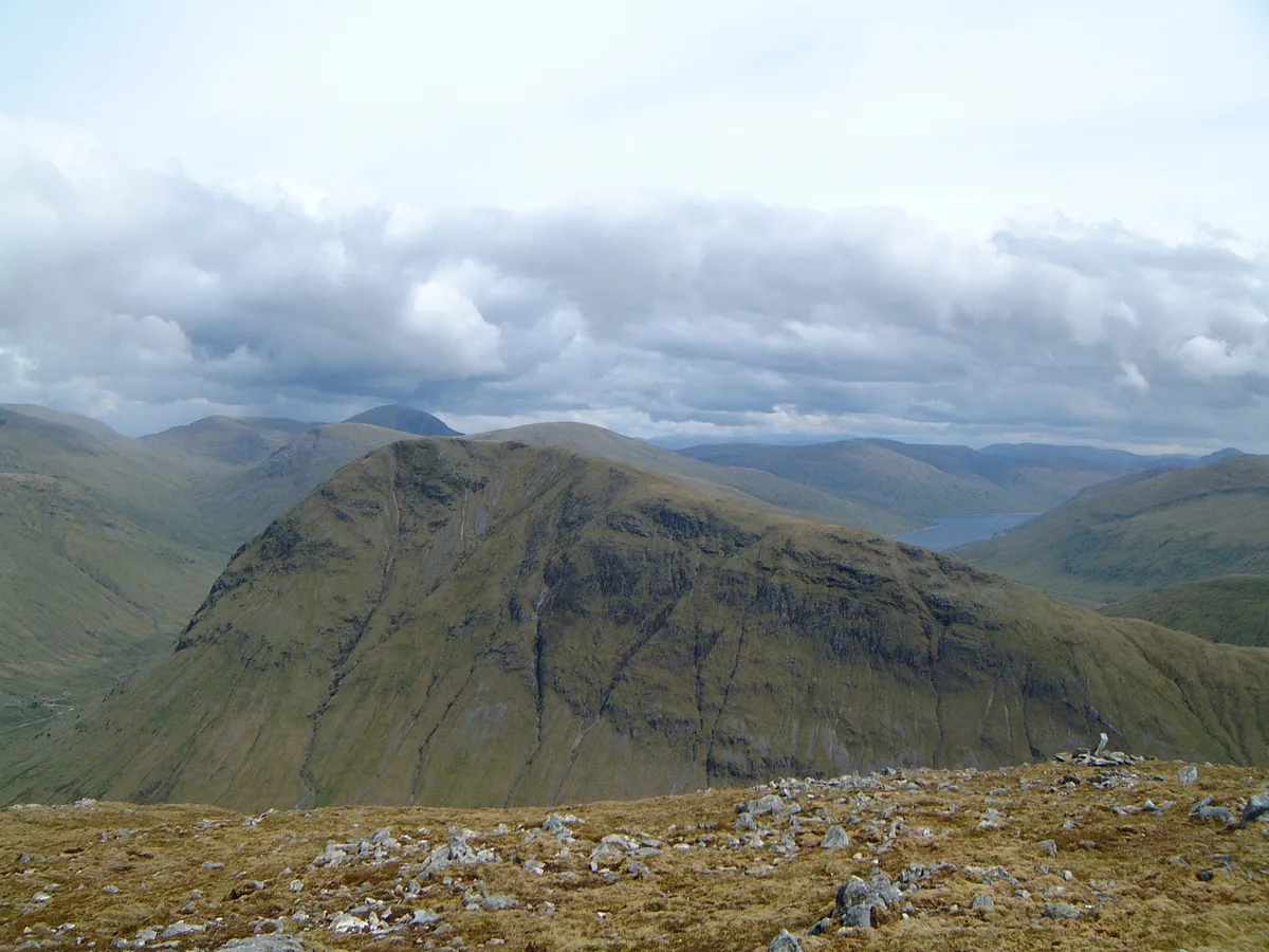
The West Highland Way (1980) is Scotland's first long-distance trail — 96 miles from Milngavie outside Glasgow to Fort William, passing Loch Lomond, Rannoch Moor, Glen Coe and the foot of Ben Nevis. The most-walked long-distance route in Scotland; 7-8 days end to end.
Photo gallery
Summary from the official site
The West Highland Way is a renowned long-distance walking route in Scotland, stretching 96 miles from Milngavie to Fort William. It offers visitors stunning landscapes and a chance to experience the natural beauty of the Scottish Highlands.
Read more on the official property page.
From the Wikipedia article
The West Highland Way (Scottish Gaelic: Slighe Taobh an Iar na Gàidhealtachd) is a linear long-distance route in Scotland. It is 154 km (96 miles) long, running from Milngavie north of Glasgow to Fort William in the Scottish Highlands, with an element of hill walking in the route. The trail, which opened in 1980, was Scotland's first officially designated Long Distance Route, and is now designated by NatureScot as one of Scotland's Great Trails. It is primarily intended as a long distance walking route, and whilst many sections are suitable for mountain biking and horseriding there are obstacles and surfaces that will require these users to dismount in places. It is managed by the West Highland Way Management Group (WHWMG) consisting of the local authorities for East Dunbartonshire, Stirling, Argyll and Bute and Highland, alongside the Loch Lomond and The Trossachs National Park Authority and NatureScot. The path is estimated to generate £5.5 million each year for the local economy. As of 2023 about 45,000 people complete the full route each year, with a similar number walking individual sections. Notable wildlife that may be seen includes feral goats (descendants of those left from the Highland Clearances), red deer, and around the peaks sometimes golden eagles.
Excerpt from Wikipedia under CC BY-SA 4.0. See the source article linked in Sources below.
Background
History
There were no trails of this kind in Scotland until the Way was opened. After the Second World War ex-RAF man Tom Hunter from Glasgow conceived of the idea of an official footpath, partly to protect the eastern shore of Loch Lomond from development. The route, with some challenging terrain, had to be worked out, and landowners negotiated with. Significant in the development of the Way was geographer Fiona Rose who surveyed the route over a year in the early 1970s, covering some 1,000 miles on foot. The trail was approved for development in 1974, and after completion was opened on 6 October 1980 by Lord Mansfield so becoming the first officially designated long-distance footpath in Scotland.…
Description
The path uses many ancient roads, including ancient drovers' roads, military roads dating to the Jacobite uprisings and old coaching routes. It is usually walked from south to north, making it a journey from the Lowlands to the Highlands. The route is commonly walked in seven to eight days, although many fitter and more experienced walkers do it in five or six, staying overnight in villages along the Way. The route can be covered in considerably less time than this ( the record was ), but a less hurried progress is the choice of the majority of walkers, allowing for appreciation of the countryside along the Way. Due to the large number of walkers being constrained to a single track, some…
Sourced from Wikipedia under CC BY-SA 4.0.
- Coordinates
- 56.5000, -4.7000
- Address
- Highlands of Scotland
- Established
- 1980
- Nearest railway station
- Bridge of Orchy — 4.3 km
- Official site
- www.westhighlandway.org
Sources
- manual: west-highland-way (manual)
- wikipedia: West Highland Way (CC BY-SA 4.0)
Featured in these 3 guides
Other places nearby
Beinn a' Chaisteil
Mountains & hills · 1.4 km

Beinn a' Chaisteil
Natural landmarks · 1.4 km
Beinn Dorain
Mountains & hills · 1.4 km

Beinn Dòrain
Natural landmarks · 1.4 km

Meall Garbh
Mountains & hills · 1.4 km

Carn Sasunnaich
Mountains & hills · 1.6 km

Meall Tionail
Mountains & hills · 1.6 km

Allt Kinglass bridge
Historic bridges · 2.1 km

Beinn nam Fuaran
Mountains & hills · 2.3 km

Eas nam Beatach
Natural landmarks · 2.9 km
Beinn an Dòthaidh
Natural landmarks · 3.5 km

Beinn an Dothaidh
Mountains & hills · 3.5 km
Nearby
📷 3Mountains & hills · Central Scotland
Beinn a' Chaisteil
Beinn a' Chaisteil — Named summit at 886 m.
📷 3Natural landmarks · Central Scotland
Beinn a' Chaisteil
Beinn a' Chaisteil — 886m mountain on the Argyll and Bute, and Perth and Kinross border, Scotland, UK.
📷 5Mountains & hills · Central Scotland
Beinn Dorain
Beinn Dorain — Named summit at 1076 m.
📷 5Natural landmarks · Central Scotland
Beinn Dòrain
Beinn Dòrain — 1076m high mountain in Argyll and Bute, Scotland, UK.
📷 5Mountains & hills · Central Scotland
Meall Garbh
Meall Garbh — mountain in scotland highlands. Elevation: 994 m.
📷 3Mountains & hills · Central Scotland
Carn Sasunnaich
Carn Sasunnaich — a mountain in scotland-highlands, United Kingdom.
Where to eat & stay near West Highland Way
Places to stay
 📷 5
📷 5Hostels · Central Scotland
West Highland Way Sleeper
West Highland Way Sleeper — a hostel in scotland highlands.
 📷 5📷 5📷 5📷 5
Campsites · Central Scotland
By the Way
By the Way — a campsite in scotland highlands.
 📷 5
📷 5Caravan parks · Central Scotland
Tyndrum Holiday Park
Tyndrum Holiday Park — a caravan park in scotland highlands.
Places to eat & drink
 📷 5
📷 5Historic pubs · Central Scotland
The Drovers Inn
The Drovers Inn — Historic pub — listed building or notable heritage status.
Other places from this era
 Flagship📷 10
Long-distance walking trails · South East England
Thames Path
184-mile National Trail along the Thames from source to the Barrier.
 📷 5
📷 5Long-distance walking trails · South East England
North Downs Way
153-mile chalk escarpment trail from Farnham to Dover.
 Flagship📷 10
Long-distance walking trails · South East England
South Downs Way
100-mile chalk-ridge trail across the South Downs National Park.
 ★ Iconic📷 4
Long-distance walking trails · South West England
Cotswold Way
102-mile National Trail along the Cotswold escarpment from Chipping Campden to Bath.
Frequently asked questions
- Where is West Highland Way?
- West Highland Way is in the Scottish Highlands, United Kingdom.
- What is West Highland Way?
- Scotland's classic 96-mile long-distance walk — Milngavie to Fort William.
- How do I get to West Highland Way?
- The nearest railway station is Bridge of Orchy, about 4.3 km away. Its coordinates are 56.5000°, -4.7000°.
- When was West Highland Way built?
- Built or established in 1980.
- Is West Highland Way free to visit?
- Yes, West Highland Way is free to enter.
- How do I get to West Highland Way?
- The nearest railway station is Bridge of Orchy, about 4.3 km away.