Farms (open to visitors) · South West England
Wayside cross 660m north of Basil Farm
In or near Treneglos.
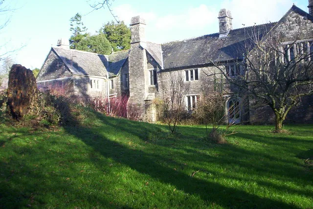
Wayside cross 660m north of Basil Farm — a Grade II*-listed farm in england-south-west, United Kingdom.

Derek Harper — CC BY-SA 2.0 via Wikimedia Commons licence
Plan your visit
- Typical visit
- 2 h–4 h
- Nearest railway station
- Mansion House Station · 8.1 km
- Family-friendly
About
Wayside cross 660m north of Basil Farm is a Grade II*-listed building in england-south-west, United Kingdom. Grade II* status is conferred by Historic England (or Cadw, Historic Environment Scotland or NIEA equivalents) on buildings of exceptional national interest. See the linked Wikipedia article for full historical and architectural details.
Photo gallery
Protected designations
- Site of Special Scientific Interest: Bodmin Moor, North SSSI
- Area of Outstanding Natural Beauty: Cornwall
Designations sourced from Natural England open data under OGL v3.
Place summary
Wayside cross 660m north of Basil Farm is a Grade II* listed structure located in South-West England. This farm cross is notable for its historical significance and architectural merit.
AI-generated from the structured facts on this page (operator, designation, listing, era). Not a substitute for visiting.
- Coordinates
- 50.6362, -4.5536
- District
- Cornwall
- Parish
- St. Clether
- Postcode
- PL15 8QN
- Parliamentary constituency
- North Cornwall
- Nearest railway station
- Mansion House Station — 8.1 km
Sources
- wikidata: Q17663539 (CC0)
Other places nearby

Chapel of St Clether
Chapels · 0.8 km
St Clether's Chapel and Holy Well
Chapels · 0.8 km

St Clether Holy Well
Archaeological sites · 0.8 km

St Clether Holy Well
Archaeological sites · 0.8 km
Basil Manor
Stately homes · 1.3 km

Saint Clether
Villages · 1.5 km

St Clether
Historic churches · 1.5 km

Trecollas Chapel
Chapels · 2.3 km

Bray Down
Mountains & hills · 2.8 km

Kivells
Farmers’ markets · 3.3 km

Rising Sun Inn Campsite
Campsites · 3.3 km

Bridge Over River Inney At Sx 224835
Historic bridges · 3.3 km
Nearby
📷 5Chapels · South West England
Chapel of St Clether
Chapel of St Clether — chapel in St Clether, Cornwall, England, UK.
📷 3Chapels · South West England
St Clether's Chapel and Holy Well
St Clether's Chapel and Holy Well — structures in St Clether, Cornwall, England, UK.
📷 3Archaeological sites · South West England
St Clether Holy Well
St Clether Holy Well — a archaeological in england-south-west, United Kingdom.
📷 5Archaeological sites · South West England
St Clether Holy Well
St Clether Holy Well — archaeological in england south west.
Flagship📷 5Stately homes · South West England
Basil Manor
Basil Manor — manor house in St Clether, Cornwall, England, UK.
📷 5Where to eat & stay near Wayside cross 660m north of Basil Farm
Places to stay
📷 5Campsites · South West England
Rising Sun Inn Campsite
Rising Sun Inn Campsite — a campsite in england south west.
 📷 5
📷 5
Campsites · South West England
Campground Otterham
Campground Otterham — a campsite in england south west.
 📷 5
📷 5Campsites · South West England
Camping and Caravan Club Bude.
Camping and Caravan Club Bude. — a campsite in england south west.
 📷 5
📷 5Caravan parks · South West England
Camelford Caravan Club Site
Camelford Caravan Club Site — a caravan park in england south west.

Caravan parks · South West England
Hentervene Holiday Park
Hentervene Holiday Park — a caravan park in england south west.
Places to eat & drink
 📷 7
📷 7Restaurants · South West England
Napoleon Inn
Napoleon Inn — a restaurant in england south west.
 📷 7
📷 7Historic pubs · South West England
The Bell Inn And Attached Wall And Coach House
The Bell Inn And Attached Wall And Coach House in England South West, United Kingdom.
 📷 5
📷 5Historic pubs · South West England
Bakers Arms Public House
Bakers Arms Public House in England South West, United Kingdom.
 📷 7
📷 7Restaurants · South West England
Nathan Outlaw
Nathan Outlaw — a restaurant in england south west.
 📷 7
📷 7Restaurants · South West England
Outlaws Fish Kitchen
Outlaws Fish Kitchen — a restaurant in england south west.
 📷 7
📷 7Restaurants · South West England
Slipway Hotel
Slipway Hotel — a restaurant in england south west.
More places in this region
 📷 5
📷 5Farms (open to visitors) · South West England
Bath City Farm
Bath City Farm — a other in england-south-east, United Kingdom.
 📷 5
📷 5Farms (open to visitors) · South West England
HoneyBrook Farm
HoneyBrook Farm — a other in england-south-east, United Kingdom.
 📷 5
📷 5Farms (open to visitors) · South West England
Down Farm
Down Farm — a other in england-south-east, United Kingdom.
 📷 5
📷 5Farms (open to visitors) · South West England
Putlake Adventure Farm
Putlake Adventure Farm — a other in england-south-east, United Kingdom.
Frequently asked questions
- Where is Wayside cross 660m north of Basil Farm?
- Wayside cross 660m north of Basil Farm is in South-West England, United Kingdom (postcode PL15 8QN), in the parish of St. Clether.
- What is Wayside cross 660m north of Basil Farm?
- Wayside cross 660m north of Basil Farm — a Grade II*-listed farm in england-south-west, United Kingdom.
- How do I get to Wayside cross 660m north of Basil Farm?
- The nearest railway station is Mansion House Station, about 8.1 km away. Drivers can use postcode PL15 8QN.
- Is Wayside cross 660m north of Basil Farm a listed building?
- Wayside cross 660m north of Basil Farm is officially recognised as Grade II* listed.
- Is Wayside cross 660m north of Basil Farm a protected site?
- Yes — Wayside cross 660m north of Basil Farm is part of the Bodmin Moor, North SSSI Site of Special Scientific Interest and the Cornwall National Landscape (AONB).
- How do I get to Wayside cross 660m north of Basil Farm?
- Drivers can navigate to postcode PL15 8QN. It sits within the North Cornwall parliamentary constituency.