Hill forts · North Wales
Wat's Dyke
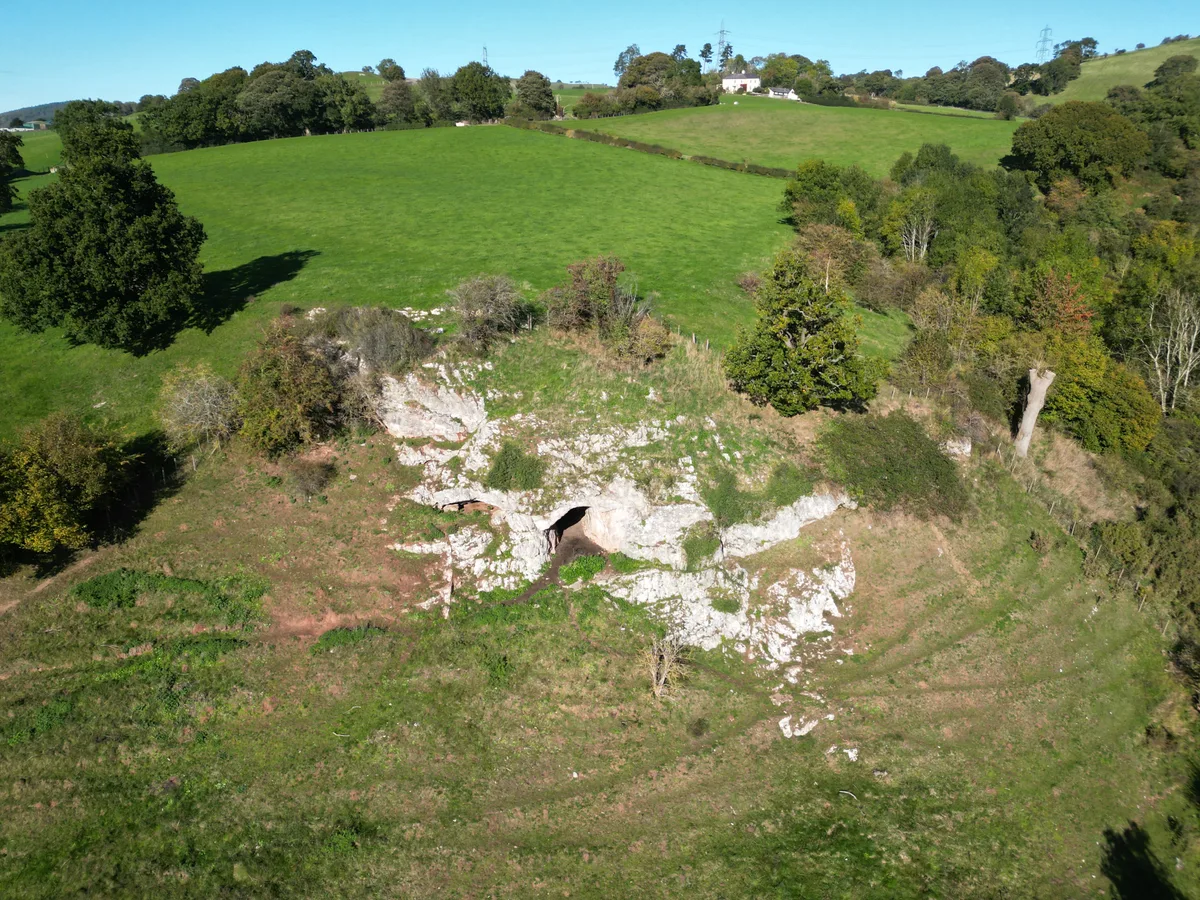
Wat's Dyke — linear earthwork in Wales and England.

Wikimedia Commons contributors — see linked file page for photographer and licence licence
Plan your visit
- Typical visit
- 1 h–2 h
- Nearest railway station
- Ruabon · 1.0 km
- Free entry
- Dog-friendly
About
Wat's Dyke is a hill fort in the United Kingdom. Wikidata describes it as: "linear earthwork in Wales and England". Coordinates: 52.9867°, -3.0286°.
Photo gallery
Protected designations
- Site of Special Scientific Interest: River Dee (England) SSSI
Designations sourced from Natural England open data under OGL v3.
From the Wikipedia article
Wat's Dyke (Welsh: Clawdd Wat) is a 40-mile (64 km) linear earthwork running through the northern Welsh Marches from Basingwerk Abbey on the River Dee estuary, passing east of Oswestry and on to Maesbury in Shropshire, England. It runs generally parallel to Offa's Dyke, sometimes within a few yards but never more than three miles (5 km) away. It now appears insignificant and is visible in some places as a raised hedgerow and in others no more than a cropmark. The ditch has long since been filled in and the bank ploughed away, but originally it was a considerable construction, considered to be strategically more sophisticated than Offa's Dyke. The date of construction is disputed, ranging from sub-Roman to the early ninth century.
Excerpt from Wikipedia under CC BY-SA 4.0. See the source article linked in Sources below.
Background
Architecture
It consists of the usual bank and ditch of an ancient dyke, with the ditch on the western side, meaning that the dyke faces Wales and by implication can be seen as protecting the English lands to the east. The placement of the dyke in the terrain also shows that care was taken to provide clear views to the west and to use local features to the best defensive advantage. A section of the dyke extends north and south from Old Oswestry, an Iron Age hill fort.
Sourced from Wikipedia under CC BY-SA 4.0.
- Coordinates
- 52.9867, -3.0286
- District
- Wrexham
- Parish
- Ruabon
- Postcode
- LL14 6LF
- Parliamentary constituency
- Montgomeryshire and Glyndwr
- Nearest railway station
- Ruabon — 1 km
- Opening
- |dedicated_to =
Sources
- wikidata: Q696088 (CC0)
- wikipedia: Wat's Dyke (CC BY-SA 4.0)
- commons: Wat's Dyke near Northop - geograph.org.uk - 202714.jpg (CC BY-SA 4.0)
Other places nearby
Loading nearby places…
Nearby
Hotels · North Wales
Wynnstay Arms
Wynnstay Arms — a hotel in wales north.
 📷 3
📷 3Towns & cities · North Wales
Ruabon
Ruabon — village and community in the county borough of Wrexham, Wales, UK.
B&Bs · North Wales
The Vaults
The Vaults — a bed-and-breakfast in wales north.
 📷 4
📷 4Heritage railway stations · North Wales
Ruabon railway station
Ruabon railway station — a Grade II*-listed railway station in wales-north, United Kingdom.
 📷 3
📷 3Manor houses · North Wales
Wynnstay Hall
Wynnstay Hall — a manor in wales-north, United Kingdom.
Vineyards · North Wales
Y Gardden, Ruabon
Y Gardden, Ruabon — a UK vineyard in wales north, producing English or Welsh wine from cool-climate grape varieties.
More places in this region
 📷 3
📷 3Hill forts · North Wales
Ffynnon Beuno and Cae Gwyn Caves
Ffynnon Beuno and Cae Gwyn Caves — Site of Special Scientific Interest in Wales.
 📷 5
📷 5Hill forts · North Wales
Penycloddiau
Penycloddiau — hillfort primarily located in Ysceifiog community, Flintshire.
 📷 5
📷 5Hill forts · North Wales
Barclodiad y Gawres
Barclodiad y Gawres — neolithic burial chamber in Anglesey, Wales, UK.
 📷 3
📷 3Hill forts · North Wales
Bodowyr Burial Chamber
Bodowyr Burial Chamber — Neolithic burial chamber in Llanidan, Anglesey, Wales, UK.
Frequently asked questions
- Where is Wat's Dyke?
- Wat's Dyke is in North Wales, United Kingdom (postcode LL14 6LF), in the parish of Ruabon.
- Is Wat's Dyke a protected site?
- Yes — Wat's Dyke is part of the River Dee (England) SSSI Site of Special Scientific Interest.
- Is Wat's Dyke free to visit?
- Yes, Wat's Dyke is free to enter.
- How do I get to Wat's Dyke?
- The nearest railway station is Ruabon, about 1.0 km away. Drivers can navigate to postcode LL14 6LF.