
Memorials & monuments · South West England
Water Tower And Hydrant, About 60 Metres South Of Church Of St Leonard
In or near Freshford.
Water Tower And Hydrant, About 60 Metres South Of Church Of St Leonard — a water tower in england-south-east, United Kingdom.

Mark Anderson — CC BY-SA 2.0 via Wikimedia Commons licence

Plan your visit
- Typical visit
- 15 min–45 min
- Nearest railway station
- Avoncliff · 2.8 km
- Free entry
- Dog-friendly
About
Water Tower And Hydrant, About 60 Metres South Of Church Of St Leonard is a water tower located in england-south-east, United Kingdom. Catalogued from Wikidata's UK heritage register; see the Wikipedia article for further historical and visitor details.
Photo gallery
See it from the streetimagery from 2024
Imagery © Mapillary contributors, CC BY-SA 4.0
Official information
Farleigh Hungerford Castle is a historic site that features the remains of a fortified mansion built in the 14th century. Visitors can explore the castle's impressive chapel, view family monuments, and learn about the history of the Hungerford family through audio tours and displays.
Protected designations
- Area of Outstanding Natural Beauty: Cotswolds
Designations sourced from Natural England open data under OGL v3.
Place summary
The Water Tower and Hydrant, located about 60 metres south of the Church of St Leonard in South-East England, is a memorial structure. Its specific historical significance and architectural details are not provided, but it serves as a notable landmark in the area.
AI-generated from the structured facts on this page (operator, designation, listing, era). Not a substitute for visiting.
- Coordinates
- 51.3150, -2.2879
- District
- Somerset
- Parish
- Norton St Philip
- Postcode
- BA2 7RR
- Parliamentary constituency
- Frome and East Somerset
- Nearest railway station
- Avoncliff — 2.8 km
- Opening
- Daily 10am - 5pm; last entry at 4.30pm
- Official site
- www.english-heritage.org.uk
Sources
- wikidata: Q26310273 (CC0)
Other places nearby

Farleigh Hungerford
Castles · 0.1 km

Chapel of St Leonard, perimeter wall and gateway, Farleigh Hungerford Castle
Chapels · 0.3 km

Farleigh Hungerford Castle
Literary houses · 0.3 km

Farleigh Hungerford Castle
Castles · 0.3 km
Hermitage House, Farleigh Castle
Castles · 0.4 km

Mill Stream Bridge On A366, About 40 Metres South Of River Frome Bridge
Historic bridges · 0.4 km
Bridge Over River Frome On A366, About 40 Metres North Of Mill Stream Bridge
Historic bridges · 0.4 km
Ravenscroft School
Natural landmarks · 0.5 km

Stowford Manor Farm Camping
Campsites · 0.9 km

Stowford Manor
Manor houses · 1.1 km

Brittania
Memorials & monuments · 1.5 km
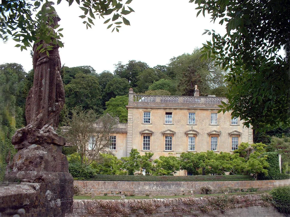
Iford Manor
Stately homes · 1.6 km
Nearby
📷 5Castles · South West England
Farleigh Hungerford
Farleigh Hungerford (grid reference ST800576) is a village and former civil parish, now in the parish of Norton St Philip, in the Somerset district, in the ceremonial county of Somerset, England, 9 mi
📷 5Chapels · South West England
Chapel of St Leonard, perimeter wall and gateway, Farleigh Hungerford Castle
Chapel of St Leonard, perimeter wall and gateway, Farleigh Hungerford Castle — Grade I listed chapel in Mendip, United Kingdom.
📷 5Literary houses · South West England
Farleigh Hungerford Castle
Farleigh Hungerford Castle — a literary house museum in england south east.
📷 5Castles · South West England
Farleigh Hungerford Castle
Farleigh Hungerford Castle — a castle in england-south-east, United Kingdom.
📷 5Castles · South West England
Hermitage House, Farleigh Castle
Hermitage House, Farleigh Castle — Grade II listed building-listed castle in england-south-east, United Kingdom.
📷 5Historic bridges · South West England
Mill Stream Bridge On A366, About 40 Metres South Of River Frome Bridge
Mill Stream Bridge On A366, About 40 Metres South Of River Frome Bridge — Grade II listed building-listed bridge in england-south-east, United Kingdom.
Where to eat & stay near Water Tower And Hydrant, About 60 Metres South Of Church Of St Leonard
Places to stay
📷 5Campsites · South West England
Stowford Manor Farm Camping
Stowford Manor Farm Camping — a campsite in england south east.
 📷 5
📷 5Campsites · South West England
Farleigh Road Campsite
Farleigh Road Campsite — a campsite in england south east.
 📷 5
📷 5 📷 5
📷 5Caravan parks · South West England
Barrow Farm CL
Barrow Farm CL — a caravan park in england south east.
 📷 5
📷 5Campsites · South West England
Pitchperfect
Pitchperfect — a campsite in england south east.
 📷 5
📷 5B&Bs · South West England
Priory Steps
Priory Steps — a bed-and-breakfast in england south east.
Places to eat & drink
 📷 5
📷 5Historic pubs · South West England
The Inn Public House
The Inn Public House in England South West, United Kingdom.
 📷 7
📷 7Historic pubs · South West England
The George Inn
The George Inn — Historic pub — listed building or notable heritage status.
 📷 7
📷 7Historic pubs · South West England
The Hop Pole Inn
The Hop Pole Inn in England South West, United Kingdom.
 📷 5
📷 5Historic pubs · South West England
The Dandy Lion
The Dandy Lion in England South West, United Kingdom.
 📷 6
📷 6Historic pubs · South West England
Bunch Of Grapes
Bunch Of Grapes in England South West, United Kingdom.
 📷 7
📷 7Historic pubs · South West England
The Stallards Public House
The Stallards Public House in England South West, United Kingdom.
More memorials in this region
 📷 5
📷 5Memorials & monuments · South West England
Bath Cenotaph
Bath Cenotaph is a memorial in the United Kingdom.
 📷 5
📷 5Memorials & monuments · South West England
Cross of Sacrifice
Cross of Sacrifice is a memorial in the United Kingdom.
 📷 5
📷 5Memorials & monuments · South West England
Grange Arch
Grange Arch is a memorial in the United Kingdom.
.jpg?width=1200) 📷 5
📷 5Memorials & monuments · South West England
King Alfred Memorial
King Alfred Memorial is a memorial in the United Kingdom.
Frequently asked questions
- Where is Water Tower And Hydrant, About 60 Metres South Of Church Of St Leonard?
- Water Tower And Hydrant, About 60 Metres South Of Church Of St Leonard is in South-East England, United Kingdom (postcode BA2 7RR), in the parish of Norton St Philip.
- What is Water Tower And Hydrant, About 60 Metres South Of Church Of St Leonard?
- Water Tower And Hydrant, About 60 Metres South Of Church Of St Leonard — a water tower in england-south-east, United Kingdom.
- How do I get to Water Tower And Hydrant, About 60 Metres South Of Church Of St Leonard?
- The nearest railway station is Avoncliff, about 2.8 km away. Drivers can use postcode BA2 7RR.
- Is Water Tower And Hydrant, About 60 Metres South Of Church Of St Leonard a protected site?
- Yes — Water Tower And Hydrant, About 60 Metres South Of Church Of St Leonard is part of the Cotswolds National Landscape (AONB).
- Is Water Tower And Hydrant, About 60 Metres South Of Church Of St Leonard free to visit?
- Yes, Water Tower And Hydrant, About 60 Metres South Of Church Of St Leonard is free to enter.
- How do I get to Water Tower And Hydrant, About 60 Metres South Of Church Of St Leonard?
- The nearest railway station is Avoncliff, about 2.8 km away. Drivers can navigate to postcode BA2 7RR.