Reservoirs & lochs · North East England
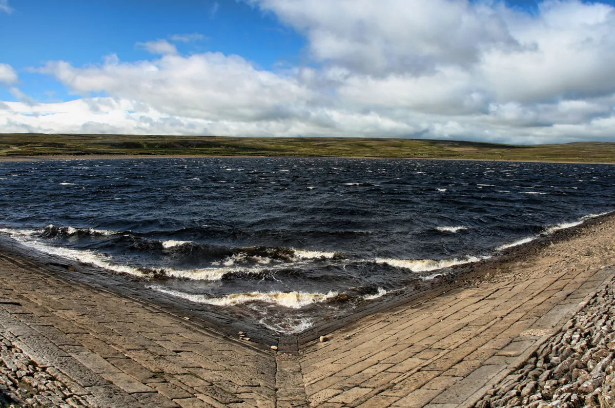
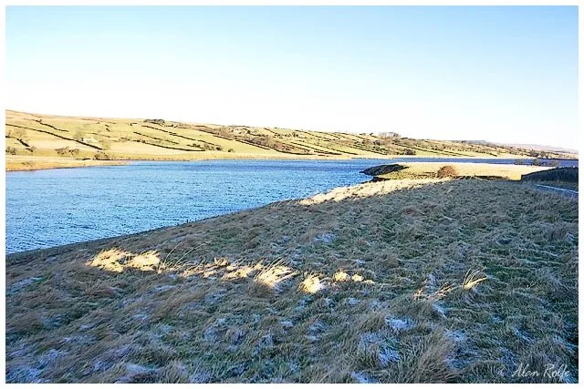
Waskerley
In or near Castleside.
Waskerley in England North East, United Kingdom.

Oliver Dixon — CC BY-SA 2.0 via Wikimedia Commons licence
Plan your visit
- Typical visit
- 1 h–2.5 h
- Nearest railway station
- Kingfisher Halt · 8.2 km
- Free entry
- Dog-friendly
Getting there & planning your visit
Waskerley is located in County Durham, with the postcode DH8 9DZ. The nearest railway station is Kingfisher Halt, which is 8.2 km away. Entry to the reservoir is free.
About
Waskerley is a place of interest in England North East, United Kingdom — drawn from open-data sources for visitor reference. See the linked Wikipedia article for the full description.
Photo gallery
Protected designations
- Site of Special Scientific Interest: Muggleswick, Stanhope and Edmundbyers Commons and Blanchland Moor SSSI
- Area of Outstanding Natural Beauty: North Pennines
Designations sourced from Natural England open data under OGL v3.
From the Wikipedia article
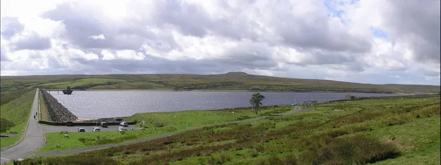
Waskerley is a village in County Durham, England. It is situated six miles to the southwest of Consett and three miles southwest of Castleside and the A68. Stanhope in the Durham Dales is a further six miles to the southwest and the Derwent Reservoir and the village of Edmundbyers is approximately five miles to the north. The village of Muggleswick is three miles to the north. In 1283 under a license the land was enclosed around Stanhope and Waskerley Head. The Stanhope & Tyne Railway line opened in 1834 transporting limestone from the quarries above Stanhope. However, the line was bankrupt by 1840 and the Derwent Iron Company took over the route to ensure a supply of limestone to the iron works at Consett. The line reopened in 1845 and the small railway village developed. There were two engine sheds, a station master’s house, two rows of housing, a school, and a Methodist chapel (now used as a barn). With the decline in railway haulage and passengers the line finally closed in 1969 and much of the village was abandoned. The Anglican church of St Matthew’s was built in 1896 and is still lit by gas lighting. Waskerley sits on top of Waskerley Moor, straddling a road between Castleside and Stanhope. The Sea to Sea Cycle Route passes close by to the north – the section crossing Waskerley Moor was formerly known as the Waskerley Way. The main landmark was the Moorcock pub, used by local farmers and users of the Sea to Sea Cycle Route. This pub closed some years ago, and is now a private house. Waskerley, Smiddy Shaw (photographed) and Hishope Reservoirs are situated on Waskerley Moor near Waskerley.
Excerpt from Wikipedia under CC BY-SA 4.0. See the source article linked in Sources below.
- Coordinates
- 54.8000, -1.9167
- District
- County Durham
- Parish
- Muggleswick
- Postcode
- DH8 9DZ
- Parliamentary constituency
- North Durham
- Nearest railway station
- Kingfisher Halt — 8.2 km
Sources
Other places nearby

Waskerley railway station
Parks · 0.3 km

Waskerley
Villages · 0.6 km

River Browney
Mines & mining heritage · 0.8 km

Burnhill railway station
Heritage railway stations · 1.0 km

The Railway Inn
Archaeological sites · 1.2 km

Bonners Lodge Caravan Park
Caravan parks · 1.3 km
Burnhill Junction railway station
Heritage railway stations · 1.4 km
Smiddy Shaw Reservoir
Reservoirs & lochs · 1.7 km

Skaylock Hill
Mountains & hills · 2.2 km

Hawkburn Head Picnic Area
Natural landmarks · 2.3 km

Saltersgate Cottage railway station
Natural landmarks · 2.5 km

Hisehope Burn Valley
Wildlife reserves · 2.7 km
Nearby
📷 4Parks · North East England
Waskerley railway station
Waskerley railway station in England North East, United Kingdom.
📷 5📷 4Mines & mining heritage · North East England
River Browney
River Browney in England North East, United Kingdom.
📷 4Heritage railway stations · North East England
Burnhill railway station
Burnhill railway station in England North East, United Kingdom.
📷 3Archaeological sites · North East England
The Railway Inn
The Railway Inn — a archaeological in scotland-lowlands, United Kingdom.
📷 5Caravan parks · North East England
Bonners Lodge Caravan Park
Bonners Lodge Caravan Park — a caravan park in scotland lowlands.
Where to eat & stay near Waskerley
Places to stay
📷 5Caravan parks · North East England
Bonners Lodge Caravan Park
Bonners Lodge Caravan Park — a caravan park in scotland lowlands.
 📷 5
📷 5Caravan parks · North East England
Manor Park Caravan Park
Manor Park Caravan Park — a caravan park in scotland lowlands.
 📷 5
📷 5B&Bs · North East England
The Burnside
The Burnside — a bed-and-breakfast in scotland lowlands.
 📷 5
📷 5Caravan parks · North East England
Hownsgill Caravan Park
Hownsgill Caravan Park — a caravan park in scotland lowlands.
 📷 5
📷 5Caravan parks · North East England
Struthers Farm Caravan Site
Struthers Farm Caravan Site — a caravan park in scotland lowlands.
📷 5Hostels · North East England
Edmundbyers Youth Hostel at Low House Haven
Edmundbyers Youth Hostel at Low House Haven — a hostel in scotland lowlands. Brand: Youth Hostels Association.
Places to eat & drink
 📷 5
📷 5Historic pubs · North East England
Black Bull Public House
Black Bull Public House in Scotland Lowlands, United Kingdom.
 📷 4
📷 4Historic pubs · North East England
Delves Lane
Delves Lane in England North East, United Kingdom.
 📷 5
📷 5Historic pubs · North East England
The Lord Crewe Arms Hotel
The Lord Crewe Arms Hotel in Scotland Lowlands, United Kingdom.
 📷 5
📷 5Cafés · North East England
The White Monk Tearoom
The White Monk Tearoom — a café in scotland lowlands.
 📷 3
📷 3 📷 5
📷 5Historic pubs · North East England
Queens Head Public House
Queens Head Public House in Scotland Lowlands, United Kingdom.
More places in this region
 📷 2
📷 2Reservoirs & lochs · North East England
Balderhead Reservoir
Balderhead Reservoir — reservoir in County Durham, England, UK.
 📷 3
📷 3Reservoirs & lochs · North East England
Blackton Reservoir
Blackton Reservoir — reservoir in County Durham, England, UK.
 📷 5
📷 5Reservoirs & lochs · North East England
Grassholme Reservoir
Grassholme Reservoir — reservoir in County Durham, England, UK.
 📷 3
📷 3Reservoirs & lochs · North East England
Hury Reservoir
Hury Reservoir — reservoir in County Durham, England, UK.
Frequently asked questions
- Where is Waskerley?
- Waskerley is in North-East England, United Kingdom (postcode DH8 9DZ), in the parish of Muggleswick.
- What is Waskerley?
- Waskerley in England North East, United Kingdom.
- How do I get to Waskerley?
- The nearest railway station is Kingfisher Halt, about 8.2 km away. Drivers can use postcode DH8 9DZ.
- Is Waskerley a protected site?
- Yes — Waskerley is part of the Muggleswick, Stanhope and Edmundbyers Commons and Blanchland Moor SSSI Site of Special Scientific Interest and the North Pennines National Landscape (AONB).
- Is Waskerley free to visit?
- Yes, Waskerley is free to enter.
- How do I get to Waskerley?
- Drivers can navigate to postcode DH8 9DZ. It sits within the North Durham parliamentary constituency.