
Natural landmarks · Northern Ireland
Waringsford
In or near Kinallen.
Waringsford in Northern Ireland, United Kingdom.

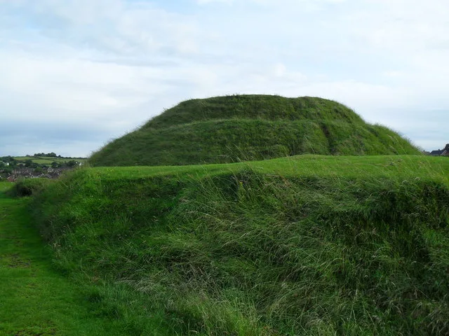
Dean Molyneaux — CC BY-SA 2.0 via Wikimedia Commons licence

Plan your visit
- Typical visit
- 1 h–2 h
- Free entry
- Dog-friendly
About
Waringsford is a place of interest in Northern Ireland, United Kingdom — drawn from open-data sources for visitor reference. See the linked Wikipedia article for the full description.
Photo gallery
From the Wikipedia article
Waringsford is a small village in County Down, Northern Ireland, 6 km south east of Dromore. It is situated within Banbridge District. In the 2001 Census it had a population of 129 people. The village, despite the lack of services, has seen substantial property development in the last five years, helped by its rural setting, relative tranquility and close proximity to the A1. The village lies within the townland of Tullinisky, in the civil parish of Garvaghy, within the barony of Iveagh Lower, Lower Half. It also lies in Banbridge District.
Excerpt from Wikipedia under CC BY-SA 4.0. See the source article linked in Sources below.
- Coordinates
- 54.3745, -6.1102
- Postcode
- BT25 2QF
- Parliamentary constituency
- Lagan Valley
Sources
- wikidata: Q58084 (CC0)
- wikipedia: Waringsford (CC BY-SA 4.0)
Other places nearby

Waringsford
Villages · 1.0 km
The Diamond
Villages · 1.1 km

Cromies Fort
Archaeological sites · 1.4 km

Kinallen
Towns & cities · 2.6 km

Carnew Fort
Archaeological sites · 2.7 km

Iveagh Lower, Lower Half
Natural landmarks · 2.7 km

Ballela
Natural landmarks · 3.4 km

Gransha Fort
Archaeological sites · 3.7 km
Garvaghy
Natural landmarks · 3.7 km

Union Hill
Archaeological sites · 4.1 km

Stepping Stones
Waterfalls · 4.6 km
Motte And Bailey
Hill forts · 4.8 km
Nearby
📷 5📷 5📷 5Archaeological sites · Northern Ireland
Cromies Fort
Cromies Fort — a archaeological in northern-ireland, United Kingdom.
📷 3Towns & cities · Northern Ireland
Kinallen
Kinallen — village in County Down, Northern Ireland, UK.
📷 5Archaeological sites · Northern Ireland
Carnew Fort
Carnew Fort — a archaeological in northern-ireland, United Kingdom.
📷 5Natural landmarks · Northern Ireland
Iveagh Lower, Lower Half
Iveagh Lower, Lower Half in Northern Ireland, United Kingdom.
Where to eat & stay near Waringsford
Places to stay
 📷 5
📷 5Campsites · Northern Ireland
Slieve Croob Camping
Slieve Croob Camping — a campsite in northern ireland.
 📷 5
📷 5Campsites · Northern Ireland
Castlewellan Touring-in-the-Trees
Castlewellan Touring-in-the-Trees — a campsite in northern ireland.
 📷 5
📷 5Campsites · Northern Ireland
Castlewellan Forest Park - Camping
Castlewellan Forest Park - Camping — a campsite in northern ireland.
 📷 5
📷 5Caravan parks · Northern Ireland
Castlewellan Forest Park - Caravan Site
Castlewellan Forest Park - Caravan Site — a caravan park in northern ireland.
 📷 5
📷 5Caravan parks · Northern Ireland
The Rock Caravan Site
The Rock Caravan Site — a caravan park in northern ireland.
 📷 5
📷 5Places to eat & drink
 📷 3
📷 3Historic pubs · Northern Ireland
Soma Festival
The Soma Festival (Sanskrit: सोम, or sóma, meaning drink of the Gods, see Soma (drink); Irish: Féile Soma) is an annual music, arts, and cultural festival. The festival includes concerts, musical perf
More natural landmarks in this region
 Flagship📷 4
Natural landmarks · Northern Ireland
Lough Erne
Lough Erne — lake in County Fermanagh, Northern Ireland, UK.
 Flagship📷 4
Natural landmarks · Northern Ireland
Lough Neagh
Lough Neagh — large lake in Northern Ireland.
 📷 3
📷 3Natural landmarks · Northern Ireland
Ballysaggart Lough
Ballysaggart Lough — lake in the United Kingdom.
 📷 5
📷 5Natural landmarks · Northern Ireland
Belmore Mountain
Belmore Mountain — mountain in the United Kingdom.
Frequently asked questions
- Where is Waringsford?
- Waringsford is in Northern Ireland, United Kingdom (postcode BT25 2QF).
- What is Waringsford?
- Waringsford in Northern Ireland, United Kingdom.
- How do I get to Waringsford?
- The nearest town is Kinallen. Drivers can use postcode BT25 2QF.
- Is Waringsford free to visit?
- Yes, Waringsford is free to enter.
- How do I get to Waringsford?
- Drivers can navigate to postcode BT25 2QF. It sits within the Lagan Valley parliamentary constituency.