Mountains & hills · Scottish Islands
Ward of Burraland
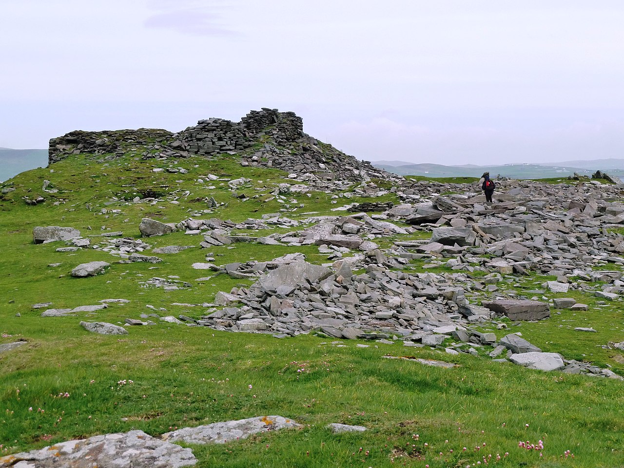
Ward of Burraland — a hill or mountain in scotland islands.
Derek Mayes — CC BY-SA 2.0 via Wikimedia Commons licence
Plan your visit
- Typical visit
- 3 h–8 h
- Best time of year
- Late spring – early autumn (May–Oct)
About
A British hill or mountain, named on Ordnance Survey maps and walked by hill-baggers. Ward of Burraland is a named hill or mountain in scotland islands, recorded in the GeoNames UK gazetteer. British landmarks of this type are typically marked on Ordnance Survey maps and recorded in the national gazetteer for cartographic and navigational reference. Coordinates and feature classification are sourced from the GeoNames open dataset.
Photo gallery
Place summary
Ward of Burraland is a mountain located in the Scottish Islands. It is characterised by its rugged terrain and scenic views, typical of the region's landscape. Visitors can expect various walking trails that offer access to the mountain's features, making it suitable for both casual hikers and more experienced climbers. The area provides opportunities for observing local wildlife and appreciating the natural environment.
AI-generated from the structured facts on this page (operator, designation, listing, era). Not a substitute for visiting.
- Coordinates
- 59.9936, -1.2104
Sources
- manual: geonames-12611748 (CC BY 4.0)
Other places nearby
Loading nearby places…
Nearby
📷 5Mountains & hills · Scottish Islands
Ward of Burraland
Ward of Burraland — mountain in scotland islands. Elevation: 72 m.
📷 3Vineyards · Scottish Islands
Burraland
Burraland — a UK vineyard in scotland islands, producing English or Welsh wine from cool-climate grape varieties.
 📷 3
📷 3Archaeological sites · Scottish Islands
Burraland, promontory fort
Burraland, promontory fort — a archaeological in scotland-islands, United Kingdom.
 📷 5
📷 5Historic churches · Scottish Islands
Sandwick Parish Church
Sandwick Parish Church — category B listed building-listed church in scotland-islands, United Kingdom.
 📷 5
📷 5Natural landmarks · Scottish Islands
Sand Wick
Sand Wick — a natural feature in scotland islands.
 📷 3
📷 3Museums · Scottish Islands
Mousa Ferry Waiting Room Exhibition
Mousa Ferry Waiting Room Exhibition — a museum in scotland-islands, United Kingdom.
More mountains in this region
 📷 3
📷 3Mountains & hills · Scottish Islands
Aikerness Bay
Aikerness Bay — bay in Orkney Islands, Scotland, UK.
 📷 3
📷 3Mountains & hills · Scottish Islands
Aith Hope
Aith Hope — bay in Orkney Islands, Scotland, UK.

Mountains & hills · Scottish Islands
Aith Voe
Aith Voe — bay on West Mainland, Shetland Islands, Scotland, UK.
 📷 3
📷 3Mountains & hills · Scottish Islands
Aith Voe
Aith Voe — bay on South Mainland, Shetland Islands, Scotland, UK.
Frequently asked questions
- Where is Ward of Burraland?
- Ward of Burraland is in the Scottish Islands, United Kingdom.
- What is Ward of Burraland?
- Ward of Burraland — a hill or mountain in scotland islands.
- How do I get to Ward of Burraland?
- Its coordinates are 59.9936°, -1.2104°.