Mountains & hills · North West England
Wandope
In or near Buttermere.
Wandope — Named summit at 773.9 m.

Wikimedia Commons contributors — see linked file page for photographer and licence licence
Plan your visit
- Typical visit
- 3 h–8 h
- Best time of year
- Late spring – early autumn (May–Oct)
- Free entry
- Dog-friendly
About
Wandope is a named summit in the United Kingdom. Wikidata describes it as: "Named summit at 773.9 m.". Coordinates: 54.5663°, -3.2571°.
Photo gallery
Protected designations
- Site of Special Scientific Interest: River Derwent and Tributaries SSSI
- Site of Special Scientific Interest: Buttermere Fells SSSI
Designations sourced from Natural England open data under OGL v3.
From the Wikipedia article
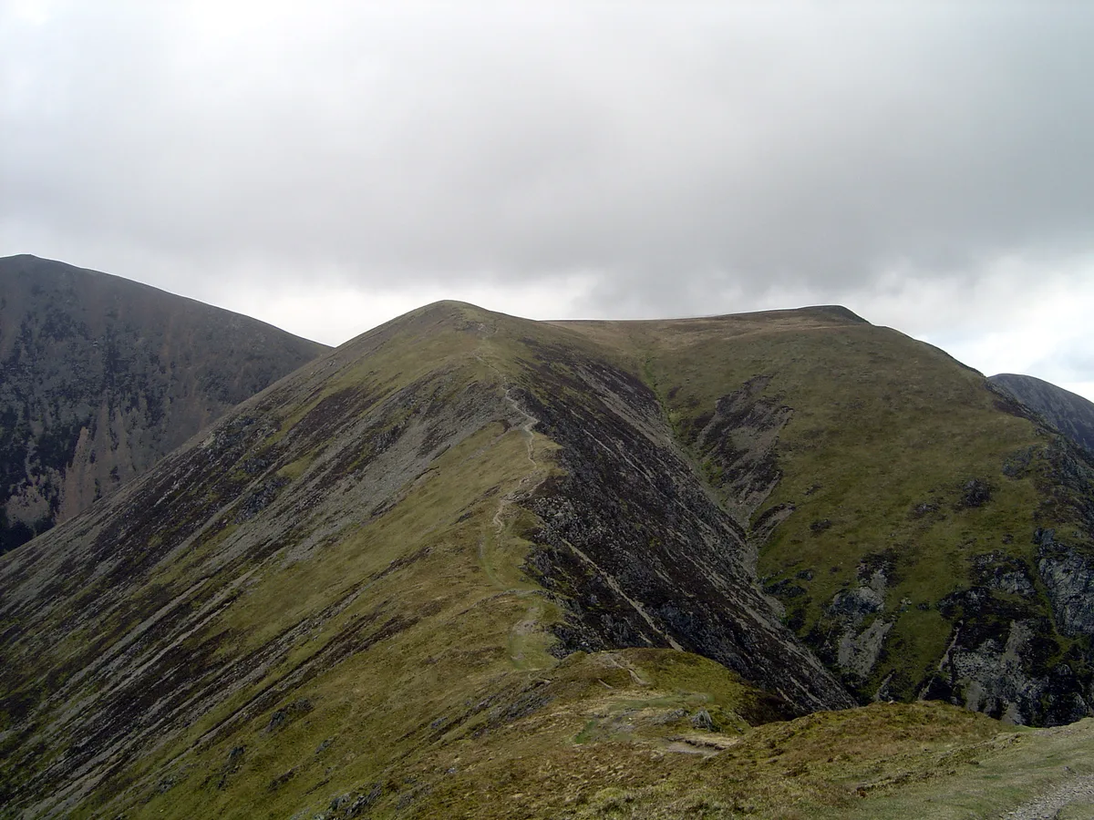
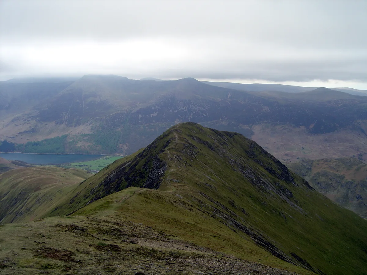
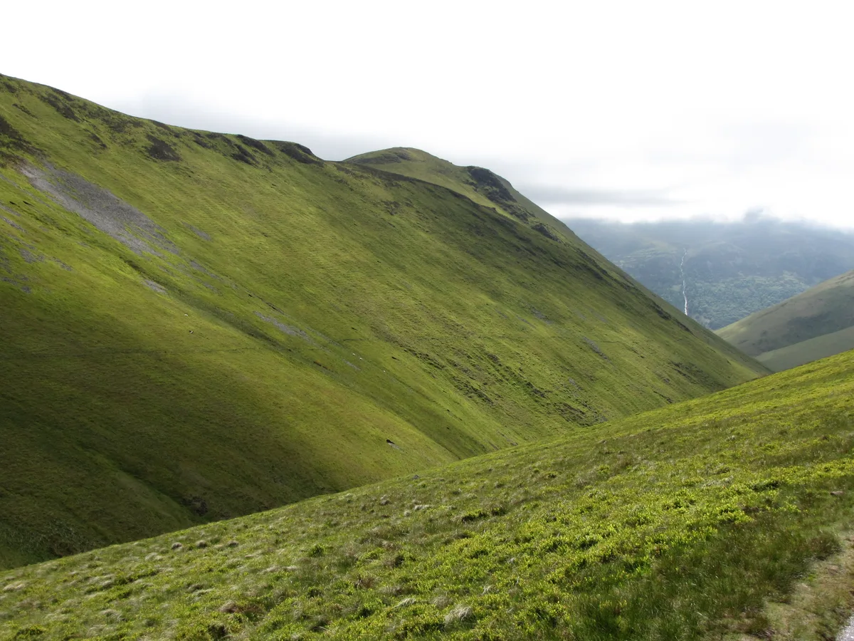
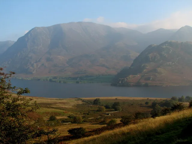
Wandope (also known as Wanlope is a fell in the north-western area of the English Lake District. It lies to the east of Crummock Water and south of Crag Hill. From the summit there are excellent panoramas of the Sca Fell and High Stile ranges.
Excerpt from Wikipedia under CC BY-SA 4.0. See the source article linked in Sources below.
- Coordinates
- 54.5663, -3.2571
- Address
- Cumbria, England
Sources
- osm: n7111594444 (ODbL)
- wikipedia: Wandope (CC BY-SA 4.0)
- commons: Whiteless Edge & Wandope from Whiteless Pike.jpg (CC BY-SA 4.0)
Other places nearby
Wandope
Natural landmarks · 0.0 km

Thirdgill Head Man
Mountains & hills · 0.5 km
Crag Hill
Mountains & hills · 0.8 km

Crag Hill
Natural landmarks · 0.8 km

Eel Crag
Mountains & hills · 1.0 km
Sail
Natural landmarks · 1.1 km
Whiteless Pike
Mountains & hills · 1.1 km

Sail
Mountains & hills · 1.1 km

Knott Rigg
Mountains & hills · 1.3 km
Knott Rigg
Natural landmarks · 1.3 km
Grasmoor
Mountains & hills · 1.5 km

Grasmoor
Natural landmarks · 1.5 km
Nearby
📷 3📷 5Mountains & hills · North West England
Thirdgill Head Man
Thirdgill Head Man — mountain in england north east. Elevation: 734 m.
📷 3📷 3Natural landmarks · North West England
Crag Hill
Crag Hill — mountain in the Lake District, Cumbria, England, UK.
📷 5Mountains & hills · North West England
Eel Crag
Eel Crag — mountain in england north east. Elevation: 807 m.
📷 3Where to eat & stay near Wandope
Places to stay
 📷 5
📷 5Campsites · North West England
Syke Farm Campsite
Syke Farm Campsite — a campsite in england north east.
 📷 5
📷 5Campsites · North West England
Dalegarth Guest House Camp Site
Dalegarth Guest House Camp Site — a campsite in england north east.
 📷 5
📷 5Campsites · North West England
Hope Memorial Camp
Hope Memorial Camp — a campsite in scotland lowlands.
 📷 5
📷 5Caravan parks · North West England
Braithwaite Caravan and Camping Club Site
Braithwaite Caravan and Camping Club Site — a caravan park in scotland lowlands.
 📷 5
📷 5Caravan parks · North West England
Lanefoot Farm
Lanefoot Farm — a caravan park in scotland lowlands.
 📷 5
📷 5Hostels · North West England
YHA Hawse End Cottage
YHA Hawse End Cottage — a hostel in england north east.
Places to eat & drink
 📷 7
📷 7Cafés · North West England
Grange Bridge Cottage
Grange Bridge Cottage — a café in england north east.
 📷 5
📷 5 📷 7
📷 7Historic pubs · North West England
The Pheasant Inn
The Pheasant Inn in Scotland Lowlands, United Kingdom.
 📷 7
📷 7Historic pubs · North West England
The Travellers Rest
The Travellers Rest in England North West, United Kingdom.
 📷 5
📷 5Historic pubs · North West England
Fox and Grapes
Fox and Grapes in England North West, United Kingdom.
 📷 5
📷 5Historic pubs · North West England
Golden Rule Hotel
Golden Rule Hotel in England North West, United Kingdom.
More mountains in this region
 📷 5
📷 5Mountains & hills · North West England
Appleton Park
Appleton Park — a hill or mountain in england west midlands.
 📷 5
📷 5Mountains & hills · North West England
High Warren
High Warren — mountain in england west midlands. Elevation: 105 m.
 📷 5
📷 5Mountains & hills · North West England
Alderley Edge
Alderley Edge — mountain in england west midlands. Elevation: 194 m.
 📷 3
📷 3Frequently asked questions
- Where is Wandope?
- Wandope is in North-East England, United Kingdom.
- What is Wandope?
- Wandope — Named summit at 773.9 m.
- How do I get to Wandope?
- Its coordinates are 54.5663°, -3.2571°.
- Is Wandope a protected site?
- Yes — Wandope is part of the River Derwent and Tributaries SSSI Site of Special Scientific Interest and the Buttermere Fells SSSI Site of Special Scientific Interest.
- Is Wandope free to visit?
- Yes, Wandope is free to enter.