
Historic houses · North East England
Walwick Grange
In or near Newbrough.
Walwick Grange in England North East, United Kingdom.

Oliver Dixon — CC BY-SA 2.0 via Wikimedia Commons licence

Plan your visit
- Typical visit
- 1 h–2 h
- Nearest railway station
- Hexham · 6.0 km
- Family-friendly
- Limited wheelchair access
Getting there & planning your visit
To visit Walwick Grange, the nearest railway station is Hexham, located 6 km away. The postcode for sat-nav is NE46 4BH. Please note that wheelchair accessibility is limited.
About
Walwick Grange is a place of interest in England North East, United Kingdom — drawn from open-data sources for visitor reference. See the linked Wikipedia article for the full description.
Photo gallery
From the Wikipedia article
Walwick Grange is a privately owned 18th-century country house ( now a farmhouse) situated on the bank of the River North Tyne close to Hadrian's Wall at Warden, Northumberland. It is a Grade II* listed building. Walwick was the seat of the Errington family from the mid 16th century. The three-storey five-bayed house was built, probably on the site of a medieval tower house, in the early 18th century. William Errington of Walwick Grange was High Sheriff of Northumberland in 1739. His son John built a new house at Chesters (Humshaugh) in the 1770s. Medieval fishponds nearby have Scheduled Ancient Monument status.
Excerpt from Wikipedia under CC BY-SA 4.0. See the source article linked in Sources below.
- Coordinates
- 55.0182, -2.1465
- District
- Northumberland
- Parish
- Warden
- Postcode
- NE46 4BH
- Parliamentary constituency
- Hexham
- Nearest railway station
- Hexham — 6 km
- Official site
- grokipedia.com
Sources
- wikidata: Q7966869 (CC0)
- wikipedia: Walwick Grange (CC BY-SA 4.0)
Other places nearby

Chesters
Villages · 0.3 km
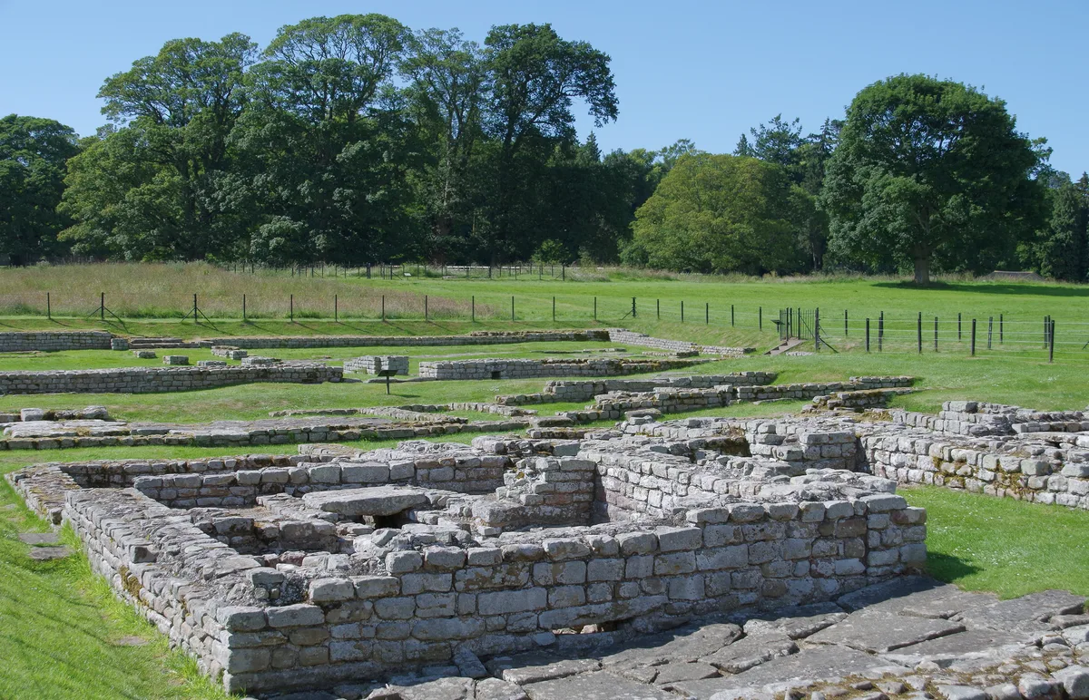
The Roman fort, vicus, bridge abutments and associated remains of Hadrian's Wall at Chesters in wall mile 27
Archaeological sites · 0.7 km

Bath-house
Archaeological sites · 1.0 km

Walwick Tower
Literary houses · 1.0 km

Headquarters building
Historic houses · 1.0 km

Commandant's House
Historic houses · 1.0 km

Chesters
Archaeological sites · 1.0 km
Cilurnum
Archaeological sites · 1.0 km

Roman temple in Chester
Follies · 1.0 km

Chesters Roman Fort
Museums · 1.0 km

Wall
Battlefields & battle sites · 1.0 km
Wall War Memorial
Memorials & monuments · 1.0 km
Nearby
📷 5📷 3Archaeological sites · North East England
The Roman fort, vicus, bridge abutments and associated remains of Hadrian's Wall at Chesters in wall mile 27
The Roman fort, vicus, bridge abutments and associated remains of Hadrian's Wall at Chesters in wall mile 27 — archaeological site in the United Kingdom.
📷 5Archaeological sites · North East England
Bath-house
Bath-house — archaeological in scotland lowlands.
📷 5Literary houses · North East England
Walwick Tower
Walwick Tower — a literary house museum in scotland lowlands.
📷 3Historic houses · North East England
Headquarters building
Headquarters building — a historic house in scotland-lowlands, United Kingdom.
📷 3Historic houses · North East England
Commandant's House
Commandant's House — a historic house in scotland-lowlands, United Kingdom.
Where to eat & stay near Walwick Grange
Places to stay
 📷 7
📷 7Hotels · North East England
George Hotel
George Hotel — a hotel in scotland lowlands.
 📷 5
📷 5Campsites · North East England
Greencarts Campsite
Greencarts Campsite — a campsite in scotland lowlands.
 📷 5
📷 5Campsites · North East England
Fallowfield Caravan Park
Fallowfield Caravan Park — a campsite in scotland lowlands.
 📷 5
📷 5Caravan parks · North East England
Riverside Leisure Holiday Park
Riverside Leisure Holiday Park — a caravan park in scotland lowlands.
 📷 5
📷 5Caravan parks · North East England
Tyne Green Holiday Park
Tyne Green Holiday Park — a caravan park in scotland lowlands.
 📷 5
📷 5Caravan parks · North East England
Heathergate Country Park
Heathergate Country Park — a caravan park in scotland lowlands.
Places to eat & drink
 📷 5
📷 5 📷 6
📷 6 📷 7
📷 7Historic pubs · North East England
Anchor Hotel
Anchor Hotel in Scotland Lowlands, United Kingdom.
 📷 7
📷 7Historic pubs · North East England
The Vicars Pele
The Vicars Pele in Scotland Lowlands, United Kingdom.
 📷 5
📷 5Historic pubs · North East England
Travellers' Rest Inn
Travellers' Rest Inn in Scotland Lowlands, United Kingdom.
 📷 5
📷 5Historic pubs · North East England
Wellington Inn
Wellington Inn in Scotland Lowlands, United Kingdom.
More historic houses in this region
 📷 3
📷 3Historic houses · North East England
Wayside cross known as Jenny Bradley 1000m north west of Bloworth Crossing on Greenhow Moor
Wayside cross known as Jenny Bradley 1000m north west of Bloworth Crossing on Greenhow Moor — a Grade II*-listed historic house in england-yorkshire, United Kingdom.
 📷 3
📷 3Historic houses · North East England
Crackpot Hall
Crackpot Hall — a historic house in england-north-west, United Kingdom.
 📷 3
📷 3Historic houses · North East England
Bunton Mine shop
Bunton Mine shop — a historic house in england-north-west, United Kingdom.
 📷 3
📷 3Historic houses · North East England
Blakethwaite Mine
Blakethwaite Mine — a historic house in england-north-west, United Kingdom.
Frequently asked questions
- Where is Walwick Grange?
- Walwick Grange is in North-East England, United Kingdom (postcode NE46 4BH), in the parish of Warden.
- What is Walwick Grange?
- Walwick Grange in England North East, United Kingdom.
- How do I get to Walwick Grange?
- The nearest railway station is Hexham, about 6.0 km away. Drivers can use postcode NE46 4BH.
- How do I get to Walwick Grange?
- The nearest railway station is Hexham, about 6.0 km away. Drivers can navigate to postcode NE46 4BH.