
Historic bridges · South East England
V4 Watling Street
In or near Milton Keynes.
V4 Watling Street is a historic bridge in the United Kingdom.

P L Chadwick — CC BY-SA 2.0 via Wikimedia Commons licence

Plan your visit
- Typical visit
- 15 min–30 min
- Nearest railway station
- Milton Keynes Central · 1.8 km
- Free entry
- Dog-friendly
Getting there & planning your visit
To visit V4 Watling Street, the nearest railway station is Milton Keynes Central, which is 1.8 km away. Entry is free.
About
V4 Watling Street is a named historic bridge in the United Kingdom. Coordinates: 52.0185°, -0.7663°. This entry is part of The Great Britain Guide, a free, ad-free, open-data tourist directory.
Photo gallery
See it from the streetimagery from 2020
Imagery © Mapillary contributors, CC BY-SA 4.0
From the Wikipedia article
Watling Street is a historic route in England, running from Dover and London in the southeast, via St Albans to Wroxeter. The road crosses the River Thames at London and was used in Classical Antiquity, Late Antiquity, and throughout the Middle Ages. It was used by the ancient Britons and paved as one of the main Roman roads in Britannia (Roman-governed Great Britain during the Roman Empire). The line of the road was later the southwestern border of the Danelaw with Wessex and Mercia, and Watling Street was numbered as one of the major highways of medieval England. First used by the ancient Britons, mainly between the areas of modern Canterbury and St Albans using a natural ford near Westminster, the road was later paved by the Romans. It connected the ports of Dubris (Dover), Rutupiae (Richborough Castle), Lemanis (Lympne), and Regulbium (Reculver) in Kent to the Roman bridge over the Thames at Londinium (London). The route continued northwest through Verulamium (St Albans) on its way to Viroconium Cornoviorum (Wroxeter). Watling Street is traditionally cited as having been the location of the Romans' defeat of Boudica, though precisely where on the route is disputed. The Roman Antonine Itinerary lists sites along the route of Watling Street as part of a longer route of 500 Roman miles connecting Richborough with Hadrian's Wall via Wroxeter. The continuation on to Blatobulgium (Birrens, Dumfriesshire) beyond Hadrian's Wall in modern Scotland may have been part of the same route, leading some scholars to call this Watling Street as well, although others restrict it to the southern leg. In the early 18th century, England's first turnpike trust was established to pave the route through Bedfordshire and Buckinghamshire. In the early 19th century, the course between London and the Channel was paved and became known as the Great Dover Road. The route from London to Wroxeter forms much of the A5 road. The route from Dover to London forms part of the A2 road. At various…
Excerpt from Wikipedia under CC BY-SA 4.0. See the source article linked in Sources below.
- Coordinates
- 52.0185, -0.7663
- District
- Milton Keynes
- Parish
- Shenley Brook End
- Postcode
- MK4 1GA
- Parliamentary constituency
- Milton Keynes Central
- Nearest railway station
- Milton Keynes Central — 1.8 km
Sources
- osm: w34697008 (ODbL)
- wikipedia: V4 Watling Street (CC BY-SA 4.0)
Other places nearby

Furzton Lake
Lakes · 0.3 km
Energy World
Gardens · 0.4 km

Sundial
Memorials & monuments · 0.4 km

National Bowl
Open-air theatres · 0.4 km

Portals
Public art & sculpture · 0.4 km
Kidsplay Activity Land
Theme parks · 0.4 km

Triple Star Head
Public art & sculpture · 0.5 km

Gambado
Theme parks · 0.6 km

Gurdwara Baba Zorawar Singh Ji Baba Fateh Singh Ji
Historic churches · 1.0 km

Shenley Brook End
Villages · 1.4 km

Shenley Roll of Honour 1914 - 1919
Memorials & monuments · 1.6 km
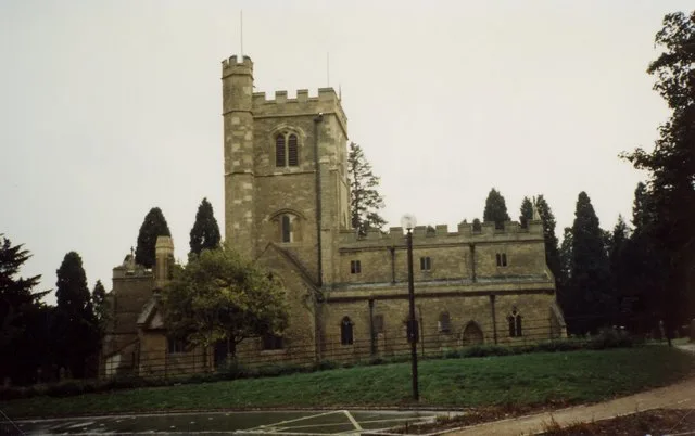
St. Mary's Church, Shenley
Historic churches · 1.6 km
Nearby
📷 5📷 4Gardens · South East England
Energy World
Energy World — a garden in england-west-midlands, United Kingdom.
📷 5📷 5Open-air theatres · South East England
National Bowl
National Bowl — a open-air theatre in england west midlands.
📷 3Public art & sculpture · South East England
Portals
Portals — a public art in South East England, United Kingdom.
📷 3Theme parks · South East England
Kidsplay Activity Land
Kidsplay Activity Land — a theme park in South East England, United Kingdom.
Where to eat & stay near V4 Watling Street
Places to stay
 📷 5
📷 5Hotels · South East England
DoubleTree by Hilton Milton Keynes
DoubleTree by Hilton Milton Keynes — a hotel in england west midlands. 4-star. Brand: DoubleTree.
 📷 5
📷 5Hotels · South East England
Mercure Parkside House
Mercure Parkside House — a hotel in england west midlands. 4-star. Brand: Mercure.
 📷 5
📷 5 📷 5
📷 5Campsites · South East England
Gulliver's Meadow Camp Site
Gulliver's Meadow Camp Site — a campsite in england west midlands.
 📷 5
📷 5Campsites · South East England
The Old Dairy Farm
The Old Dairy Farm — a campsite in england west midlands.
 📷 5
📷 5Caravan parks · South East England
Cosgrove Leisure Park
Cosgrove Leisure Park — a caravan park in england west midlands.
Places to eat & drink
📷 5Historic pubs · South East England
The Prince Albert Public House
The Prince Albert Public House in England South East, United Kingdom.
 📷 3
📷 3Historic pubs · South East England
The Cross Keys
The Cross Keys — Historic pub — listed building or notable heritage status.
 📷 7
📷 7Historic pubs · South East England
The Maltsters Arms Public House
The Maltsters Arms Public House in England South East, United Kingdom.
 📷 3
📷 3Historic pubs · South East England
The New Inn
The New Inn — Historic pub — listed building or notable heritage status.
 📷 7
📷 7Historic pubs · South East England
The Cuba Public House
The Cuba Public House in England South East, United Kingdom.
 📷 5
📷 5Historic pubs · South East England
The Shoulder Of Mutton Public House
The Shoulder Of Mutton Public House in England South East, United Kingdom.
More bridges in this region
 📷 5
📷 5Historic bridges · South East England
Briary Hill Bridge east
Briary Hill Bridge east is a historic bridge in the United Kingdom.
 📷 5
📷 5Historic bridges · South East England
Briary Hill Bridge west
Briary Hill Bridge west is a historic bridge in the United Kingdom.
 📷 5
📷 5Historic bridges · South East England
Bridge 157 VIR (Bath Hard Road)
Bridge 157 VIR (Bath Hard Road) is a historic bridge in the United Kingdom.
 📷 5
📷 5Historic bridges · South East England
Dorking Arch Bridge
Dorking Arch Bridge is a historic bridge in the United Kingdom.
Frequently asked questions
- Where is V4 Watling Street?
- V4 Watling Street is in South-East England, United Kingdom (postcode MK4 1GA), in the parish of Shenley Brook End.
- What is V4 Watling Street?
- V4 Watling Street is a historic bridge in the United Kingdom.
- How do I get to V4 Watling Street?
- The nearest railway station is Milton Keynes Central, about 1.8 km away. The nearest town is Milton Keynes. Drivers can use postcode MK4 1GA.
- Is V4 Watling Street free to visit?
- Yes, V4 Watling Street is free to enter.
- How do I get to V4 Watling Street?
- The nearest railway station is Milton Keynes Central, about 1.8 km away. Drivers can navigate to postcode MK4 1GA.