National parks · North East England
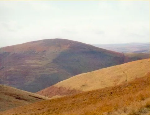
Usway Burn
In or near Alwinton.
Usway Burn in England North East, United Kingdom.

Andy Waddington — CC BY-SA 2.0 via Wikimedia Commons licence
Plan your visit
- Typical visit
- 4 h–8 h
- Best time of year
- Spring – autumn (Apr–Oct)
- Free entry
- Family-friendly
- Dog-friendly
About
Usway Burn is a place of interest in England North East, United Kingdom — drawn from open-data sources for visitor reference. See the linked Wikipedia article for the full description.
Photo gallery
Protected designations
- Site of Special Scientific Interest: River Coquet and Coquet Valley Woodlands SSSI
Designations sourced from Natural England open data under OGL v3.
From the Wikipedia article
The Usway Burn is an upland river on the southern flanks of the Cheviot Hills, in the Northumberland National Park, England. It is a tributary of the River Coquet and is about 15 km in length. It is located close to the northernmost end of the Pennine Way.
Excerpt from Wikipedia under CC BY-SA 4.0. See the source article linked in Sources below.
- Coordinates
- 55.3628, -2.1806
- District
- Northumberland
- Parish
- Alwinton
- Postcode
- NE65 7BN
- Parliamentary constituency
- North Northumberland
Sources
- wikidata: Q23463570 (CC0)
- wikipedia: Usway Burn (CC BY-SA 4.0)
Other places nearby

old Linbrig Village
Archaeological sites · 1.1 km

Green Side
Mountains & hills · 2.0 km

Wholehope Knowe
Mountains & hills · 2.1 km

Shillhope Law
Mountains & hills · 2.4 km
Shillhope Law
Natural landmarks · 2.4 km
Lords Seat
Mountains & hills · 2.6 km

Calf Lee
Mountains & hills · 2.6 km

Long Hill
Mountains & hills · 2.7 km

Saughy Hill
Mountains & hills · 2.8 km
Saughy Hill
Mountains & hills · 2.9 km

Peat Law
Mountains & hills · 3.1 km

Barrow Meadow
Wildlife reserves · 3.3 km
Nearby
📷 3Archaeological sites · North East England
old Linbrig Village
old Linbrig Village — a archaeological in scotland-lowlands, United Kingdom.
📷 5Mountains & hills · North East England
Green Side
Green Side — a hill or mountain in scotland lowlands.
📷 5Mountains & hills · North East England
Wholehope Knowe
Wholehope Knowe — mountain in scotland lowlands. Elevation: 443 m.
📷 3📷 3📷 5Mountains & hills · North East England
Lords Seat
Lords Seat — mountain in scotland lowlands. Elevation: 392.3 m.
Where to eat & stay near Usway Burn
Places to stay
 📷 5
📷 5Campsites · North East England
Firing Point - Farm
Firing Point - Farm — a campsite in scotland lowlands.
 📷 5
📷 5 📷 5
📷 5 📷 5
📷 5Caravan parks · North East England
Border Forest Caravan Park
Border Forest Caravan Park — a caravan park in scotland lowlands.
 📷 5
📷 5Hotels · North East England
William de Percy
William de Percy — a hotel in scotland lowlands.
 📷 5
📷 5Hostels · North East England
Mounthooly Bunk House
Mounthooly Bunk House — a hostel in scotland lowlands.
Places to eat & drink
 📷 5
📷 5Historic pubs · North East England
The Redesdale Arms
The Redesdale Arms in Scotland Lowlands, United Kingdom.
 📷 7
📷 7Historic pubs · North East England
Plough Inn With Outbuilding To North
Plough Inn With Outbuilding To North in Scotland Lowlands, United Kingdom.
 📷 7
📷 7Historic pubs · North East England
Bridge Of Aln Hotel
Bridge Of Aln Hotel in Scotland Lowlands, United Kingdom.
 📷 7
📷 7 📷 7
📷 7More national parks in this region
 📷 4
📷 4 📷 4
📷 4National parks · North East England
Mallerstang
Mallerstang in England North East, United Kingdom.
 📷 4
📷 4National parks · North East England
Kisdon Force
Kisdon Force in England North East, United Kingdom.
 📷 4
📷 4Frequently asked questions
- Where is Usway Burn?
- Usway Burn is in North-East England, United Kingdom (postcode NE65 7BN), in the parish of Alwinton.
- What is Usway Burn?
- Usway Burn in England North East, United Kingdom.
- How do I get to Usway Burn?
- Drivers can use postcode NE65 7BN.
- Is Usway Burn a protected site?
- Yes — Usway Burn is part of the River Coquet and Coquet Valley Woodlands SSSI Site of Special Scientific Interest.
- Is Usway Burn free to visit?
- Yes, Usway Burn is free to enter.
- How do I get to Usway Burn?
- Drivers can navigate to postcode NE65 7BN. It sits within the North Northumberland parliamentary constituency.