
Campsites · South East England
Upper Parsonage Farm
In or near Ditcham.
Upper Parsonage Farm — a campsite in england south east.

Barry Shimmon — CC BY-SA 2.0 via Wikimedia Commons licence

Plan your visit
- Typical visit
- 1 h–2 h
- Nearest railway station
- Petersfield · 5.3 km
About
Upper Parsonage Farm is a campsite located in england south east. Campsite listed with verified location and OSM metadata. Pitch availability, facilities (toilets, showers, electric hookup) and seasonal opening vary — confirm directly.
Photo gallery
Place summary
Upper Parsonage Farm is a campsite located in South-East England. This site offers visitors a rural setting, ideal for outdoor activities and experiencing the countryside. Facilities typically include basic amenities for camping, allowing for a straightforward camping experience. The farm environment may provide opportunities for nature walks and enjoying the surrounding landscape.
AI-generated from the structured facts on this page (operator, designation, listing, era). Not a substitute for visiting.
- Coordinates
- 50.9781, -1.0029
- County
- Hampshire
- District
- East Hampshire
- Parish
- East Meon
- Postcode
- GU32 1QR
- Parliamentary constituency
- East Hampshire
- Phone
- 01730823490
- Nearest railway station
- Petersfield — 5.3 km
- Official site
- www.upperparsonagefarm.co.uk
Sources
- osm: n6683578037 (ODbL)
- fsq: 0e41b645cb9e41a888f9988f (Apache-2.0)
Other places nearby

Tegdown Hill
Mountains & hills · 1.3 km

Butser Hill
Vineyards · 1.4 km
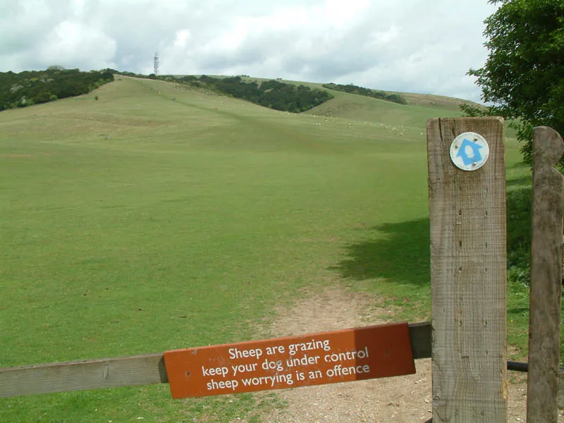
Butser Hill
Mountains & hills · 1.6 km

East Meon Off Road Cycle Trail
Mountain bike trails · 1.6 km

Hyden Hill
Mountains & hills · 1.7 km

Cross Dykes
Memorials & monuments · 1.8 km
Pillow Mound
Archaeological sites · 1.9 km

Barrow Hill
Mountains & hills · 2.0 km

Barrow Hill
Mountains & hills · 2.0 km

Shipwright's Way
Mountain bike trails · 2.3 km
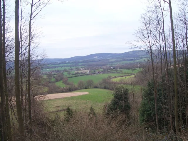
War Down
Mountains & hills · 2.6 km

QECP Red MTB
Mountain bike trails · 2.6 km
Nearby
📷 5Mountains & hills · South East England
Tegdown Hill
Tegdown Hill — mountain in england south east. Elevation: 220 m.
📷 5Vineyards · South East England
Butser Hill
Butser Hill — a UK vineyard in england south east, producing English or Welsh wine from cool-climate grape varieties.
📷 5📷 5Mountain bike trails · South East England
East Meon Off Road Cycle Trail
East Meon Off Road Cycle Trail — a mtb trail in england south east.
📷 5Mountains & hills · South East England
Hyden Hill
Hyden Hill — mountain in england south east. Elevation: 210 m.
📷 5Memorials & monuments · South East England
Cross Dykes
Cross Dykes — a memorial in South East England, United Kingdom.
Where to eat & stay near Upper Parsonage Farm
Places to stay
 📷 5📷 5
Campsites · South East England
The Sustainability Centre
The Sustainability Centre — a campsite in england south east.
 📷 5
Caravan parks · South East England
Brocklands Farm
Brocklands Farm — a caravan park in england south east.
 📷 5
 📷 5
Campsites · South East England
Grenville at Wallops Wood
Grenville at Wallops Wood — a campsite in england south east.
 📷 5
Campsites · South East England
Pit Hill Farm Campsite.
Pit Hill Farm Campsite. — a campsite in england south east.
Places to eat & drink
 📷 7
Historic pubs · South East England
The Five Bells Public House
The Five Bells Public House in England South East, United Kingdom.
 📷 7
Historic pubs · South East England
Bat & Ball Inn
Bat & Ball Inn in England South East, United Kingdom.
 📷 7
Historic pubs · South East England
The Market Inn
The Market Inn in England South East, United Kingdom.
 📷 5
Historic pubs · South East England
The Red Lion Hotel
The Red Lion Hotel in England South East, United Kingdom.
 📷 7
Historic pubs · South East England
The Good Intent
The Good Intent in England South East, United Kingdom.
 📷 5
Historic pubs · South East England
The Harrow
The Harrow in England South East, United Kingdom.
More places in this region
 📷 5
Campsites · South East England
Hammonds Glamping
Hammonds Glamping — a campsite in england london.
 📷 5
Campsites · South East England
Chantry Wood Campsite
Chantry Wood Campsite — a campsite in england london.
 📷 5
Campsites · South East England
Ranmore Common Campsite
Ranmore Common Campsite — a campsite in england london.
 📷 5
Frequently asked questions
- Where is Upper Parsonage Farm?
- Upper Parsonage Farm is in Hampshire, South-East England, United Kingdom (postcode GU32 1QR), in the parish of East Meon.
- What is Upper Parsonage Farm?
- Upper Parsonage Farm — a campsite in england south east.
- How do I get to Upper Parsonage Farm?
- The nearest railway station is Petersfield, about 5.3 km away. The nearest town is Ditcham. Drivers can use postcode GU32 1QR.
- How do I get to Upper Parsonage Farm?
- The nearest railway station is Petersfield, about 5.3 km away. Drivers can navigate to postcode GU32 1QR.