
Historic bridges · Yorkshire & the Humber
Ulla Bridge
In or near Colsterdale.
Ulla Bridge — Grade II listed building-listed bridge in england-yorkshire, United Kingdom.

JThomas — CC BY-SA 2.0 via Wikimedia Commons licence

Plan your visit
- Typical visit
- 15 min–30 min
- Nearest railway station
- Leyburn · 5.8 km
- Free entry
- Dog-friendly
Getting there & planning your visit
To visit Ulla Bridge, the nearest railway station is Leyburn, located 5.8 km away. The postcode for navigation is DL8 4RW, and entry to the bridge is free.
About
Ulla Bridge is a Grade II listed building-listed bridge in england-yorkshire, United Kingdom, registered on the National Heritage List for England (NHLE entry 1318318). Listed status protects buildings and structures of special architectural or historic interest. See the linked Wikipedia article for further details.
Photo gallery
Heritage listing
Details CALDBERGH WITH COVERHAM TO WEST SCRAFTON SE 08 NE EAST SCRAFTON ROAD (south side, off) 3/38 Ulla Bridge - II Pack-horse bridge. Probably C17-C18. Rubble. Single segmental arch which has been widened both upstream and downstream, giving 3 parallel structures of almost even width. Soffits throughout of evenly-sized and shaped voussoirs. No parapets. Superseded by new road bridge, Caldbergh Bridge, slighly downstream, in 1933. Listing NGR: SE0912985102 Legacy The contents of this record have been generated from a legacy data system. Legacy System number: 322520 Legacy System: LBS
From the Historic England List Entry under OGL v3.
Protected designations
- Site of Special Scientific Interest: East Nidderdale Moors (Flamstone Pin - High Ruckles) SSSI
- Area of Outstanding Natural Beauty: Nidderdale
Designations sourced from Natural England open data under OGL v3.
Place summary
Ulla Bridge is a Grade II listed bridge located in Yorkshire. It is recognised for its historical significance and architectural merit.
AI-generated from the structured facts on this page (operator, designation, listing, era). Not a substitute for visiting.
- Coordinates
- 54.2615, -1.8614
- District
- North Yorkshire
- Parish
- Caldbergh with East Scrafton
- Postcode
- DL8 4RW
- Parliamentary constituency
- Richmond and Northallerton
- Nearest railway station
- Leyburn — 5.8 km
Sources
- wikidata: Q26604469 (CC0)
Other places nearby

St Simon's Chapel
Historic houses · 0.6 km

Castle Steads slight univallate hillfort
Vineyards · 1.4 km

Coverham
Villages · 1.4 km

Forbidden Corner
National parks · 1.6 km
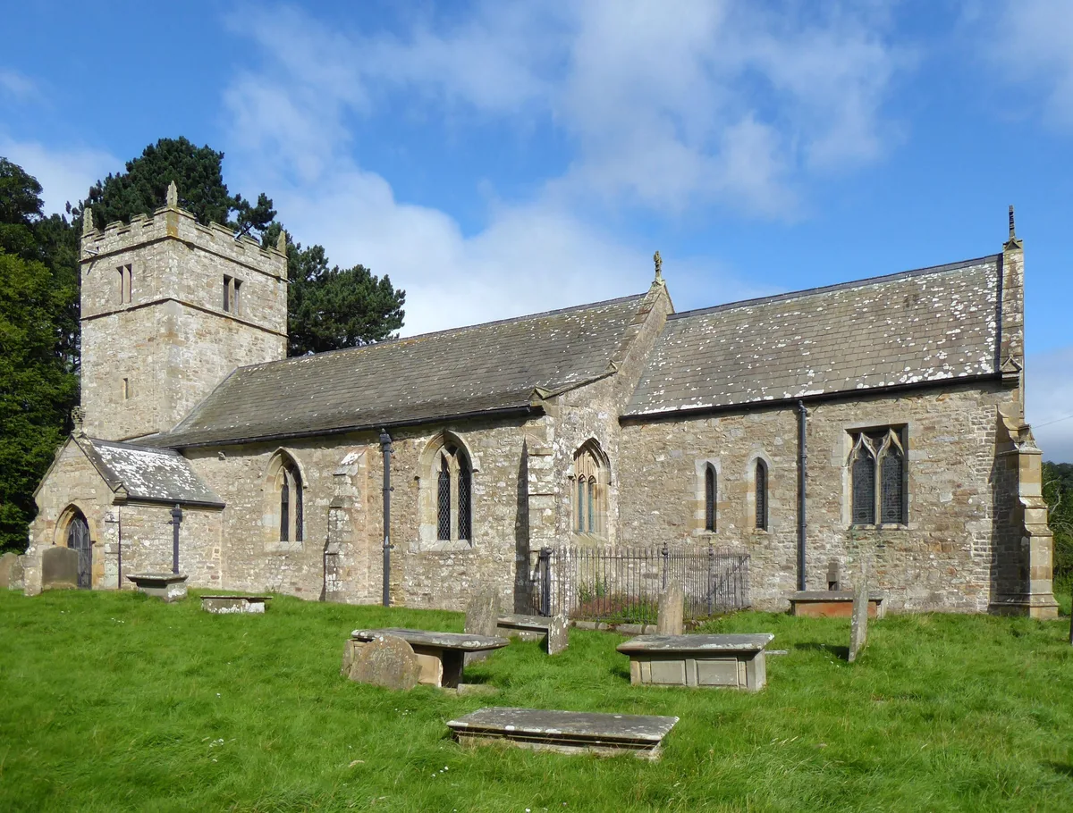
Holy Trinity Church, Coverham
Historic churches · 1.8 km
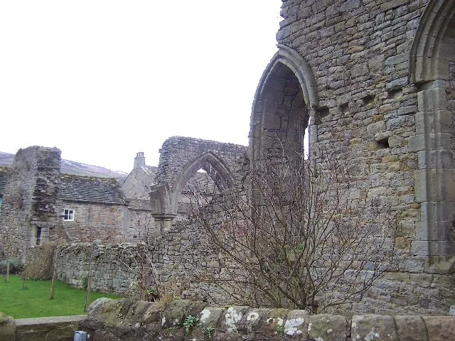
Coverham Abbey
Abbeys & priories · 2.0 km

Coverham Abbey
Cathedrals · 2.0 km

Scrafton Pot
Caves · 2.3 km
West Scrafton
Villages · 2.3 km

Carlton in Coverdale Round Hill
Castles · 2.4 km
Foresters Arms Inn
Historic pubs · 2.4 km
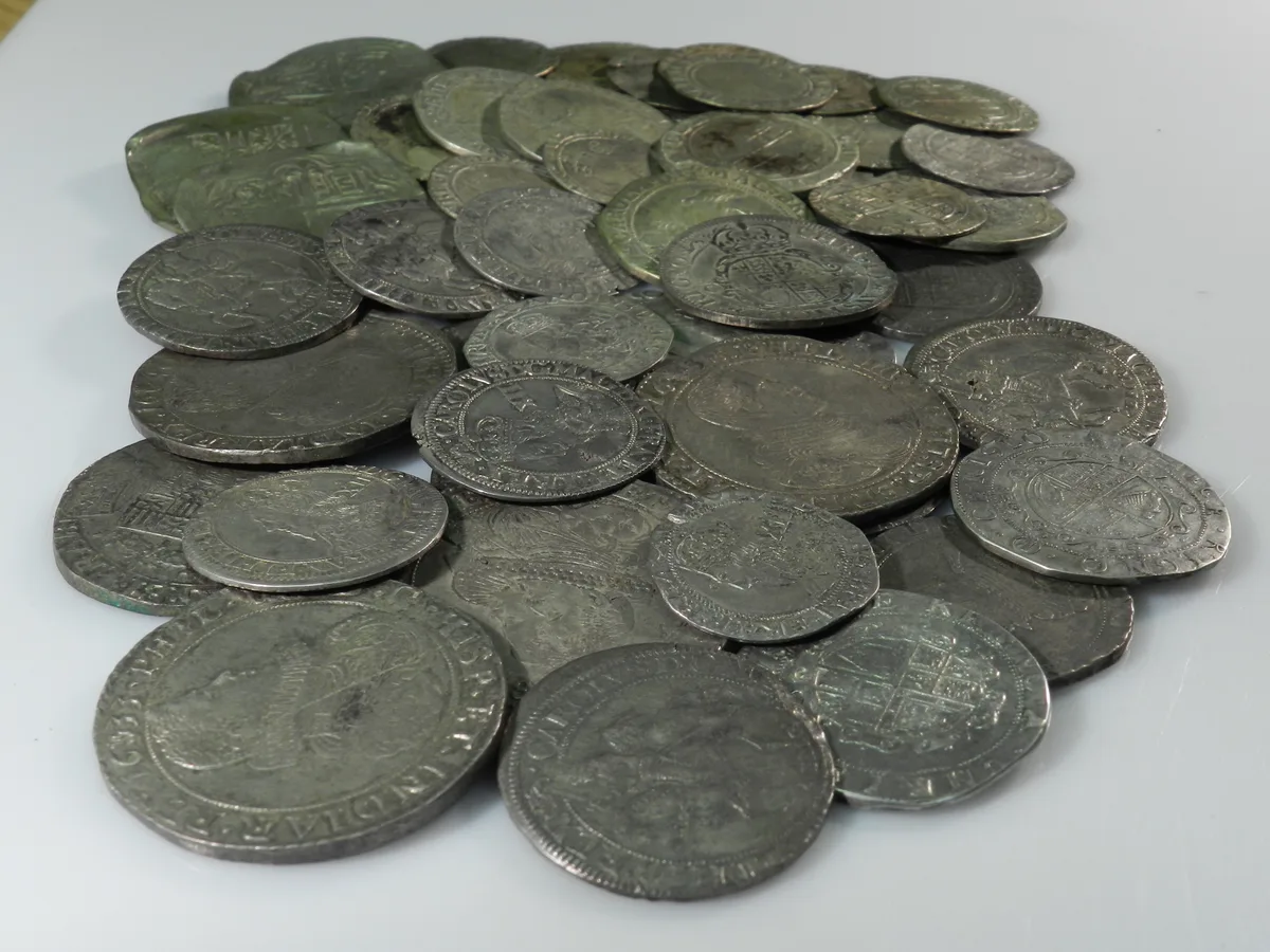
Middleham Hoard
Hill forts · 2.5 km
Nearby
📷 3Historic houses · Yorkshire & the Humber
St Simon's Chapel
St Simon's Chapel — a historic house in england-yorkshire, United Kingdom.
📷 5Vineyards · Yorkshire & the Humber
Castle Steads slight univallate hillfort
Castle Steads slight univallate hillfort — a UK vineyard in england yorkshire, producing English or Welsh wine from cool-climate grape varieties.
📷 5📷 5National parks · Yorkshire & the Humber
Forbidden Corner
The Forbidden Corner is a folly garden located in the Tupgill Park Estate, at Coverham in Coverdale, in the Yorkshire Dales National Park, England. It is open to the public. The folly garden is design
📷 3Historic churches · Yorkshire & the Humber
Holy Trinity Church, Coverham
Holy Trinity Church, Coverham — church in Coverham, North Yorkshire, England, UK.
★ Iconic📷 3Abbeys & priories · Yorkshire & the Humber
Coverham Abbey
Coverham Abbey — abbey in Coverham, North Yorkshire, England, UK.
Where to eat & stay near Ulla Bridge
Places to stay
 📷 7
📷 7B&Bs · Yorkshire & the Humber
The Old Vicarage
The Old Vicarage — a bed-and-breakfast in england yorkshire.
 📷 5
📷 5B&Bs · Yorkshire & the Humber
The Priory
The Priory — a bed-and-breakfast in england yorkshire.
 📷 7
📷 7Hotels · Yorkshire & the Humber
The Wensleydale Hotel
The Wensleydale Hotel — a hotel in england yorkshire.
 📷 7
📷 7Hotels · Yorkshire & the Humber
The Wensleydale Heifer
The Wensleydale Heifer — a hotel in england yorkshire.
 📷 5
📷 5 📷 5
📷 5Campsites · Yorkshire & the Humber
Brookfields Farm
Brookfields Farm — a campsite in england yorkshire.
Places to eat & drink
📷 5Historic pubs · Yorkshire & the Humber
Foresters Arms Inn
Foresters Arms Inn in England Yorkshire, United Kingdom.
 📷 7
📷 7Cafés · Yorkshire & the Humber
The Castle Keep Tea Room
The Castle Keep Tea Room — a café in england yorkshire.
 📷 7
📷 7Historic pubs · Yorkshire & the Humber
Fox And Hounds Inn
Fox And Hounds Inn in England Yorkshire, United Kingdom.
 📷 6
📷 6Historic pubs · Yorkshire & the Humber
The Blue Lion
The Blue Lion in England Yorkshire, United Kingdom.
 📷 7
📷 7Cafés · Yorkshire & the Humber
Kim's Cafe & Bistro
Kim's Cafe & Bistro — a café in england yorkshire.
 📷 5
📷 5Restaurants · Yorkshire & the Humber
The Sandpiper Inn
The Sandpiper Inn — a restaurant in england yorkshire.
More bridges in this region
 📷 5
📷 5Historic bridges · Yorkshire & the Humber
Broadbottom Viaduct
Broadbottom Viaduct is a historic bridge in the United Kingdom.
 📷 3
📷 3Historic bridges · Yorkshire & the Humber
Goyt Cliff Viaduct
Goyt Cliff Viaduct is a historic bridge in the United Kingdom.
 📷 3
📷 3Historic bridges · Yorkshire & the Humber
Iron Bridge
Iron Bridge is a historic bridge in the United Kingdom.
.jpg?width=1200) 📷 5
📷 5Historic bridges · Yorkshire & the Humber
Marple Aqueduct
Marple Aqueduct is a historic bridge in the United Kingdom.
Frequently asked questions
- Where is Ulla Bridge?
- Ulla Bridge is in Yorkshire, United Kingdom (postcode DL8 4RW), in the parish of Caldbergh with East Scrafton.
- What is Ulla Bridge?
- Ulla Bridge — Grade II listed building-listed bridge in england-yorkshire, United Kingdom.
- How do I get to Ulla Bridge?
- The nearest railway station is Leyburn, about 5.8 km away. Drivers can use postcode DL8 4RW.
- Is Ulla Bridge a listed building?
- Ulla Bridge is officially recognised as Grade II listed building listed.
- Is Ulla Bridge a protected site?
- Yes — Ulla Bridge is part of the East Nidderdale Moors (Flamstone Pin - High Ruckles) SSSI Site of Special Scientific Interest and the Nidderdale National Landscape (AONB).
- Is Ulla Bridge free to visit?
- Yes, Ulla Bridge is free to enter.
- How do I get to Ulla Bridge?
- The nearest railway station is Leyburn, about 5.8 km away. Drivers can navigate to postcode DL8 4RW.