
Archaeological sites · South West England
Uley Long Barrow
In or near Owlpen.
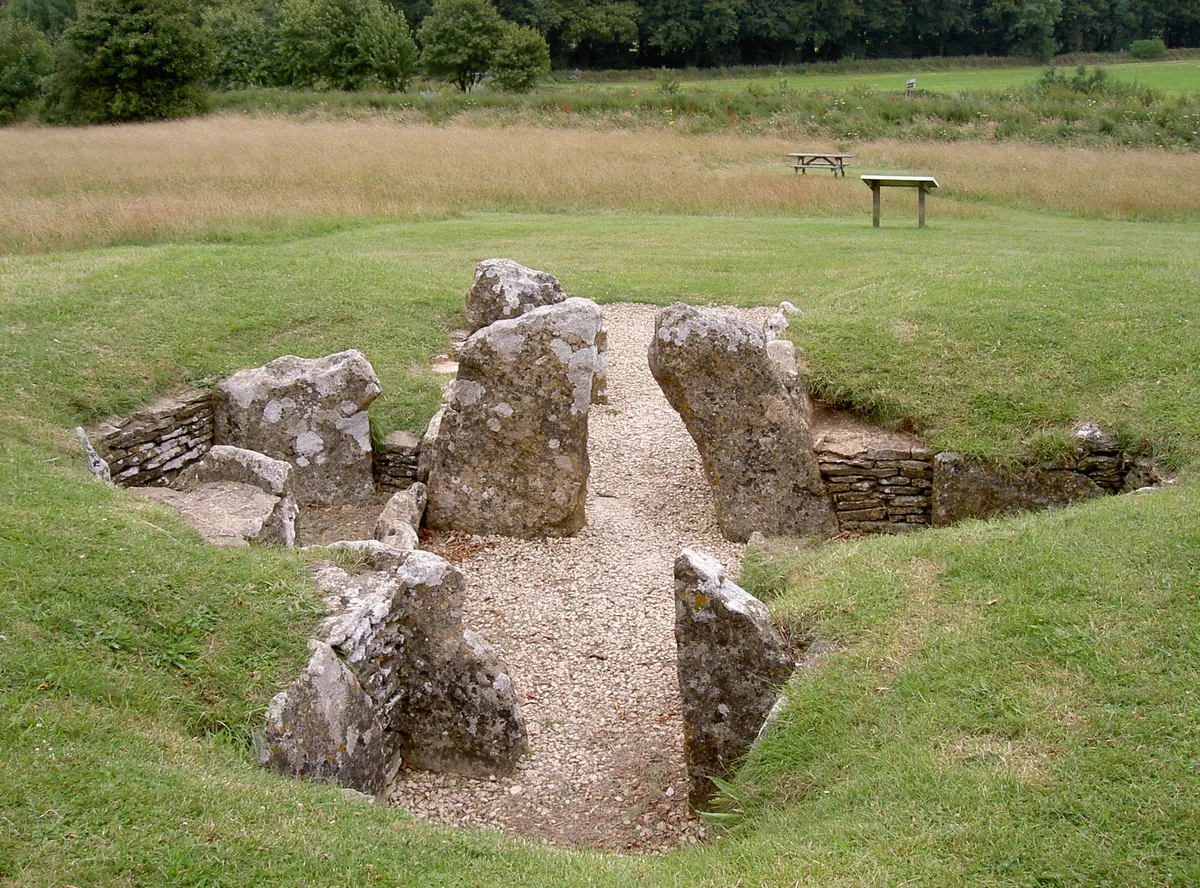
Uley Long Barrow — archaeological in england west midlands.

Chris Andrews — CC BY-SA 2.0 via Wikimedia Commons licence

Plan your visit
- Typical visit
- 45 min–1.5 h
- Nearest railway station
- Cam and Dursley · 4.2 km
About
Uley Long Barrow is a archaeological located in england west midlands. A British archaeological site recorded in OpenStreetMap with at least one heritage quality signal (Wikidata link, Wikipedia article or designated operator).
Photo gallery
Protected designations
- Area of Outstanding Natural Beauty: Cotswolds
Designations sourced from Natural England open data under OGL v3.
Place summary
Uley Long Barrow is an archaeological site located in the West Midlands. This ancient burial mound dates back to the Neolithic period and is part of the broader tradition of long barrows found across Britain. The site offers insight into early human funerary practices and landscape use. Visitors can explore the earthwork structure and surrounding area, which provides a glimpse into prehistoric life.
AI-generated from the structured facts on this page (operator, designation, listing, era). Not a substitute for visiting.
- Coordinates
- 51.6987, -2.3059
- County
- Gloucestershire
- District
- Stroud
- Parish
- Coaley
- Postcode
- GL11 5AR
- Parliamentary constituency
- Stroud
- Nearest railway station
- Cam and Dursley — 4.2 km
Sources
- osm: n330373140 (ODbL)
- wikidata: Q2474714 (CC0)
Other places nearby

Uley Long Barrow
Archaeological sites · 0.0 km
Crawley Hill
Mountains & hills · 0.0 km

West Hill
Archaeological sites · 0.6 km

Coaley Peak Toposcope
Viewpoints · 1.0 km

Rose And Crown Inn
Historic pubs · 1.2 km

Uley Bury
Vineyards · 1.2 km

Nympsfield
Villages · 1.2 km

Uley Bury
Archaeological sites · 1.2 km

Coaley Peak
Mountains & hills · 1.3 km
Nympsfield Long Barrow
Hill forts · 1.4 km

The Old Crown
Historic pubs · 1.4 km

Cam Long Down
Mountains & hills · 1.5 km
Nearby
📷 5Archaeological sites · South West England
Uley Long Barrow
The Uley Long Barrow, also known locally as Hetty Pegler's Tump, is a Neolithic burial mound near the village of Uley, Gloucestershire, England.
📷 5Mountains & hills · South West England
Crawley Hill
Crawley Hill — a hill or mountain in england west midlands.
📷 3Archaeological sites · South West England
West Hill
West Hill — a archaeological in england-west-midlands, United Kingdom.
📷 3Viewpoints · South West England
Coaley Peak Toposcope
Coaley Peak Toposcope is a viewpoint in the United Kingdom.
📷 5Historic pubs · South West England
Rose And Crown Inn
Rose And Crown Inn in England South East, United Kingdom.
📷 5Vineyards · South West England
Uley Bury
Uley Bury — a UK vineyard in england west midlands, producing English or Welsh wine from cool-climate grape varieties.
Where to eat & stay near Uley Long Barrow
Places to stay
 📷 5
📷 5Caravan parks · South West England
The Beeches Caravan CL
The Beeches Caravan CL — a caravan park in england west midlands.
 📷 5
📷 5Hotels · South West England
Stonehouse Court Hotel
Stonehouse Court Hotel — a hotel in england west midlands.
 📷 5
📷 5B&Bs · South West England
Churchend Farm B & B
Churchend Farm B & B — a bed-and-breakfast in england west midlands.
 📷 5
📷 5Hotels · South West England
Wild Garlic Rooms
Wild Garlic Rooms — a hotel in england west midlands.
 📷 5
📷 5Caravan parks · South West England
Moorend Farm CL caravan site
Moorend Farm CL caravan site — a caravan park in england west midlands.
 📷 5
📷 5Caravan parks · South West England
Apple Tree Park
Apple Tree Park — a caravan park in england west midlands.
Places to eat & drink
📷 5Historic pubs · South West England
Rose And Crown Inn
Rose And Crown Inn in England South East, United Kingdom.
📷 5 📷 5
📷 5 📷 5
📷 5Historic pubs · South West England
The White Lion
The White Lion in England South East, United Kingdom.
 📷 7
📷 7Cafés · South West England
The Lazy Goose
The Lazy Goose — a café in england west midlands.
 📷 5
📷 5Restaurants · South West England
The Old Fleece Inn
The Old Fleece Inn — a restaurant in england west midlands.
More archaeological sites in this region
 📷 5
📷 5Archaeological sites · South West England
Battlesbury Camp Monuments: hillfort, settlement, cemetery, barrows, enclosure, and field systems
Battlesbury Camp Monuments: hillfort, settlement, cemetery, barrows, enclosure, and field systems — archaeological site in Warminster, Wiltshire, England, UK.
 📷 2
📷 2Archaeological sites · South West England
Blandford Forest
Blandford Forest — forest in Blandford Forum, England.
 📷 5
📷 5Archaeological sites · South West England
Boulsbury Wood
Boulsbury Wood — protected area in Dorset and Hampshire, England.
.jpg?width=1200) 📷 5
📷 5Archaeological sites · South West England
Cranborne Chase
Cranborne Chase — Plateau in southern England.
Frequently asked questions
- Where is Uley Long Barrow?
- Uley Long Barrow is in Gloucestershire, the West Midlands, United Kingdom (postcode GL11 5AR), in the parish of Coaley.
- What is Uley Long Barrow?
- Uley Long Barrow — archaeological in england west midlands.
- How do I get to Uley Long Barrow?
- The nearest railway station is Cam and Dursley, about 4.2 km away. Drivers can use postcode GL11 5AR.
- Who owns Uley Long Barrow?
- Uley Long Barrow is owned by English Heritage.
- Is Uley Long Barrow a protected site?
- Yes — Uley Long Barrow is part of the Cotswolds National Landscape (AONB).
- How do I get to Uley Long Barrow?
- The nearest railway station is Cam and Dursley, about 4.2 km away. Drivers can navigate to postcode GL11 5AR.