Historic churches · Yorkshire & the Humber
Ulceby, North Lincolnshire
In or near North Killingholme.
Ulceby is a village and civil parish in North Lincolnshire, England. It is situated 0.5 miles (0.8 km) north from the A180 road, 10 miles (16 km) north-west from Grimsby and 14 miles (23 km) east from

David Wright — CC BY-SA 2.0 via Wikimedia Commons licence
_Junction_with_Coronation_Road_-_geograph.org.uk_-_2009872.jpg)
Plan your visit
- Typical visit
- 30 min–1 h
- Nearest railway station
- Ulceby · 1.6 km
- Free entry
Getting there & planning your visit
To visit Ulceby in North Lincolnshire, the nearest railway station is Ulceby, located 1.6 km away. The postcode for the area is DN39 6US, which can be used for sat-nav. Entry to the church is free.
About
Ulceby is a village and civil parish in North Lincolnshire, England. It is situated 0.5 miles (0.8 km) north from the A180 road, 10 miles (16 km) north-west from Grimsby and 14 miles (23 km) east from Scunthorpe. Ulceby is a rural village surrounded by fields, farms and the nearby villages of Habrough, Wootton and Croxton. The first part of the name is an Old Norse name (Úlfr), and the by means farmstead. At the 2001 census the village had a population of 1,500 in 631 households, and at the 2011 census the village had grown to 1,711.
Photo gallery
Protected designations
- Site of Special Scientific Interest: Humber Estuary - 2000480 SSSI
- Ramsar wetland: Humber Estuary
Designations sourced from Natural England open data under OGL v3.
From the Wikipedia article
Ulceby is a village and civil parish in North Lincolnshire, England. It is situated 0.5 miles (0.8 km) north from the A180 road, 10 miles (16 km) north-west from Grimsby and 14 miles (23 km) east from Scunthorpe. Ulceby is a rural village surrounded by fields, farms and the nearby villages of Habrough, Wootton and Croxton. The first part of the name is an Old Norse name (Úlfr), and the by means farmstead. At the 2001 census the village had a population of 1,500 in 631 households, and at the 2011 census the village had grown to 1,711.
Excerpt from Wikipedia under CC BY-SA 4.0. See the source article linked in Sources below.
- Coordinates
- 53.6183, -0.3245
- District
- North Lincolnshire
- Parish
- Ulceby
- Postcode
- DN39 6US
- Parliamentary constituency
- Brigg and Immingham
- Nearest railway station
- Ulceby — 1.6 km
Sources
- wikipedia: Ulceby, North Lincolnshire (CC BY-SA 4.0)
Other places nearby

Brocklesby Station Bridge
Viewpoints · 1.6 km

Brocklesby railway station
Heritage railway stations · 1.6 km

Wootton, Lincolnshire
Historic churches · 2.3 km

Newsham Abbey
Historic churches · 2.3 km

Newsham Abbey
Abbeys & priories · 2.4 km

Newsham Bridge
Historic bridges · 2.6 km

Newsham Lodge
Follies · 2.7 km

Medieval settlement of Croxton
Vineyards · 2.8 km

North Killingholme
Villages · 3.3 km

Kirmington
Villages · 3.6 km

Kirmington Roman settlement
Archaeological sites · 3.7 km

Thornton Hunt Inn
Hotels · 3.7 km
Nearby
📷 3Viewpoints · Yorkshire & the Humber
Brocklesby Station Bridge
Brocklesby Station Bridge is a viewpoint in the United Kingdom.
📷 4Heritage railway stations · Yorkshire & the Humber
Brocklesby railway station
Brocklesby railway station — a Grade II*-listed railway station in england-yorkshire, United Kingdom.
📷 5Historic churches · Yorkshire & the Humber
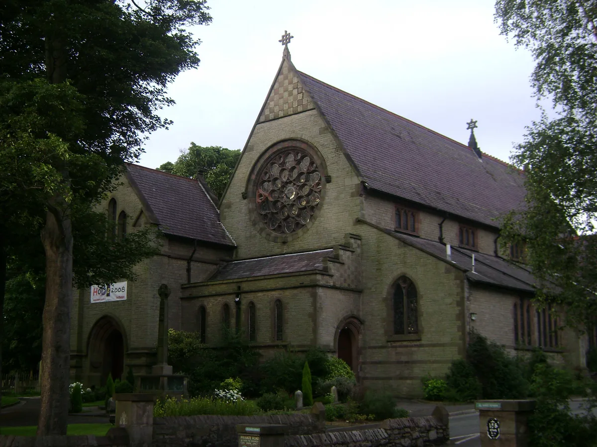
Wootton, Lincolnshire
Wootton, Lincolnshire — a church in england-yorkshire, United Kingdom.
📷 5Historic churches · Yorkshire & the Humber
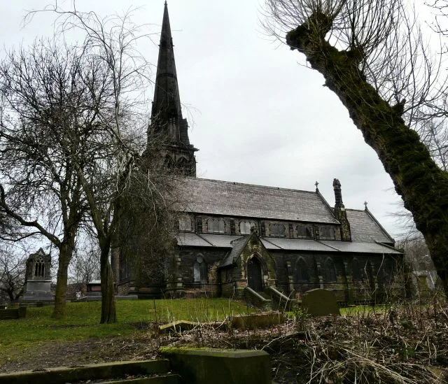
Newsham Abbey
Newsham Abbey was an abbey in Newsham, a small hamlet north of Brocklesby village in Lincolnshire, England, and one of nine within the historical county. Founded by Peter of Gousla in 1143, Newsham wa
📷 5📷 4Historic bridges · Yorkshire & the Humber
Newsham Bridge
Newsham Bridge — Grade I listed building-listed bridge in england-yorkshire, United Kingdom.
Where to eat & stay near Ulceby, North Lincolnshire
Places to stay
📷 5Hotels · Yorkshire & the Humber
Thornton Hunt Inn
Thornton Hunt Inn — a hotel in england yorkshire.
 📷 7
📷 7Hotels · Yorkshire & the Humber
Hampton by Hilton Humberside Airport
Hampton by Hilton Humberside Airport — a hotel in england yorkshire. 3-star. Brand: Hampton.
 📷 5
📷 5Hotels · Yorkshire & the Humber
The Amethyst Hotel
The Amethyst Hotel — a hotel in england yorkshire.
 📷 5
📷 5Caravan parks · Yorkshire & the Humber
Mealand Hill Caravan Park
Mealand Hill Caravan Park — a caravan park in england yorkshire.
📷 5Caravan parks · Yorkshire & the Humber
Mealand Hill Caravan Park
Mealand Hill Caravan Park — a caravan park in england yorkshire.
 📷 5
📷 5B&Bs · Yorkshire & the Humber
Holcombe Guest House
Holcombe Guest House — a bed-and-breakfast in england yorkshire.
Places to eat & drink
 📷 5
📷 5Historic pubs · Yorkshire & the Humber
Criterion Public House
Criterion Public House in England Yorkshire, United Kingdom.
 📷 6
📷 6Historic pubs · Yorkshire & the Humber
Vauxhall Tavern Public House
Vauxhall Tavern Public House in England Yorkshire, United Kingdom.
 📷 5
📷 5Historic pubs · Yorkshire & the Humber
Earl De Grey Public House
Earl De Grey Public House in England Yorkshire, United Kingdom.
 📷 5
📷 5Historic pubs · Yorkshire & the Humber
The Kingston Public House
The Kingston Public House in England Yorkshire, United Kingdom.
 📷 5
📷 5Historic pubs · Yorkshire & the Humber
Prince's Dock Chambers And The Quayside Public House
Prince's Dock Chambers And The Quayside Public House in England Yorkshire, United Kingdom.
 📷 7
📷 7Historic pubs · Yorkshire & the Humber
The Old White Hart Inn
The Old White Hart Inn in England Yorkshire, United Kingdom.
More places in this region
 📷 5
📷 5Historic churches · Yorkshire & the Humber
All Saints Church, Marple
All Saints Church, Marple — church in Marple, Greater Manchester, England, UK.
 📷 3
📷 3Historic churches · Yorkshire & the Humber
Brookfield Unitarian Church
Brookfield Unitarian Church — church in Manchester, UK.
 📷 5
📷 5Historic churches · Yorkshire & the Humber
Chadkirk Chapel
Chadkirk Chapel — church and museum in Stockport, United Kingdom.
 📷 3
📷 3Historic churches · Yorkshire & the Humber
Christ Church, Heaton Norris
Christ Church, Heaton Norris — church in Stockport, UK.
Frequently asked questions
- Where is Ulceby, North Lincolnshire?
- Ulceby, North Lincolnshire is in Yorkshire, United Kingdom (postcode DN39 6US), in the parish of Ulceby.
- What is Ulceby, North Lincolnshire?
- Ulceby is a village and civil parish in North Lincolnshire, England. It is situated 0.5 miles (0.8 km) north from the A180 road, 10 miles (16 km) north-west from Grimsby and 14 miles (23 km) east from
- How do I get to Ulceby, North Lincolnshire?
- The nearest railway station is Ulceby, about 1.6 km away. Drivers can use postcode DN39 6US.
- Is Ulceby, North Lincolnshire a protected site?
- Yes — Ulceby, North Lincolnshire is part of the Humber Estuary - 2000480 SSSI Site of Special Scientific Interest and the Humber Estuary Ramsar wetland.
- Is Ulceby, North Lincolnshire free to visit?
- Yes, Ulceby, North Lincolnshire is free to enter.
- How do I get to Ulceby, North Lincolnshire?
- The nearest railway station is Ulceby, about 1.6 km away. Drivers can navigate to postcode DN39 6US.