National parks · North East England
Tynedale
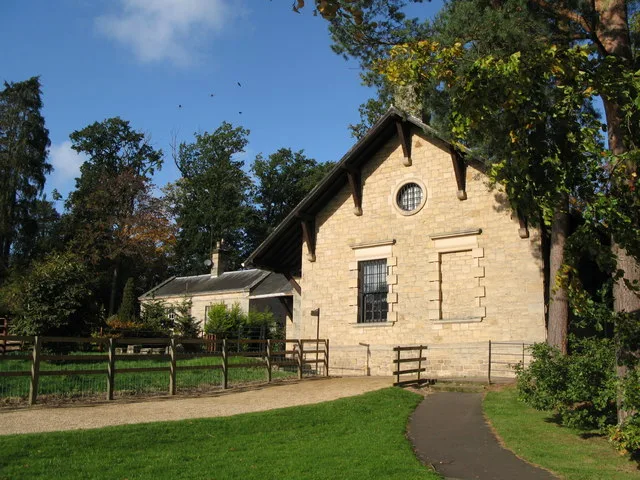
In or near Acomb.
Tynedale in England North East, United Kingdom.

James T M Towill — CC BY-SA 2.0 via Wikimedia Commons licence
Plan your visit
- Typical visit
- 4 h–8 h
- Best time of year
- Spring – autumn (Apr–Oct)
- Nearest railway station
- Hexham · 7.2 km
- Free entry
- Family-friendly
- Dog-friendly
Getting there & planning your visit
To visit Tynedale, the nearest railway station is Hexham, located 7.2 km away. The postcode for Tynedale is NE46 4AD, which you can use for sat-nav coordinates. Entry to the park is free.
About
Tynedale is a place of interest in England North East, United Kingdom — drawn from open-data sources for visitor reference. See the linked Wikipedia article for the full description.
Photo gallery
From the Wikipedia article
Tynedale was a local government district in Northumberland, England. The district had a resident population of 58,808 according to the 2001 census. The main towns were Hexham, Haltwhistle and Prudhoe. The district contained part of Hadrian's Wall and the southern part of Northumberland National Park. With an area of 2,219 km2 (857 sq mi) it was the largest English district created in 1974 and remained so until 1996 when it was superseded by the East Riding of Yorkshire. It was bigger than several English counties, including Nottinghamshire, Leicestershire and Hertfordshire. It was also the second-least densely populated district (behind Eden, Cumbria). The district was formed on 1 April 1974, under the Local Government Act 1972, and was a merger of Hexham and Prudhoe urban districts, along with Bellingham, Haltwhistle and Hexham rural districts. Tynedale was historically a liberty created alongside the county of Hexhamshire by Henry I of England. The district was abolished as part of the 2009 structural changes to local government in England effective from 1 April 2009 with responsibilities being transferred to Northumberland County Council, a unitary authority. However, the name "Tynedale", which predates the formation of the council, is still widely used for the Tyne Valley area of Northumberland. Since then, Northumberland County Council has had a Tynedale area committee covering the area.
Excerpt from Wikipedia under CC BY-SA 4.0. See the source article linked in Sources below.
- Coordinates
- 55.0360, -2.1270
- District
- Northumberland
- Parish
- Humshaugh
- Postcode
- NE46 4AD
- Parliamentary constituency
- Hexham
- Established
- 1974
- Nearest railway station
- Hexham — 7.2 km
- Official site
- www.tynedale.gov.uk
Sources
Other places nearby

Humshaugh
Villages · 0.2 km

Humshaugh War Memorial
Memorials & monuments · 0.5 km

Humshaugh
Forts · 0.5 km

Hadrian's Wall Path
Military museums · 0.5 km

George Hotel
Hotels · 0.7 km

Chollerford
Historic bridges · 0.7 km

Chollerford Bridge
Historic bridges · 0.8 km

Chollerford railway station
Heritage railway stations · 0.8 km

A6079 road
Natural landmarks · 1.0 km

Low Brunton
Other places · 1.0 km
Clayton Museum
Science centres · 1.2 km

Chesters Roman Fort Museum
Museums · 1.2 km
Nearby
📷 5📷 3Memorials & monuments · North East England
Humshaugh War Memorial
Humshaugh War Memorial — Grade II listed building-listed memorial in scotland-lowlands, United Kingdom.
📷 5Forts · North East England
Humshaugh
Humshaugh in England North East, United Kingdom.
📷 5Military museums · North East England
Hadrian's Wall Path
Hadrian's Wall Path — a military museum in scotland lowlands.
📷 7Hotels · North East England
George Hotel
George Hotel — a hotel in scotland lowlands.
📷 4Historic bridges · North East England
Chollerford
Chollerford in England North East, United Kingdom.
Where to eat & stay near Tynedale
Places to stay
📷 7Hotels · North East England
George Hotel
George Hotel — a hotel in scotland lowlands.
 📷 5
📷 5Campsites · North East England
Greencarts Campsite
Greencarts Campsite — a campsite in scotland lowlands.
 📷 5
📷 5Campsites · North East England
Fallowfield Caravan Park
Fallowfield Caravan Park — a campsite in scotland lowlands.
 📷 5
📷 5Caravan parks · North East England
Well House CAMC CL
Well House CAMC CL — a caravan park in scotland lowlands.
 📷 5
📷 5Campsites · North East England
Barrasford Park Camping Site
Barrasford Park Camping Site — a campsite in scotland lowlands.
📷 5Caravan parks · North East England
Barrasford Park Caravan Site
Barrasford Park Caravan Site — a caravan park in scotland lowlands.
Places to eat & drink
 📷 5
📷 5 📷 6
📷 6 📷 7
📷 7Historic pubs · North East England
The Vicars Pele
The Vicars Pele in Scotland Lowlands, United Kingdom.
 📷 7
📷 7Historic pubs · North East England
Anchor Hotel
Anchor Hotel in Scotland Lowlands, United Kingdom.
 📷 5
📷 5Historic pubs · North East England
Travellers' Rest Inn
Travellers' Rest Inn in Scotland Lowlands, United Kingdom.
 📷 5
📷 5Historic pubs · North East England
Wellington Inn
Wellington Inn in Scotland Lowlands, United Kingdom.
More national parks in this region
 📷 4
📷 4 📷 4
📷 4National parks · North East England
Mallerstang
Mallerstang in England North East, United Kingdom.
 📷 4
📷 4National parks · North East England
Kisdon Force
Kisdon Force in England North East, United Kingdom.
 📷 4
📷 4Frequently asked questions
- Where is Tynedale?
- Tynedale is in North-East England, United Kingdom (postcode NE46 4AD), in the parish of Humshaugh.
- What is Tynedale?
- Tynedale in England North East, United Kingdom.
- How do I get to Tynedale?
- The nearest railway station is Hexham, about 7.2 km away. Drivers can use postcode NE46 4AD.
- When was Tynedale built?
- Built or established in 1974.
- Is Tynedale free to visit?
- Yes, Tynedale is free to enter.
- How do I get to Tynedale?
- The nearest railway station is Hexham, about 7.2 km away. Drivers can navigate to postcode NE46 4AD.