
Public art & sculpture · East Midlands
Traffic Flow
In or near Bradmore.
Traffic Flow — a public art in england-east-midlands, United Kingdom.

Alan Murray-Rust — CC BY-SA 2.0 via Wikimedia Commons licence

Plan your visit
- Typical visit
- 1 h–2 h
- Nearest railway station
- Nottingham · 0.4 km
- Free entry
- Dog-friendly
Getting there & planning your visit
Traffic Flow is located in Nottingham, postcode NG1 7EF. The nearest railway station is Nottingham, which is 0.4 km away. Entry is free.
About
Traffic Flow is a public art located in england-east-midlands, United Kingdom. Sourced from OpenStreetMap (ODbL licence); see local listings for visitor information, opening hours and admission details.
Photo gallery
See it from the streetimagery from 2020
Imagery © Mapillary contributors, CC BY-SA 4.0
Official information
The Rebel Writers Trail in Nottingham celebrates the city's notable authors, including Lord Byron and D.H. Lawrence. Visitors can explore various locations associated with these writers throughout the city.
From the Wikipedia article
In transportation engineering, traffic flow is the study of interactions between travellers (including pedestrians, cyclists, drivers, and their vehicles) and infrastructure (including highways, signage, and traffic control devices), with the aim of understanding and developing an optimal transport network with efficient movement of traffic and minimal traffic congestion problems. The foundation for modern traffic flow analysis dates back to the 1920s with Frank Knight's analysis of traffic equilibrium, further developed by Wardrop in 1952. Despite advances in computing, a universally satisfactory theory applicable to real-world conditions remains elusive. Current models blend empirical and theoretical techniques to forecast traffic and identify congestion areas, considering variables like vehicle use and land changes. Traffic flow is influenced by the complex interactions of vehicles, displaying behaviors such as cluster formation and shock wave propagation. Key traffic stream variables include speed, flow, and density, which are interconnected. Free-flowing traffic is characterized by fewer than 12 vehicles per mile per lane, whereas higher densities can lead to unstable conditions and persistent stop-and-go traffic. Models and diagrams, such as time-space diagrams, help visualize and analyze these dynamics. Traffic flow analysis can be approached at different scales: microscopic (individual vehicle behavior), macroscopic (fluid dynamics-like models), and mesoscopic (probability functions for vehicle distributions). Empirical approaches, such as those outlined in the Highway Capacity Manual, are commonly used by engineers to model and forecast traffic flow, incorporating factors like fuel consumption and emissions. The kinematic wave model, introduced by Lighthill and Whitham in 1955, is a cornerstone of traffic flow theory, describing the propagation of traffic waves and impact of bottlenecks. Bottlenecks, whether stationary or moving, significantly disrupt flow and reduce roadway capacity. The Federal Highway Authority attributes 40% of congestion to bottlenecks. Classical traffic flow theories include the Lighthill-Whitham-Richards model and various car-following models that describe how vehicles interact in traffic streams. An alternative theory, Kerner's three-phase traffic theory, suggests a range of capacities at bottlenecks rather than a single value. The Newell-Daganzo merge model and car-following models further refine our understanding of traffic dynamics and are instrumental in modern traffic engineering and simulation.
Excerpt from Wikipedia under CC BY-SA 4.0. See the source article linked in Sources below.
Background
History
Attempts to produce a mathematical theory of traffic flow date back to the 1920s, when American Economist Frank Knight first produced an analysis of traffic equilibrium, which was refined into Wardrop's first and second principles of equilibrium in 1952. Nonetheless, even with the advent of significant computer processing power, to date there has been no satisfactory general theory that can be consistently applied to real flow conditions. Current traffic models use a mixture of empirical and theoretical techniques. These models are then developed into traffic forecasts, and take account of proposed local or major changes, such as increased vehicle use, changes in land use or changes in mode…
Description
of different Transport Modes]] Traffic behaves in a complex and nonlinear way, depending on the interactions of a large number of vehicles. Due to the individual reactions of human drivers, vehicles do not interact simply following the laws of mechanics, but rather display cluster formation and shock wave propagation, both forward and backward, depending on vehicle density. Some mathematical models of traffic flow use a vertical queue assumption, in which the vehicles along a congested link do not spill back along the length of the link. In a free-flowing network, traffic flow theory refers to the traffic stream variables of speed, flow, and concentration. These relationships are mainly…
Sourced from Wikipedia under CC BY-SA 4.0.
- Coordinates
- 52.9494, -1.1503
- District
- Nottingham
- Parish
- Nottingham, unparished area
- Postcode
- NG1 7EF
- Parliamentary constituency
- Nottingham East
- Nearest railway station
- Nottingham — 0.4 km
- Official site
- ourrebelwriters.uk
Sources
- osm: way/129535739 (ODbL)
- wikipedia: Traffic flow (CC BY-SA 4.0)
Other places nearby

Nottingham Franciscan Friary
Abbeys & priories · 0.0 km

Alan Sillitoe (1928 - 2010)
Memorials & monuments · 0.1 km

Ye Olde Trip to Jerusalem
Historic pubs · 0.1 km

Standing In This Place
Public art & sculpture · 0.1 km
.jpg?width=1200)
St Nicholas' Church, Nottingham
Historic churches · 0.1 km
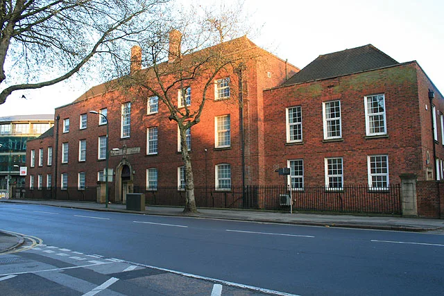
Nottingham Labour Exchange
Historic churches · 0.1 km

Castle Wharf
Marinas · 0.1 km
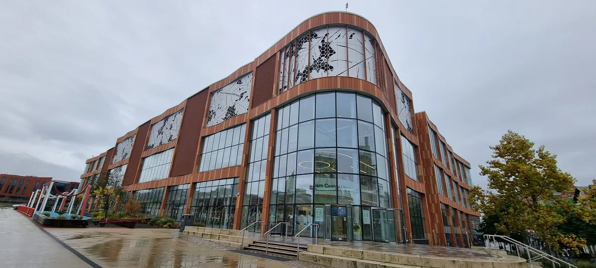
Nottingham Central Library
Historic libraries · 0.2 km
.jpg?width=1200)
Ye Olde Trip to Jerusalem
Historic pubs · 0.2 km

Nottingham Castle Gate Hospital
Castles · 0.2 km

Canal House
Historic pubs · 0.2 km

Brewhouse Yard Museum
Museums · 0.2 km
Nearby
📷 3Abbeys & priories · East Midlands
Nottingham Franciscan Friary
Nottingham Franciscan Friary — founded 1224–1230, dissolved in 1539.
📷 3Memorials & monuments · East Midlands
Alan Sillitoe (1928 - 2010)
Alan Sillitoe (1928 - 2010) — a memorial in england-east-midlands, United Kingdom.
★ Iconic📷 4Historic pubs · East Midlands
Ye Olde Trip to Jerusalem
The Nottingham pub carved into Castle Rock that claims to date from 1189.
📷 3Public art & sculpture · East Midlands
Standing In This Place
Standing In This Place — a public art in england-east-midlands, United Kingdom.
📷 4Historic churches · East Midlands
St Nicholas' Church, Nottingham
St Nicholas' Church, Nottingham — church in Nottingham, Nottinghamshire, England, UK.
📷 3Historic churches · East Midlands
Nottingham Labour Exchange
Nottingham Labour Exchange — former labour exchange, now a church, in the English city of Nottingham.
Where to eat & stay near Traffic Flow
Places to stay
 📷 5
📷 5Hotels · East Midlands
Bentinck Hotel
Bentinck Hotel — a hotel in england east midlands.
 📷 5
📷 5Hostels · East Midlands
Igloo Hybrid
Igloo Hybrid — a hostel in england east midlands.
 📷 5
📷 5Hotels · East Midlands
Lace Market Hotel
Lace Market Hotel — a hotel in england east midlands.
 📷 5
📷 5Hostels · East Midlands
Midtown Hostel
Midtown Hostel — a hostel in england east midlands.
 📷 5
📷 5Hotels · East Midlands
Hilton Nottingham
Hilton Nottingham — a hotel in england east midlands.
 📷 7
📷 7Hotels · East Midlands
The Walton Hotel
The Walton Hotel — a hotel in england east midlands.
Places to eat & drink
★ Iconic📷 4Historic pubs · East Midlands
Ye Olde Trip to Jerusalem
The Nottingham pub carved into Castle Rock that claims to date from 1189.
📷 3Historic pubs · East Midlands
Ye Olde Trip to Jerusalem
Ye Olde Trip to Jerusalem — Historic pub — listed building or notable heritage status.
📷 6 📷 5
📷 5Historic pubs · East Midlands
Ye Olde Salutation Inn
Ye Olde Salutation Inn in England East Midlands, United Kingdom.
 📷 3
📷 3Historic pubs · East Midlands
Pitcher & Piano
Pitcher & Piano — Historic pub — listed building or notable heritage status.
 📷 5
📷 5Historic pubs · East Midlands
Flying Horse Inn
Flying Horse Inn in England East Midlands, United Kingdom.
More places in this region
 📷 5
📷 5Public art & sculpture · East Midlands
West Walton Village Sign
West Walton Village Sign — a public art in england-london, United Kingdom.
 📷 5
📷 5Public art & sculpture · East Midlands
Tilney St Lawrence Village Sign
Tilney St Lawrence Village Sign — a public art in england-london, United Kingdom.
 📷 5
📷 5Public art & sculpture · East Midlands
Emneth Village Sign
Emneth Village Sign — a public art in england-london, United Kingdom.
 📷 5
📷 5Public art & sculpture · East Midlands
Marshland St James Village Sign
Marshland St James Village Sign — a public art in england-london, United Kingdom.
Frequently asked questions
- Where is Traffic Flow?
- Traffic Flow is in the East Midlands, United Kingdom (postcode NG1 7EF), in the parish of Nottingham, unparished area.
- What is Traffic Flow?
- Traffic Flow — a public art in england-east-midlands, United Kingdom.
- How do I get to Traffic Flow?
- The nearest railway station is Nottingham, about 0.4 km away. Drivers can use postcode NG1 7EF.
- Is Traffic Flow free to visit?
- Yes, Traffic Flow is free to enter.
- How do I get to Traffic Flow?
- The nearest railway station is Nottingham, about 0.4 km away. Drivers can navigate to postcode NG1 7EF.