Abbeys & priories · Mid Wales
Tirabad
In or near Llanwrtyd.
Tirabad in Wales Mid, United Kingdom.

Alan Hughes — CC BY-SA 2.0 via Wikimedia Commons licence
Plan your visit
- Typical visit
- 45 min–1.5 h
- Nearest railway station
- Sugar Loaf · 4.2 km
- Family-friendly
- Limited wheelchair access
Getting there & planning your visit
To visit Tirabad Abbey in Mid Wales, the nearest railway station is Sugar Loaf, which is 4.2 km away. The postcode for navigation is LD4 4DR. Please note that wheelchair accessibility is limited.
About
Tirabad is a place of interest in Wales Mid, United Kingdom — drawn from open-data sources for visitor reference. See the linked Wikipedia article for the full description.
Photo gallery
From the Wikipedia article
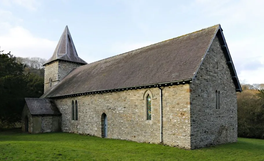
Tirabad is a village in Powys, Wales. The name means "the abbot's land"; the village belonged to Strata Florida abbey in the Middle Ages. The village is located on the edge of the Crychan Forest and is 8 kilometres (5 mi) south of Llanwrtyd and 18 kilometres (10 mi) north of Llanymddyfri. Many people had to leave the village during World War II as the military used the area for artillery training, but the village expanded substantially in the 1950s, when the Forestry Commission, now defunct, began tree plantations and built about 25 houses, a school, a village hall and a shop for their employees. St. David's Church, built in 1726, is the only Georgian church in Breconshire. No services are currently held at the church due to structural problems with the building, although work is underway to enable it to be reopened. Just outside the village is the Tirabad Centre, an outdoor pursuits centre run by the Tirabad Residential Educational Trust and owned jointly by outsiders, three state schools in Berkshire, England - Charters in Sunningdale, The Emmbrook near Wokingham and Maiden Erlegh in Earley. The Centre was closed in March 2021 and its assets taken over by liquidators. Tirabad is on the Epynt Way long distance walking/cycling/horse-riding route. Epynt Way Section 3 uses the road that runs past the village, linking to Maesyron to the east. Epynt Way Section 4 (the "Tirabad Section") starts just west of the village near the Tirabad Old Chapel, taking a forestry track from the Cynghordy Road. Section 4 links to Craigyrwyddon and the Crychan Forest.
Excerpt from Wikipedia under CC BY-SA 4.0. See the source article linked in Sources below.
- Coordinates
- 52.0589, -3.6372
- District
- Powys
- Parish
- Llangamarch
- Postcode
- LD4 4DR
- Parliamentary constituency
- Brecon, Radnor and Cwm Tawe
- Nearest railway station
- Sugar Loaf — 4.2 km
Sources
Other places nearby

Cefn Llwydlo
Mountains & hills · 2.3 km

Castell Teirtut
Literary houses · 2.3 km

Blaen Cyrnog
Mountains & hills · 2.6 km

Blaen Cilieni
Natural landmarks · 3.0 km

Cefn Blewog
Mountains & hills · 3.5 km

Caeau Ty'n-llwyni
Other places · 3.5 km

Waen Rydd
Natural landmarks · 3.6 km

Moel Bylchau
Mountains & hills · 3.9 km

Esgair Fwyog Picnic Site
Natural landmarks · 4.1 km

Crychan Forest Tracks
Forests & woodlands · 4.1 km
Sugar Loaf railway station
Mountains & hills · 4.3 km

Trefawr Track
Farms (open to visitors) · 4.4 km
Nearby
📷 5📷 5📷 5📷 3📷 5Where to eat & stay near Tirabad
Places to stay
 📷 5
📷 5 📷 7
📷 7Hotels · Mid Wales
Neuadd Arms Hotel
Neuadd Arms Hotel — a hotel in wales mid.
 📷 5
📷 5Caravan parks · Mid Wales
Cwmcuttan Caravan Site
Cwmcuttan Caravan Site — a caravan park in wales mid.
 📷 5
📷 5Caravan parks · Mid Wales
Riverside Caravan & Camping Park
Riverside Caravan & Camping Park — a caravan park in wales mid.
 📷 5
📷 5B&Bs · Mid Wales
The Royal Oak Inn
The Royal Oak Inn — a bed-and-breakfast in wales mid.
 📷 5
📷 5Campsites · Mid Wales
Rhandir mwyn C & C C
Rhandir mwyn C & C C — a campsite in wales mid.
Places to eat & drink
 📷 7
📷 7 📷 5
📷 5More abbeys in this region
 📷 3
📷 3 📷 3
📷 3Abbeys & priories · Mid Wales
Cwmhir Abbey
Cwmhir Abbey — Grade II* listed building in Abbeycwmhir. Abbey.
 📷 3
📷 3 📷 3
📷 3Frequently asked questions
- Where is Tirabad?
- Tirabad is in Mid Wales, United Kingdom (postcode LD4 4DR), in the parish of Llangamarch.
- What is Tirabad?
- Tirabad in Wales Mid, United Kingdom.
- How do I get to Tirabad?
- The nearest railway station is Sugar Loaf, about 4.2 km away. Drivers can use postcode LD4 4DR.
- How do I get to Tirabad?
- The nearest railway station is Sugar Loaf, about 4.2 km away. Drivers can navigate to postcode LD4 4DR.