Mountains & hills · West Midlands
Tinker's Hill
Also known as: Tinkers' Hill
In or near Little Malvern.
Tinker's Hill — Named summit at 213 m.

Wikimedia Commons contributors — see linked file page for photographer and licence licence
Plan your visit
- Typical visit
- 3 h–8 h
- Best time of year
- Late spring – early autumn (May–Oct)
- Nearest railway station
- Colwall · 2.6 km
- Free entry
- Dog-friendly
Getting there & planning your visit
To visit Tinker's Hill, the nearest railway station is Colwall, located 2.6 km away. The postcode for Tinker's Hill is WR14 4JN, which you can use for sat-nav coordinates (latitude 52.0578, longitude -2.3428). Entry is free.
About
Tinker's Hill is a named summit in the United Kingdom. Also known as: Tinkers' Hill. Wikidata describes it as: "Named summit at 213 m.". Coordinates: 52.0578°, -2.3428°.
Photo gallery
Official information
Tinker's Hill is part of the Malvern Hills Area of Outstanding Natural Beauty, offering scenic views and opportunities for outdoor activities such as walking and cycling. Visitors can explore the natural landscape and enjoy the tranquility of the area.
Protected designations
- Site of Special Scientific Interest: The Malvern Hills SSSI
- Area of Outstanding Natural Beauty: Cotswolds
- Area of Outstanding Natural Beauty: Malvern Hills
Designations sourced from Natural England open data under OGL v3.
From the Wikipedia article
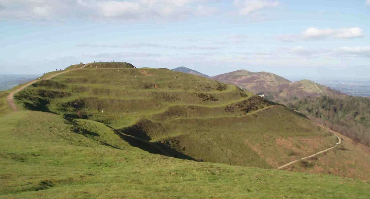
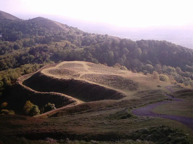
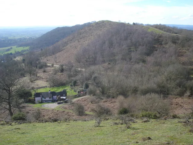
Tinkers Hill is situated in the range of Malvern Hills that runs about 13 kilometres (8 mi) north-south along the Herefordshire-Worcestershire border. It lies to the east of Herefordshire Beacon with views across the Vale of Evesham and the Cotswolds. It has an elevation of 213 metres (699 ft). In June 2004, the Worcestershire Bat Group identified Tinkers Hill Wood as being home to a colony of barbastelles, a species of bat protected under the European Habitats Directive.
Excerpt from Wikipedia under CC BY-SA 4.0. See the source article linked in Sources below.
- Coordinates
- 52.0578, -2.3428
- County
- Worcestershire
- District
- Malvern Hills
- Parish
- Little Malvern
- Postcode
- WR14 4JN
- Parliamentary constituency
- West Worcestershire
- Nearest railway station
- Colwall — 2.6 km
- Official site
- www.malvernhillsaonb.org.uk
Sources
- osm: n11233362425 (ODbL)
- wikipedia: Tinkers Hill (CC BY-SA 4.0)
- commons: Tinkers Hill - geograph.org.uk - 590231.jpg (CC BY-SA 4.0)
Other places nearby

Herefordshire Beacon Camp
Vineyards · 0.6 km

Little Malvern Priory
Abbeys & priories · 0.6 km

Little Malvern
Towns & cities · 0.6 km
British Camp
Castles · 0.6 km
Herefordshire Beacon
Mountains & hills · 0.6 km

Millennium Hill
Mountains & hills · 0.7 km

Clutter's Cave
Caves · 0.7 km

Hangmans Hill
Mountains & hills · 0.8 km

Sir Edward Elgar's Grave
Memorials & monuments · 1.1 km

Black Hill
Mountains & hills · 1.3 km
Swinyard Hill
Mountains & hills · 1.5 km

Perrycroft
Gardens · 1.8 km
Nearby
Vineyards · West Midlands
Herefordshire Beacon Camp
Herefordshire Beacon Camp — a UK vineyard in england west midlands, producing English or Welsh wine from cool-climate grape varieties.
📷 4Abbeys & priories · West Midlands
Little Malvern Priory
Little Malvern Priory — a Grade I-listed abbey in england-west-midlands, United Kingdom.
📷 3Towns & cities · West Midlands
Little Malvern
Little Malvern — village in Worcestershire, England, UK.
📷 3Castles · West Midlands
British Camp
British Camp — former castle in Herefordshire, England, UK.
Mountains & hills · West Midlands
Herefordshire Beacon
Herefordshire Beacon — Named summit at 338 m.
📷 5Mountains & hills · West Midlands
Millennium Hill
Millennium Hill — mountain in england west midlands. Elevation: 327 m.
Where to eat & stay near Tinker's Hill
Places to stay
 📷 5
📷 5Campsites · West Midlands
Little Hollows
Little Hollows — a campsite in england west midlands.
 📷 5
📷 5Campsites · West Midlands
The Malvern
The Malvern — a campsite in england west midlands.
 📷 5
📷 5Caravan parks · West Midlands
Marlbrook Farm
Marlbrook Farm — a caravan park in england west midlands.
 📷 5
📷 5Hotels · West Midlands
Cottage In The Wood Hotel & Restaurant
Cottage In The Wood Hotel & Restaurant — a hotel in england west midlands. 3-star.
 📷 5
📷 5Caravan parks · West Midlands
The Turbles
The Turbles — a caravan park in england west midlands.
 📷 5
📷 5Places to eat & drink
 📷 5
📷 5Historic pubs · West Midlands
Farmers Arms Public House
Farmers Arms Public House in England West Midlands, United Kingdom.
 📷 7
📷 7Historic pubs · West Midlands
Seven Stars Inn
Seven Stars Inn in England West Midlands, United Kingdom.
 📷 6
📷 6Historic pubs · West Midlands
Plough Inn Public House
Plough Inn Public House in England West Midlands, United Kingdom.
 📷 6
📷 6Historic pubs · West Midlands
Royal Oak Inn Public House
Royal Oak Inn Public House in England West Midlands, United Kingdom.
 📷 5
📷 5Historic pubs · West Midlands
The Trumpet Inn
The Trumpet Inn in England West Midlands, United Kingdom.
 📷 7
📷 7More mountains in this region
 📷 5
📷 5Mountains & hills · West Midlands
Stile Cop
Stile Cop — mountain in england east midlands. Elevation: 219 m.
 📷 5
📷 5Mountains & hills · West Midlands
Rawnsley Hill
Rawnsley Hill — mountain in england east midlands. Elevation: 237 m.
 📷 5
📷 5Mountains & hills · West Midlands
Hound Hill
Hound Hill — mountain in england east midlands. Elevation: 98 m.
Frequently asked questions
- Where is Tinker's Hill?
- Tinker's Hill is in Worcestershire, the West Midlands, United Kingdom (postcode WR14 4JN), in the parish of Little Malvern.
- What is Tinker's Hill?
- Tinker's Hill — Named summit at 213 m.
- How do I get to Tinker's Hill?
- The nearest railway station is Colwall, about 2.6 km away. Drivers can use postcode WR14 4JN.
- Is Tinker's Hill a protected site?
- Yes — Tinker's Hill is part of the The Malvern Hills SSSI Site of Special Scientific Interest and the Cotswolds National Landscape (AONB).
- Is Tinker's Hill free to visit?
- Yes, Tinker's Hill is free to enter.
- How do I get to Tinker's Hill?
- The nearest railway station is Colwall, about 2.6 km away. Drivers can navigate to postcode WR14 4JN.