
Towns & cities · North West England
Thrimby
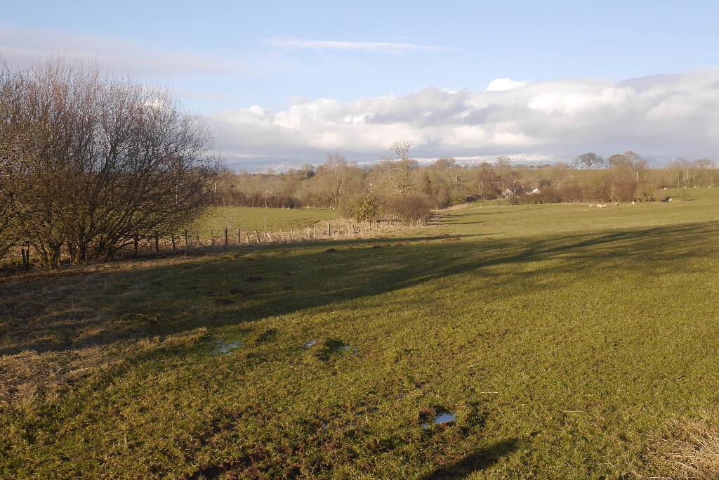
Thrimby — village and former civil parish in Cumbria, England, UK.

Wikimedia Commons contributors — see linked file page for photographer and licence licence

Plan your visit
- Typical visit
- 3 h–6 h
- Free entry
- Family-friendly
- Dog-friendly
About
Thrimby is a town, city, village or settlement in the United Kingdom. Recent population estimates put it at around 30 people. Address: CA10. Wikidata describes it as: "village and former civil parish in Cumbria, England, UK". Coordinates: 54.5780°, -2.6900°.
Photo gallery
Protected designations
- Site of Special Scientific Interest: River Eden and Tributaries SSSI
- Area of Outstanding Natural Beauty: North Pennines
Designations sourced from Natural England open data under OGL v3.
From the Wikipedia article
Thrimby is a hamlet and former civil parish, now in the parish of Little Strickland, in Westmorland and Furness, Cumbria, England. In 2001 the population of the civil parish of Thrimby was 30. The population measured at the 2011 Census was less than 100. Details are included in the parish of Great Strickland. It has a Grade 2* farmhouse called Thrimby Hall, as seen in series 4 of the BBC Two fly-on-the-wall farming documentary "This Farming Life".
Excerpt from Wikipedia under CC BY-SA 4.0. See the source article linked in Sources below.
Background
History
Thrimby was a chapelry with 2 townships within Morland parish. It became a civil parish in 1866. On 1 April 2019 the parish was merged with Little Strickland. On 23 October 1970, the nine-mile Tebay to Thrimby section of the M6 was opened, built by Christiani-Shand. The section terminated on the A6. The next junction further north would be at Penrith (A66).
Sourced from Wikipedia under CC BY-SA 4.0.
- Coordinates
- 54.5780, -2.6900
- District
- Westmorland and Furness
- Parish
- Little Strickland
- Postcode
- CA10
- Parliamentary constituency
- Westmorland and Lonsdale
- Population
- 30
Sources
- wikidata: Q1874032 (CC0)
- wikipedia: Thrimby (CC BY-SA 4.0)
- commons: Out Scar - geograph.org.uk - 549743.jpg (CC BY-SA 4.0)
Other places nearby

Little Strickland
Other places · 1.4 km

Oaklands Country Park
Caravan parks · 2.1 km

Shap Beck Drove Arch Fold
Public art & sculpture · 2.2 km

Great Strickland
Towns & cities · 2.4 km

In Scar
Mountains & hills · 2.4 km

Leath
Other places · 2.5 km

Hackthorpe Hall
Historic houses · 2.5 km

Knipe Scar
Viewpoints · 2.8 km

Scarside Plantation
Vineyards · 2.8 km
Knipe Scar
Viewpoints · 2.9 km

Knipe Scar
Viewpoints · 3.0 km

Lowther Park
Mountains & hills · 3.0 km
Thrimby is a charming town located in North West England. Visitors can explore the artistic features at Shap Beck Drove Arch Fold and enjoy the natural surroundings of Little Strickland. These sites offer a delightful experience for those seeking local attractions in the area.
At a glance
- Population
- 30
- Constituency
- Westmorland and Lonsdale
- Top categories near here
Things to see in Thrimby
2 attractions within 12 km.
📷 4Other places · North West England
Little Strickland
Little Strickland in England North East, United Kingdom.
📷 3Public art & sculpture · North West England
Shap Beck Drove Arch Fold
Shap Beck Drove Arch Fold — a public art in england-north-east, United Kingdom.
Nearby
📷 4Other places · North West England
Little Strickland
Little Strickland in England North East, United Kingdom.
📷 5Caravan parks · North West England
Oaklands Country Park
Oaklands Country Park — a caravan park in england north east.
📷 3Public art & sculpture · North West England
Shap Beck Drove Arch Fold
Shap Beck Drove Arch Fold — a public art in england-north-east, United Kingdom.
📷 3Towns & cities · North West England
Great Strickland
Great Strickland — village and civil parish in Cumbria, England, UK.
📷 5📷 3Where to eat & stay near Thrimby
Places to stay
📷 5Caravan parks · North West England
Oaklands Country Park
Oaklands Country Park — a caravan park in england north east.
 📷 5
📷 5Campsites · North West England
Greengill Campsite
Greengill Campsite — a campsite in england north east.
 📷 5
📷 5Caravan parks · North West England
Newby End Farm Caravan Site
Newby End Farm Caravan Site — a caravan park in england north east.
 📷 5
📷 5Campsites · North West England
New Ing Lodge Camping
New Ing Lodge Camping — a campsite in england north east.
📷 5Hostels · North West England
New Ing Lodge
New Ing Lodge — a hostel in england north east.
 📷 5
📷 5Caravan parks · North West England
The Punchbowl Caravan Park
The Punchbowl Caravan Park — a caravan park in scotland lowlands.
Places to eat & drink
 📷 7
📷 7Historic pubs · North West England
Two Lions public house and integral stables
Two Lions public house and integral stables in Scotland Lowlands, United Kingdom.
 📷 6
📷 6Historic pubs · North West England
Gloucester Arms
Gloucester Arms in Scotland Lowlands, United Kingdom.
 📷 7
📷 7Cafés · North West England
Narrowbar Cafe
Narrowbar Cafe — a café in scotland lowlands.
 📷 5
📷 5Historic pubs · North West England
Horse And Farrier Inn And Stables
Horse And Farrier Inn And Stables in Scotland Lowlands, United Kingdom.
 📷 5
📷 5Historic pubs · North East England
1, Scattergate
1, Scattergate in England North East, United Kingdom.
 📷 3
📷 3More towns in this region
 Flagship📷 3
Towns & cities · North West England
Manchester
Manchester — city in Greater Manchester, England.
 📷 3
📷 3Towns & cities · North West England
Alderley Edge
Alderley Edge — village and civil parish in Cheshire East, UK.
_-_geograph.org.uk_-_60497.jpg?width=1200) 📷 5
📷 5Towns & cities · North West England
Appleton Thorn
Appleton Thorn — village in Warrington, Cheshire, UK.
 📷 5
📷 5Towns & cities · North West England
Aston juxta Mondrum
Aston juxta Mondrum — village and civil parish in Cheshire East, England, UK.
Frequently asked questions
- Where is Thrimby?
- Thrimby is in North-West England, United Kingdom (postcode CA10), in the parish of Little Strickland.
- What is Thrimby?
- Thrimby — village and former civil parish in Cumbria, England, UK.
- How do I get to Thrimby?
- Drivers can use postcode CA10.
- Is Thrimby a protected site?
- Yes — Thrimby is part of the River Eden and Tributaries SSSI Site of Special Scientific Interest and the North Pennines National Landscape (AONB).
- Is Thrimby free to visit?
- Yes, Thrimby is free to enter.
- How do I get to Thrimby?
- Drivers can navigate to postcode CA10. It sits within the Westmorland and Lonsdale parliamentary constituency.