
Caves · North West England
Three Counties System
In or near Ingleton.
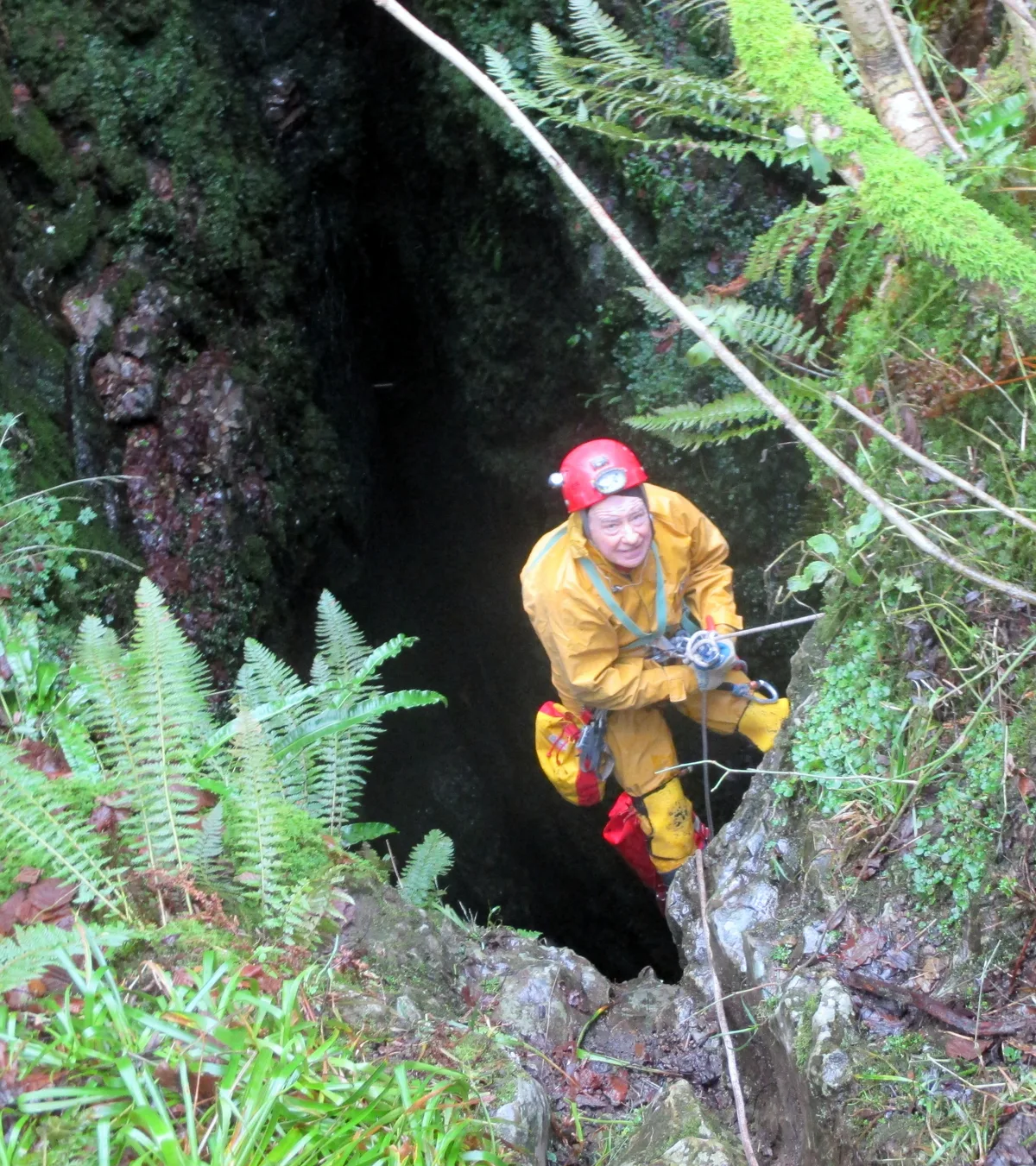
Three Counties System — a cave broad in england-north-west, United Kingdom.

shikari — CC BY-SA 2.0 via Wikimedia Commons licence

Plan your visit
- Typical visit
- 45 min–1.5 h
- Nearest railway station
- Ribblehead · 9.5 km
- Free entry
- Dog-friendly
About
Three Counties System is a cave broad located in england-north-west, United Kingdom. Catalogued from Wikidata's UK heritage register; see the linked Wikipedia article for further details on its history, architecture and visiting information.
Photo gallery
Official information
The Three Counties System is a network of caves located in the UK, featuring various entrances and passages for caving enthusiasts. Visitors can explore numerous caves such as Ireby Fell Cavern, Notts Pot, and Bull Pot of the Witches, each offering unique geological formations and challenges.
Protected designations
- Site of Special Scientific Interest: Leck Beck Head Catchment Area SSSI
Designations sourced from Natural England open data under OGL v3.
Place summary
The Three Counties System is a cave system located in North-West England. It is notable for its extensive network of passages and chambers, formed through natural processes over millennia. The cave is significant for geological studies and is a designated Site of Special Scientific Interest.
AI-generated from the structured facts on this page (operator, designation, listing, era). Not a substitute for visiting.
Background
History
Most of the individual systems that make up the Three Counties System had been explored to a greater or lesser extent a long time before the possibility of an extended system was mooted. Thus Lost Johns' Cave was explored by the Yorkshire Ramblers' Club in the 1920s, Ease Gill Caverns by a number of caving clubs from the time of the original discovery of Lancaster Hole in 1946, and Ireby Fell Cavern in 1949. The existence for the Three Counties System was first mooted by Dave Brook in 1968, when he proposed that the many fragmented systems stretching from Barbondale in the north to Kingsdale in the south could be part of a much larger system. Over the next 43 years, many discoveries by many…
Description
The Three Counties System's most southerly entrance is currently North by North End Pot (, NGR SD 6830 7654) on the northerly flank of Kingsdale in North Yorkshire, and the most northerly entrance is currently Bull Pot of the Witches (, NGR SD 6623 8131) beneath Barbon Low Fell in Cumbria – a distance of over 5.2 km. Between the two, the system passes beneath Leck Fell which is in Lancashire. The system runs mainly north–south, its western extent being limited by the Craven Fault which truncates the limestone exposure, and the eastern extent where the limestones are conformable overlain by younger rocks. Streams flow from the higher topography from the east and sink into swallet holes at…
Sourced from Wikipedia under CC BY-SA 4.0.
- Coordinates
- 54.2070, -2.5065
- Address
- North-West England
- Nearest railway station
- Ribblehead — 9.5 km
- Official site
- www.braemoor.co.uk
Sources
- wikidata: Q20876878 (CC0)
- wikipedia: Three Counties System (CC BY-SA 4.0)
Other places nearby
Humble Pot
Caves · 0.0 km

Rumbling Hole
Caves · 0.1 km

Long Drop Cave
Caves · 0.1 km
Rumbling Beck Cave
Caves · 0.1 km
Coal Hole
Caves · 0.1 km
Bumbling Hole
Caves · 0.2 km
Short Drop
Caves · 0.2 km
Short Drop Cave - Gavel Pot System
Caves · 0.2 km
Rift Entrance
Caves · 0.2 km
Eye Holes
Caves · 0.2 km
Death's Head Hole
Mountains & hills · 0.3 km

Death's Head Hole
Caves · 0.3 km
Nearby
📷 5📷 3📷 3📷 5📷 5📷 5Where to eat & stay near Three Counties System
Places to stay
 📷 5
📷 5Caravan parks · North West England
Fell View Park
Fell View Park — a caravan park in england north west.
 📷 5
📷 5Caravan parks · North West England
Ireby Green Caravan Park
Ireby Green Caravan Park — a caravan park in england north west.
 📷 5
📷 5Campsites · North West England
New House Caravan Park
New House Caravan Park — a campsite in england north west.
 📷 5
📷 5Caravan parks · North West England
Woodclose Park
Woodclose Park — a caravan park in england north west.
📷 5Caravan parks · North West England
Woodclose Park
Woodclose Park — a caravan park in england north west.
📷 5Caravan parks · North West England
Woodclose Park
Woodclose Park — a caravan park in england north west.
Places to eat & drink
 📷 5
📷 5Historic pubs · North West England
Punch Bowl Hotel
Punch Bowl Hotel in England North West, United Kingdom.
 📷 5
📷 5Historic pubs · North West England
Horse And Farrier Inn
Horse And Farrier Inn in England North West, United Kingdom.
 📷 5
📷 5 📷 5
📷 5Cafés · North West England
Lakehouse Food & Drink
Lakehouse Food & Drink — a café in england north west.
 📷 5
📷 5Cafés · North West England
Gun Dog Coffee Shop
Gun Dog Coffee Shop — a café in england north west.
 📷 5
📷 5Restaurants · North West England
The Game Cock Inn
The Game Cock Inn — a restaurant in england north west. Cuisine: french;english.
More caves in this region
 📷 3
📷 3 📷 3
📷 3 📷 3
📷 3 📷 3
📷 3Caves · North West England
Austwick Beck Head
Austwick Beck Head is a cave in the United Kingdom.
Frequently asked questions
- Where is Three Counties System?
- Three Counties System is in North-West England, United Kingdom.
- What is Three Counties System?
- Three Counties System — a cave broad in england-north-west, United Kingdom.
- How do I get to Three Counties System?
- The nearest railway station is Ribblehead, about 9.5 km away. Its coordinates are 54.2070°, -2.5065°.
- Is Three Counties System a protected site?
- Yes — Three Counties System is part of the Leck Beck Head Catchment Area SSSI Site of Special Scientific Interest.
- Is Three Counties System free to visit?
- Yes, Three Counties System is free to enter.