Mountains & hills · North East England
Threat Rigg
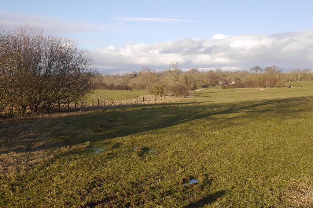
Threat Rigg — mountain in england north east. Elevation: 176 m.

Christine Johnstone — CC BY-SA 2.0 via Wikimedia Commons licence
Plan your visit
- Typical visit
- 3 h–8 h
- Best time of year
- Late spring – early autumn (May–Oct)
About
Threat Rigg is a mountain located in england north east. Elevation: 176 m. A named British peak recorded in OpenStreetMap. Peaks are typically named on Ordnance Survey 1:50k mapping.
Photo gallery
Place summary
Threat Rigg is a mountain located in North-East England. It is part of the North Pennines Area of Outstanding Natural Beauty. The area is known for its rugged terrain and diverse wildlife, attracting walkers and outdoor enthusiasts. Visitors can expect panoramic views of the surrounding landscape, making it a notable spot for hiking and exploration.
AI-generated from the structured facts on this page (operator, designation, listing, era). Not a substitute for visiting.
- Coordinates
- 54.5864, -2.5545
Sources
- osm: n3644248531 (ODbL)
Other places nearby
Loading nearby places…
Nearby
 📷 5
📷 5Castles · North East England
Bewley Castle
Bewley Castle — a castle in england-north-east, United Kingdom.
📷 5Literary houses · North East England
Bewley Castle
Bewley Castle — a literary house museum in england north east.
 📷 3
📷 3Public art & sculpture · Scottish Lowlands
Bolton Pinfold Cone
Bolton Pinfold Cone — a public art in scotland-lowlands, United Kingdom.
.jpg?width=1200) 📷 3
📷 3Towns & cities · North East England
King's Meaburn
King's Meaburn — village and civil parish in Cumbria, UK.
 📷 5
📷 5Towns & cities · Scottish Lowlands
Bolton
Bolton — village and civil parish in Cumbria, England, UK.
 📷 5
📷 5Towns & cities · North East England
Crackenthorpe
Crackenthorpe — village in Cumbria, England, UK.
Where to eat & stay near Threat Rigg
Places to stay
 📷 5
📷 5Caravan parks · North East England
Highgate Holiday Park
Highgate Holiday Park — a caravan park in england north east.
 📷 5
📷 5Caravan parks · North East England
Newby End Farm Caravan Site
Newby End Farm Caravan Site — a caravan park in england north east.
 📷 5
📷 5B&Bs · North East England
Bongate House
Bongate House — a bed-and-breakfast in england north east.
 📷 5
📷 5Campsites · North East England
Greengill Campsite
Greengill Campsite — a campsite in england north east.
 📷 5
📷 5Caravan parks · Scottish Lowlands
Low Moor Caravan and Campsite
Low Moor Caravan and Campsite — a caravan park in scotland lowlands.
 📷 5
📷 5Caravan parks · North East England
Park House Caravan Park
Park House Caravan Park — a caravan park in england north east.
Places to eat & drink
 📷 3
📷 3Historic pubs · North East England
Langwathby
Langwathby in England North East, United Kingdom.
 📷 5
📷 5Cafés · Scottish Lowlands
Narrowbar Cafe
Narrowbar Cafe — a café in scotland lowlands.
 📷 5
📷 5Cafés · North West England
The White Hare Cafe
The White Hare Cafe — a café in england north west.
More mountains in this region
 📷 3
📷 3Mountains & hills · North East England
Angletarn Pikes
Angletarn Pikes — Named summit at 566 m.
 📷 3
📷 3Mountains & hills · North East England
Angletarn Pikes South Top
Angletarn Pikes South Top — Named summit at 563.6 m.
 📷 3
📷 3Mountains & hills · North East England
Ard Crags
Ard Crags — Named summit at 581 m.
 📷 3
📷 3Mountains & hills · North East England
Arnison Crag
Arnison Crag — Named summit at 433 m.
Frequently asked questions
- Where is Threat Rigg?
- Threat Rigg is in North-East England, United Kingdom.
- What is Threat Rigg?
- Threat Rigg — mountain in england north east. Elevation: 176 m.
- How do I get to Threat Rigg?
- Its coordinates are 54.5864°, -2.5545°.