
Forests & woodlands · East of England
Thorpe Wood Nature Reserve
In or near Peterborough.
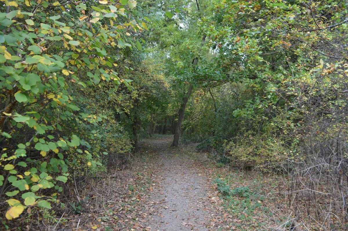
Thorpe Wood Nature Reserve is a forest or woodland in the United Kingdom.

Wikimedia Commons contributors — see linked file page for photographer and licence licence

Plan your visit
- Typical visit
- 1 h–3 h
- Nearest railway station
- Ham Lane (FMR) · 1.4 km
- Free entry
- Family-friendly
- Dog-friendly
Getting there & planning your visit
To visit Thorpe Wood Nature Reserve, you can take a train to Ham Lane (FMR), which is 1.4 km away. The postcode for the reserve is PE3 6RU. Entry is free.
About
Thorpe Wood Nature Reserve is a named forest, woodland or nature reserve in the United Kingdom. Coordinates: 52.5710°, -0.2920°. This entry is part of The Great Britain Guide, a free, ad-free, open-data tourist directory.
Photo gallery
Official information
Longthorpe Tower is a historic site featuring one of the most complete sets of 14th-century domestic wall paintings in northern Europe. Visitors can explore the tower and view its fascinating medieval artwork, which includes various religious and worldly subjects. The site is managed by Nene Park Trust and offers guided tours led by volunteers.
From the Wikipedia article
Thorpe Wood is a 10 hectare nature reserve on the western outskirts of Peterborough in Cambridgeshire. It is managed by the Wildlife Trust for Bedfordshire, Cambridgeshire and Northamptonshire. This is ancient woodland on heavy clay, with mature oak and ash trees, and an understorey of hazel and field maple. The ground flora is diverse, including wild garlic, wood anemones and bluebells. There is access from Nene Parkway.
Excerpt from Wikipedia under CC BY-SA 4.0. See the source article linked in Sources below.
- Coordinates
- 52.5710, -0.2920
- District
- Peterborough
- Parish
- Peterborough, unparished area
- Postcode
- PE3 6RU
- Parliamentary constituency
- Peterborough
- Nearest railway station
- Ham Lane (FMR) — 1.4 km
- Opening
- Open most weekends for tours from 28 Mar to 1 Nov
- Official site
- www.english-heritage.org.uk
Sources
- osm: w105526330 (ODbL)
- wikipedia: Thorpe Wood (CC BY-SA 4.0)
- commons: Thorpe Wood 1.jpg (CC BY-SA 4.0)
Other places nearby
Thorpe Wood
Wildlife reserves · 0.3 km

Longthorpe Tower
Natural landmarks · 0.3 km

Longthorpe Tower
Castles · 0.3 km

Church of St Botolph, Longthorpe
Historic churches · 0.4 km

Longthorpe
Archaeological sites · 0.7 km

Longthorpe
Archaeological sites · 0.7 km

Bluebell Bridge
Historic bridges · 0.8 km

Longthorpe Manor
Manor houses · 0.8 km

Longthorpe II
Archaeological sites · 1.0 km

Bird In Flight
Public art & sculpture · 1.2 km

Peterborough Arch
Public art & sculpture · 1.2 km
Roman Barn
Historic houses · 1.2 km
Nearby
📷 5Wildlife reserves · East of England
Thorpe Wood
Thorpe Wood — nature reserve in the United Kingdom.
📷 5Natural landmarks · East of England
Longthorpe Tower
Longthorpe Tower — a place in East of England, United Kingdom.
📷 5Castles · East of England
Longthorpe Tower
Longthorpe Tower — castle in england london. Operated by English Heritage.
📷 5Historic churches · East of England
Church of St Botolph, Longthorpe
Church of St Botolph, Longthorpe — a Grade I-listed church in england-london, United Kingdom.
📷 5Archaeological sites · East of England
Longthorpe
Longthorpe — an archaeological site in East of England, United Kingdom.
📷 5Where to eat & stay near Thorpe Wood Nature Reserve
Places to stay
 📷 5
📷 5Campsites · East of England
Ferry Meadows
Ferry Meadows — a campsite in england london.
 📷 5
📷 5Campsites · East of England
Glade Campsite
Glade Campsite — a campsite in england london.
📷 5Campsites · East of England
Lakeview Campsite
Lakeview Campsite — a campsite in england london.
 📷 7
📷 7 📷 5
📷 5Hotels · East of England
Sibson Inn Hotel
Sibson Inn Hotel — a hotel in england london.
 📷 5
📷 5Places to eat & drink
 📷 5
📷 5Restaurants · East of England
The Banyan Tree
The Banyan Tree — a restaurant in england london.
 📷 5
📷 5 📷 5
📷 5 📷 7
📷 7Historic pubs · East of England
Prince Of Wales Feathers
Prince Of Wales Feathers in England East, United Kingdom.
 📷 7
📷 7Historic pubs · East of England
Wheatsheaf Public House
Wheatsheaf Public House in England East, United Kingdom.
 📷 5
📷 5Historic pubs · East of England
The Blue Bell Public House
The Blue Bell Public House in England East, United Kingdom.
More forests in this region
 📷 5
📷 5Forests & woodlands · East of England
Adams Road Bird Sanctuary
Adams Road Bird Sanctuary is a forest or woodland in the United Kingdom.
 📷 5
📷 5Forests & woodlands · East of England
Arthur's Meadow NR
Arthur's Meadow NR is a forest or woodland in the United Kingdom.
 📷 5
📷 5Forests & woodlands · East of England
Ashwell Quarry & Quarry Springs
Ashwell Quarry & Quarry Springs is a forest or woodland in the United Kingdom.
 📷 5
📷 5Forests & woodlands · East of England
Ashwell Springs
Ashwell Springs is a forest or woodland in the United Kingdom.
Frequently asked questions
- Where is Thorpe Wood Nature Reserve?
- Thorpe Wood Nature Reserve is in East of England, United Kingdom (postcode PE3 6RU), in the parish of Peterborough, unparished area.
- What is Thorpe Wood Nature Reserve?
- Thorpe Wood Nature Reserve is a forest or woodland in the United Kingdom.
- How do I get to Thorpe Wood Nature Reserve?
- The nearest railway station is Ham Lane (FMR), about 1.4 km away. The nearest town is Peterborough. Drivers can use postcode PE3 6RU.
- Who owns Thorpe Wood Nature Reserve?
- Thorpe Wood Nature Reserve is owned by Wildlife Trust for Bedfordshire, Cambridgeshire and Northamptonshire.
- Is Thorpe Wood Nature Reserve free to visit?
- Yes, Thorpe Wood Nature Reserve is free to enter.
- How do I get to Thorpe Wood Nature Reserve?
- The nearest railway station is Ham Lane (FMR), about 1.4 km away. Drivers can navigate to postcode PE3 6RU.