
Mountains & hills · West Midlands
The Wrekin
Also known as: Din Gwrygon
In or near Coalbrookdale.
The Wrekin — Named summit at 407 m.

Wikimedia Commons contributors — see linked file page for photographer and licence licence

Plan your visit
- Typical visit
- 3 h–8 h
- Best time of year
- Late spring – early autumn (May–Oct)
- Nearest railway station
- Wellington · 4.3 km
- Free entry
- Dog-friendly
Getting there & planning your visit
To visit The Wrekin, the nearest railway station is Wellington, located 4.3 km away. Entry is free, and the postcode for sat-nav is TF6 5AH.
About
The Wrekin is a named summit in the United Kingdom. Also known as: Din Gwrygon. Wikidata describes it as: "Named summit at 407 m.". Coordinates: 52.6693°, -2.5514°.
Photo gallery
Protected designations
- Site of Special Scientific Interest: The Wrekin & The Ercall SSSI
- Area of Outstanding Natural Beauty: Shropshire Hills
Designations sourced from Natural England open data under OGL v3.
From the Wikipedia article
The Wrekin ( REE-kin) is a hill in east Shropshire, England. It is located some five miles (8 km) west of Telford, on the border between the unitary authorities of Shropshire and Telford and Wrekin. Rising above the Shropshire Plain to a height of 407 metres (1,335 ft) above sea level, it is a prominent and well-known landmark, signalling the entrance to Shropshire for travellers westbound on the M54 motorway. The Wrekin is contained within the northern salient of the Shropshire Hills AONB. The hill is popular with walkers and tourists and offers good views of Shropshire. It can be seen well into Staffordshire and the Black Country, and even as far as the Beetham Tower in Manchester, Winter Hill in Lancashire and Cleeve Hill in Gloucestershire.
Excerpt from Wikipedia under CC BY-SA 4.0. See the source article linked in Sources below.
Background
Visiting
The Wrekin can be accessed from the final junction on the M54 motorway (J7) before it turns into the A5 which continues to Shrewsbury. The hill is then signposted. There is a well-used footpath up the side of the hill which has an entrance at the end of the road off the M54. There is also a small car park and parking bays up the road. Between the Ercall and the Wrekin is a well positioned car park, at Forest Glen, allowing easy access to both areas. The ascent is steep in parts. The Wrekin is owned by the Raby Estate, currently headed by Lord Barnard.
Sourced from Wikipedia under CC BY-SA 4.0.
- Coordinates
- 52.6693, -2.5514
- District
- Shropshire
- Parish
- Wroxeter and Uppington
- Postcode
- TF6 5AH
- Parliamentary constituency
- South Shropshire
- Nearest railway station
- Wellington — 4.3 km
Sources
- osm: n692358 (ODbL)
- wikipedia: The Wrekin (CC BY-SA 4.0)
- commons: TheWrekin.jpg (CC BY-SA 4.0)
Other places nearby
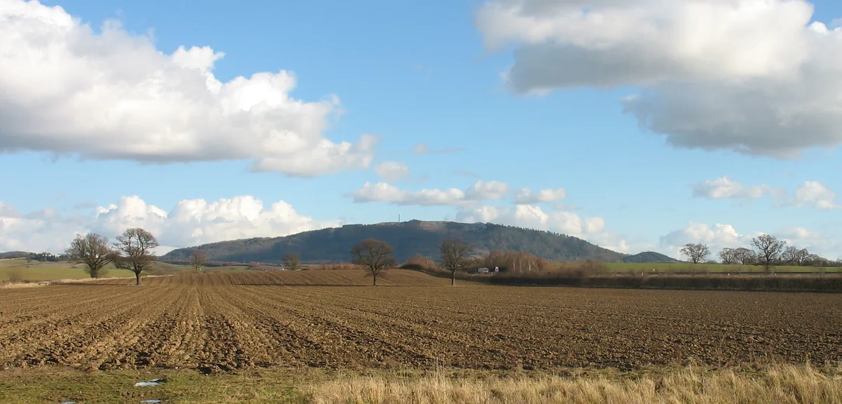
The Wrekin
Natural landmarks · 0.0 km

The Wrekin
Vineyards · 0.2 km

Wrekin Hill Fort
Hill forts · 0.2 km
Heaven Gate
Archaeological sites · 0.4 km

Hell Gate
Archaeological sites · 0.6 km

Wrekin Scout Camp
Campsites · 0.9 km

Little Hill
Mountains & hills · 1.0 km

Lawrence's Hill
Mountains & hills · 1.8 km

Maddocks Hill
Mountains & hills · 2.0 km

Maddock's Hill
Mountains & hills · 2.0 km
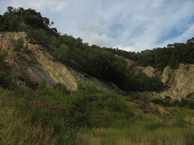
The Ercall
Mountains & hills · 2.3 km

Burcot Manor
Manor houses · 2.9 km
Nearby
📷 5📷 5Vineyards · West Midlands
The Wrekin
The Wrekin — a UK vineyard in england west midlands, producing English or Welsh wine from cool-climate grape varieties.
📷 3Hill forts · West Midlands
Wrekin Hill Fort
Wrekin Hill Fort — a hill fort in england-west-midlands, United Kingdom.
📷 3Archaeological sites · West Midlands
Heaven Gate
Heaven Gate — a archaeological in england-west-midlands, United Kingdom.
📷 3Archaeological sites · West Midlands
Hell Gate
Hell Gate — a archaeological in england-west-midlands, United Kingdom.
📷 5Where to eat & stay near The Wrekin
Places to stay
📷 5 📷 5
📷 5Campsites · West Midlands
Iron Gorge Camping
Iron Gorge Camping — a campsite in england west midlands.
 📷 5
📷 5Caravan parks · West Midlands
Pool View Caravan Park
Pool View Caravan Park — a caravan park in england west midlands.
 📷 7
📷 7Hotels · West Midlands
Travelodge
Travelodge — a hotel in england west midlands.
 📷 5
📷 5 📷 5
📷 5Places to eat & drink
 📷 7
📷 7Historic pubs · West Midlands
Kynnersley Arms Public House Incorporating Remains Of Mill And Furnace
Kynnersley Arms Public House Incorporating Remains Of Mill And Furnace in England West Midlands, United Kingdom.
 📷 7
📷 7Historic pubs · West Midlands
Dun Cow Public House
Dun Cow Public House in England West Midlands, United Kingdom.
 📷 7
📷 7 📷 7
📷 7Historic pubs · West Midlands
The Coalbrookdale Inn
The Coalbrookdale Inn in England West Midlands, United Kingdom.
 📷 5
📷 5Historic pubs · West Midlands
Crown Inn Including Outbuildings Adjoining South West
Crown Inn Including Outbuildings Adjoining South West in England West Midlands, United Kingdom.
 📷 5
📷 5Historic pubs · West Midlands
The Beacon Public House
The Beacon Public House in England West Midlands, United Kingdom.
More mountains in this region
 📷 5
📷 5Mountains & hills · West Midlands
Stile Cop
Stile Cop — mountain in england east midlands. Elevation: 219 m.
 📷 5
📷 5Mountains & hills · West Midlands
Rawnsley Hill
Rawnsley Hill — mountain in england east midlands. Elevation: 237 m.
 📷 5
📷 5Mountains & hills · West Midlands
Hound Hill
Hound Hill — mountain in england east midlands. Elevation: 98 m.
 📷 5
📷 5Frequently asked questions
- Where is The Wrekin?
- The Wrekin is in the West Midlands, United Kingdom (postcode TF6 5AH), in the parish of Wroxeter and Uppington.
- What is The Wrekin?
- The Wrekin — Named summit at 407 m.
- How do I get to The Wrekin?
- The nearest railway station is Wellington, about 4.3 km away. The nearest town is Coalbrookdale. Drivers can use postcode TF6 5AH.
- Is The Wrekin a protected site?
- Yes — The Wrekin is part of the The Wrekin & The Ercall SSSI Site of Special Scientific Interest and the Shropshire Hills National Landscape (AONB).
- Is The Wrekin free to visit?
- Yes, The Wrekin is free to enter.
- How do I get to The Wrekin?
- The nearest railway station is Wellington, about 4.3 km away. Drivers can navigate to postcode TF6 5AH.