
Memorials & monuments · South East England
The Water Tower
In or near Ardingly.
The Water Tower — Grade II listed building-listed memorial in england-south-east, United Kingdom.

N Chadwick — CC BY-SA 2.0 via Wikimedia Commons licence

Plan your visit
- Typical visit
- 15 min–45 min
- Nearest railway station
- Kingscote · 2.3 km
- Free entry
- Dog-friendly
Getting there & planning your visit
The Water Tower is located in West Sussex, postcode RH19 4LN. The nearest railway station is Kingscote, which is 2.3 km away. Entry to the site is free.
About
The Water Tower is a Grade II listed building-listed memorial in england-south-east, United Kingdom, registered on the National Heritage List for England (NHLE entry 1025562). Listed status protects buildings and structures of special architectural or historic interest. See the linked Wikipedia article for further details.
Photo gallery
Heritage listing
Details WEST HOATHLY SELSFIELD ROAD 1. 5405 The Water Tower Selsfield Common TQ 33 SW 6/517 II 2. A prominent landmark. Late C19. Round tower of 5 storeys. Stone mullions cornice. High castellated parapet. Slit window. Listing NGR: TQ3492834210 Legacy The contents of this record have been generated from a legacy data system. Legacy System number: 302854 Legacy System: LBS
From the Historic England List Entry under OGL v3.
Protected designations
- Site of Special Scientific Interest: Wakehurst & Chiddingly Woods SSSI
- Area of Outstanding Natural Beauty: High Weald
- Area of Outstanding Natural Beauty: Surrey Hills
Designations sourced from Natural England open data under OGL v3.
From the Wikipedia article
A water tower is an elevated building supporting a water tank. Water Tower may also refer to:
Excerpt from Wikipedia under CC BY-SA 4.0. See the source article linked in Sources below.
- Coordinates
- 51.0913, -0.0747
- County
- West Sussex
- District
- Mid Sussex
- Parish
- West Hoathly
- Postcode
- RH19 4LN
- Parliamentary constituency
- East Grinstead and Uckfield
- Nearest railway station
- Kingscote — 2.3 km
Sources
- wikidata: Q26276467 (CC0)
- wikipedia: The Water Tower (CC BY-SA 4.0)
Other places nearby

Selsfield Common
Mountains & hills · 0.4 km
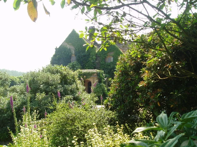
Gravetye Manor
Stately homes · 1.3 km

Turners Hill
Villages · 1.5 km

West Hoathly
Museums · 2.0 km

Philpots Camp: a promontory fort and Mesolithic rock shelters 500m north west of Philpots Farm
Vineyards · 2.0 km
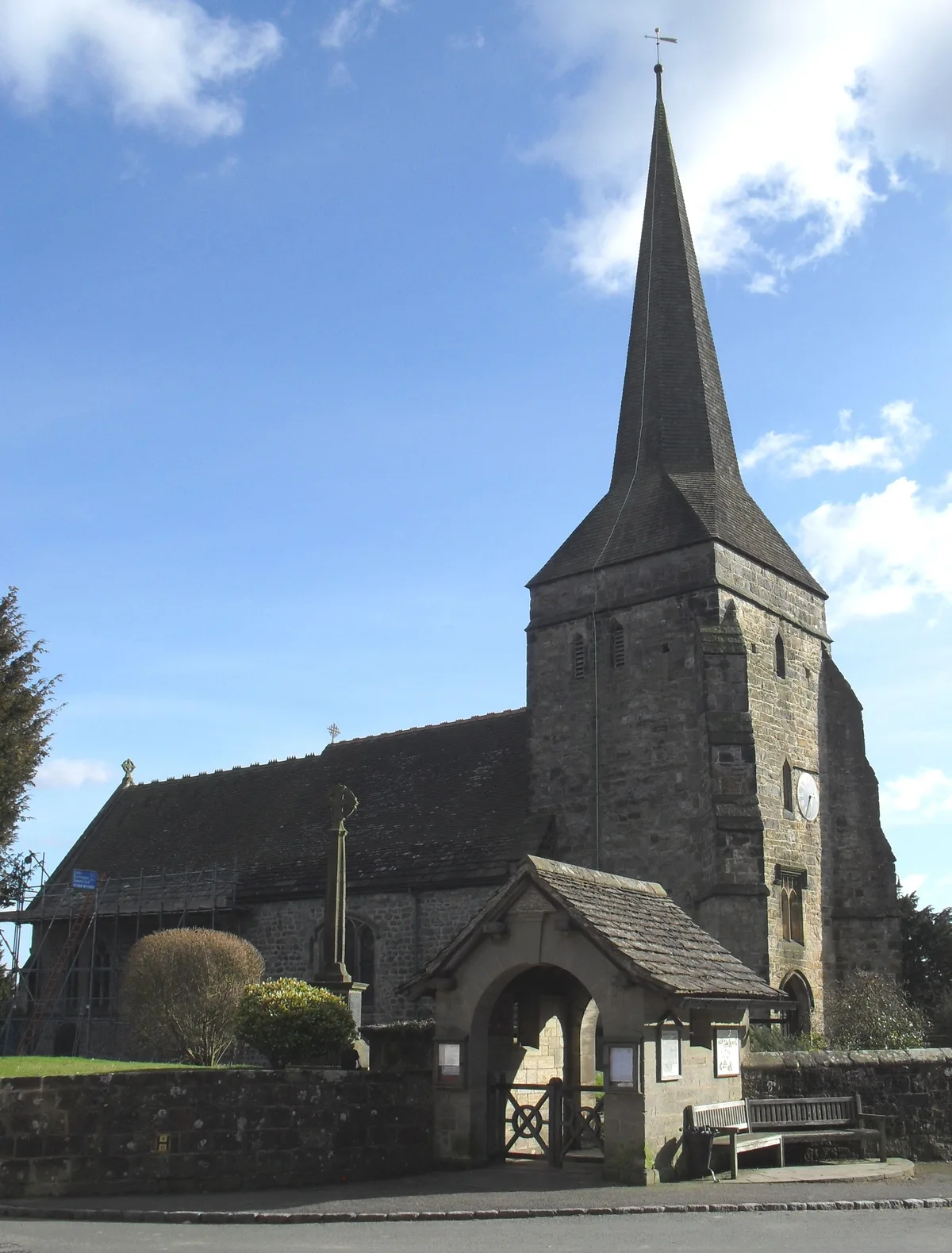
St Margaret's Church, West Hoathly
Historic churches · 2.1 km

The Manor House
Historic houses · 2.1 km

Priest House
Historic houses · 2.2 km

Banana Van
Natural landmarks · 2.3 km

Hook Farm Campsite
Campsites · 2.4 km

Bluebell Railway
Historic bridges · 2.5 km

Millennium Seed Bank Partnership
Gardens · 2.8 km
Nearby
📷 5Mountains & hills · South East England
Selsfield Common
Selsfield Common — a hill or mountain in england south east.
📷 5Stately homes · South East England
Gravetye Manor
Gravetye Manor — manor house, restaurant and gardens in West Hoathly, West Sussex, England, UK.
📷 5📷 5Museums · South East England
West Hoathly
West Hoathly — a museum in england-south-east, United Kingdom.
📷 5Vineyards · South East England
Philpots Camp: a promontory fort and Mesolithic rock shelters 500m north west of Philpots Farm
Philpots Camp: a promontory fort and Mesolithic rock shelters 500m north west of Philpots Farm — a UK vineyard in england south east, producing English or Welsh wine from cool-climate grape varieties.
📷 5Historic churches · South East England
St Margaret's Church, West Hoathly
St Margaret's Church, West Hoathly — church in Mid Sussex, England, UK.
Where to eat & stay near The Water Tower
Places to stay
📷 5Campsites · South East England
Hook Farm Campsite
Hook Farm Campsite — a campsite in england south east.
 📷 5
📷 5Campsites · South East England
Embers
Embers — a campsite in england south east.
 📷 5
📷 5Campsites · South East England
Evergreen Farm Woodland Campsite
Evergreen Farm Woodland Campsite — a campsite in england south east.
 📷 5
📷 5Campsites · South East England
Bluebell Camp Site
Bluebell Camp Site — a campsite in england south east.
 📷 7
📷 7Hotels · South East England
The Crown
The Crown — a hotel in england south east.
 📷 7
📷 7Hotels · South East England
The Dorset Arms
The Dorset Arms — a hotel in england south east.
Places to eat & drink
 📷 7
📷 7 📷 5
📷 5 📷 5
📷 5Historic pubs · South East England
White Hart Inn
White Hart Inn in England South East, United Kingdom.
 📷 5
📷 5Historic pubs · South East England
Old Punch Bowl
Old Punch Bowl in England South East, United Kingdom.
 📷 5
📷 5Historic pubs · South East England
The Jolly Tanners Public House
The Jolly Tanners Public House in England South East, United Kingdom.
 📷 7
📷 7Historic pubs · South East England
The Old Cage Public House
The Old Cage Public House in England South East, United Kingdom.
More memorials in this region
 📷 5
📷 5Memorials & monuments · South East England
Air Forces Memorial
Air Forces Memorial is a memorial in the United Kingdom.
 📷 5
📷 5Memorials & monuments · South East England
All Saints Church
All Saints Church is a memorial in the United Kingdom.
 📷 5
📷 5Memorials & monuments · South East England
Bevans War Memorial
Bevans War Memorial is a memorial in the United Kingdom.
.jpg?width=1200) 📷 5
📷 5Memorials & monuments · South East England
Cumberland Obelisk
Cumberland Obelisk is a memorial in the United Kingdom.
Frequently asked questions
- Where is The Water Tower?
- The Water Tower is in West Sussex, South-East England, United Kingdom (postcode RH19 4LN), in the parish of West Hoathly.
- What is The Water Tower?
- The Water Tower — Grade II listed building-listed memorial in england-south-east, United Kingdom.
- How do I get to The Water Tower?
- The nearest railway station is Kingscote, about 2.3 km away. Drivers can use postcode RH19 4LN.
- Is The Water Tower a listed building?
- The Water Tower is officially recognised as Grade II listed building listed.
- Is The Water Tower a protected site?
- Yes — The Water Tower is part of the Wakehurst & Chiddingly Woods SSSI Site of Special Scientific Interest and the High Weald National Landscape (AONB).
- Is The Water Tower free to visit?
- Yes, The Water Tower is free to enter.
- How do I get to The Water Tower?
- The nearest railway station is Kingscote, about 2.3 km away. Drivers can navigate to postcode RH19 4LN.