
Vineyards · West Midlands
The Walls: a large multivallate hillfort
In or near Wyken.
The Walls: a large multivallate hillfort — a UK vineyard in england west midlands, producing English or Welsh wine from cool-climate grape varieties.

Roger Kidd — CC BY-SA 2.0 via Wikimedia Commons licence

Plan your visit
- Typical visit
- 1 h–2 h
- Best time of year
- Late summer & autumn (Aug–Oct)
- Nearest railway station
- Bridgnorth Cliff Railway Bottom Station · 7.8 km
About
The Walls: a large multivallate hillfort is one of Britain's growing number of vineyards, located in england west midlands. UK viticulture has expanded significantly since the 1980s, with English sparkling wines now winning international awards. Most British vineyards offer tours and tastings of their estate-grown wines. hillfort in Shropshire, England, UK
Photo gallery
Place summary
The Walls is a large multivallate hillfort located in the West Midlands. This archaeological site features multiple earthen ramparts and ditches, indicative of its historical significance. The area surrounding the hillfort has been developed into a vineyard, offering visitors a chance to explore the landscape while enjoying wine-related activities. The combination of heritage and viticulture provides a unique setting for those interested in both history and wine production.
AI-generated from the structured facts on this page (operator, designation, listing, era). Not a substitute for visiting.
- Coordinates
- 52.5677, -2.3166
- District
- Shropshire
- Parish
- Worfield
- Postcode
- WV15 5PA
- Parliamentary constituency
- South Shropshire
- Nearest railway station
- Bridgnorth Cliff Railway Bottom Station — 7.8 km
Sources
- wikidata: Q17676686 (CC0)
Other places nearby

The Walls
Historic houses · 0.0 km
Hilton
Villages · 0.1 km

Hilton Manor
Manor houses · 1.6 km

Ackleton Hill
Mountains & hills · 1.9 km

Stanlow
Villages · 2.1 km
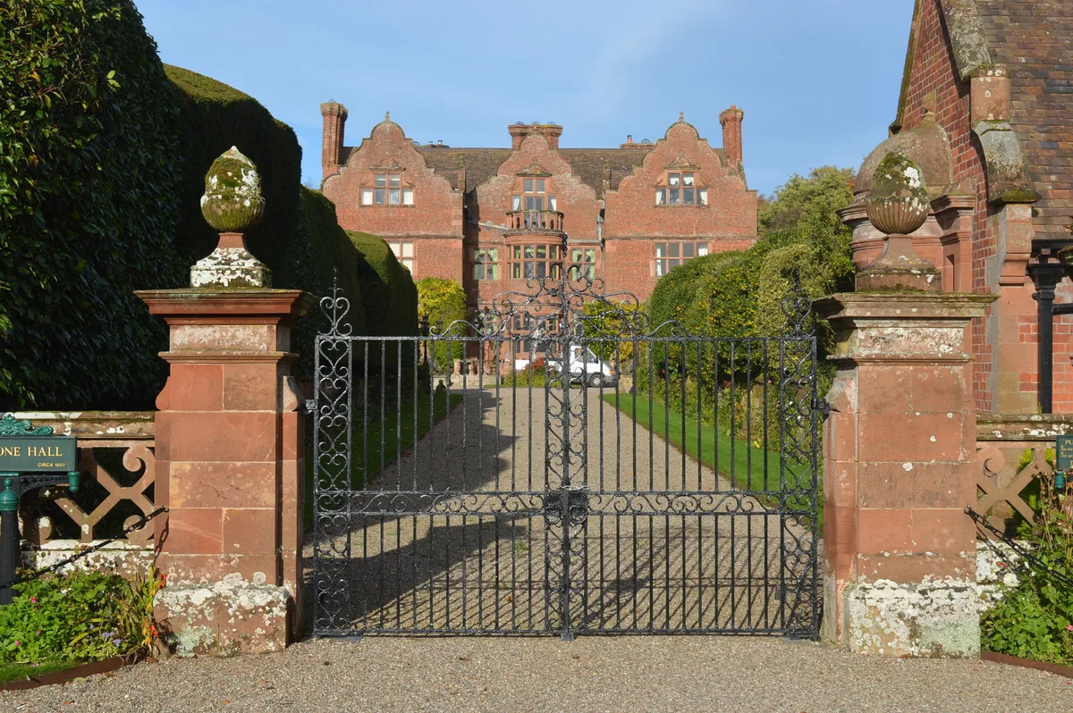
Ludstone Hall
Stately homes · 2.6 km

Wyken
Towns & cities · 2.7 km

Broad Bridge
Historic bridges · 2.9 km

Lower Hall
Historic houses · 2.9 km

Worfield
Villages · 3.0 km

Rotunda
Follies · 3.1 km

Worfield War Memorial
Memorials & monuments · 3.1 km
Nearby
📷 3Historic houses · West Midlands
The Walls
The Walls — a historic house in england-west-midlands, United Kingdom.
📷 5📷 3Manor houses · West Midlands
Hilton Manor
Hilton Manor — Grade II listed building-listed manor in england-west-midlands, United Kingdom.
📷 5Mountains & hills · West Midlands
Ackleton Hill
Ackleton Hill — mountain in england west midlands. Elevation: 100 m.
📷 5Flagship📷 3Stately homes · West Midlands
Ludstone Hall
Ludstone Hall — Grade I listed house in Claverley, Shropshire, England, UK.
Where to eat & stay near The Walls: a large multivallate hillfort
Places to stay
 📷 5
📷 5Caravan parks · West Midlands
Stanmore Hall Touring Park
Stanmore Hall Touring Park — a caravan park in england west midlands.
 📷 5
📷 5 📷 5
📷 5Caravan parks · West Midlands
Russell's Caravan Park
Russell's Caravan Park — a caravan park in england west midlands.
📷 5Caravan parks · West Midlands
Severn Valley Caravan Park
Severn Valley Caravan Park — a caravan park in england west midlands.
 📷 5
📷 5Caravan parks · West Midlands
Riverside Caravan Park
Riverside Caravan Park — a caravan park in england west midlands.
 📷 5
📷 5Campsites · West Midlands
Glamping West Midlands
Glamping West Midlands — a campsite in england west midlands.
Places to eat & drink
 📷 5
📷 5Historic pubs · West Midlands
The Pigot Arms
The Pigot Arms in England West Midlands, United Kingdom.
 📷 7
📷 7Historic pubs · West Midlands
Hundred House Hotel
Hundred House Hotel in England West Midlands, United Kingdom.
 📷 3
📷 3Historic pubs · West Midlands
The Plough Inn
The Plough Inn — Historic pub — listed building or notable heritage status.
 📷 5
📷 5Historic pubs · West Midlands
Foster Arms Public House
Foster Arms Public House in England West Midlands, United Kingdom.
 📷 5
📷 5Historic pubs · West Midlands
Black Boy Public House
Black Boy Public House in England West Midlands, United Kingdom.
 📷 5
📷 5Historic pubs · West Midlands
Severn Arms Public House
Severn Arms Public House in England West Midlands, United Kingdom.
More places in this region
 📷 2
📷 2Vineyards · West Midlands
Forest Bank
Forest Bank — a UK vineyard in england east midlands, producing English or Welsh wine from cool-climate grape varieties.
 📷 5
📷 5Vineyards · West Midlands
Castle Ring
Castle Ring — a UK vineyard in england east midlands, producing English or Welsh wine from cool-climate grape varieties.

Vineyards · West Midlands
Hillfort known as The Castle Fort at Castlebank Plantation
Hillfort known as The Castle Fort at Castlebank Plantation — a UK vineyard in england west midlands, producing English or Welsh wine from cool-climate grape varieties.
Vineyards · West Midlands
Castle Old Fort
Castle Old Fort — a UK vineyard in england west midlands, producing English or Welsh wine from cool-climate grape varieties.
Frequently asked questions
- Where is The Walls: a large multivallate hillfort?
- The Walls: a large multivallate hillfort is in the West Midlands, United Kingdom (postcode WV15 5PA), in the parish of Worfield.
- What is The Walls: a large multivallate hillfort?
- The Walls: a large multivallate hillfort — a UK vineyard in england west midlands, producing English or Welsh wine from cool-climate grape varieties.
- How do I get to The Walls: a large multivallate hillfort?
- The nearest railway station is Bridgnorth Cliff Railway Bottom Station, about 7.8 km away. Drivers can use postcode WV15 5PA.
- How do I get to The Walls: a large multivallate hillfort?
- The nearest railway station is Bridgnorth Cliff Railway Bottom Station, about 7.8 km away. Drivers can navigate to postcode WV15 5PA.