
Gardens · South East England
The Vines, Oxford
In or near Oxford.
The Vines, Oxford — a garden in england-west-midlands, United Kingdom.

David Martin — CC BY-SA 2.0 via Wikimedia Commons licence

Plan your visit
- Typical visit
- 1 h–2.5 h
- Best time of year
- Spring & summer (Apr–Sep)
- Nearest railway station
- Oxford · 3.0 km
- Free entry
- Dog-friendly
Getting there & planning your visit
To visit The Vines in Oxford, the nearest railway station is Oxford, located 3 km away. The postcode for sat-nav is OX3 0DA. Entry details are not provided, so please check in advance for any fees or accessibility information.
About
The Vines, Oxford is a garden of interest in england-west-midlands, United Kingdom — drawn from open-data sources for visitor reference. See the linked Wikipedia article for the full description.
Photo gallery
Official information
The Rain Pavilion is a public art installation located on the Piazza at Oxford Brookes University. It features steel structures resembling leaves that create a gentle rain effect, providing a unique sensory experience for visitors. The pavilion is part of the university's commitment to integrating art within its campus environment.
From the Wikipedia article
The Vines is a house on Pullens Lane, Headington, a suburb in east Oxford, England. It was the first house to be built on the west side of the lane, on land that was originally owned by the Morrell family, local brewers. The house is built of red brick with stone dressings. The house was built in 1889–90 for Professor Sydney Howard Vines (1849–1934). It was designed by the Victorian architect Harry Wilkinson Moore (1850–1915). In 1923, it became known as The Vineyard, after the first owner, Professor Vines. In 1948, the Vineyard was purchased by the United Oxford Hospitals, who renamed it to be Pollock House after its last owner. From 1948 to 1956, it was used as the Nurses Training School of the then Wingfield-Morris Orthopaedic Hospital, now the Nuffield Orthopaedic Centre. From 1958 till around 1976, it was used as the hospital's Night Nurses' Home. Subsequently, it was part of Oxford Brookes University until 2004. The house was renamed to The Vines, is now occupied by Scholarship & Christianity in Oxford (SCIO), the United Kingdom centre of the Council for Christian Colleges and Universities (CCCU). Close by, also in Pullens Lane, is Cotuit Hall, part of EF International Academy and previously one of the halls of residence at Oxford Brookes University. This was designed by the same architect, H. W. Moore, and built in 1892. In the past, it was known as Napier House.
Excerpt from Wikipedia under CC BY-SA 4.0. See the source article linked in Sources below.
- Coordinates
- 51.7595, -1.2272
- County
- Oxfordshire
- District
- Oxford
- Parish
- Oxford, unparished area
- Postcode
- OX3 0DA
- Parliamentary constituency
- Oxford East
- Nearest railway station
- Oxford — 3 km
- Official site
- www.brookes.ac.uk
Sources
- wikidata: Q7772708 (CC0)
- wikipedia: The Vines, Oxford (CC BY-SA 4.0)
Other places nearby

Cotuit Hall
Gardens · 0.1 km
Rye St Antony School
Natural landmarks · 0.1 km

Joe Pullen's Tree
Memorials & monuments · 0.4 km
Headington Rye Oxford
Natural landmarks · 0.5 km
Pergamon Press Strike
Memorials & monuments · 0.5 km

Rain Pavilion
Public art & sculpture · 0.5 km
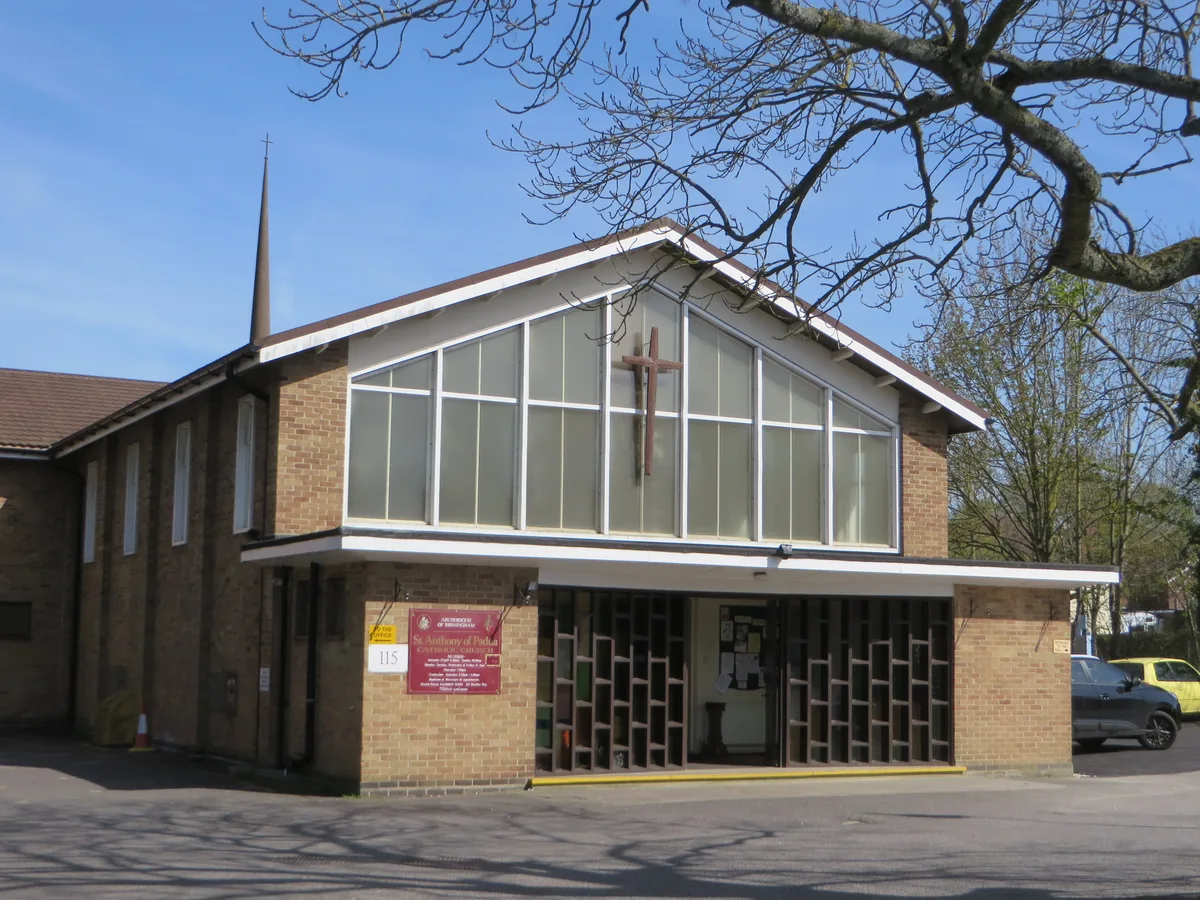
St Anthony of Padua, Oxford
Historic churches · 0.5 km
Rhoda Broughton
Memorials & monuments · 0.5 km

JRR Tolkien
Memorials & monuments · 0.5 km

Assembly
Public art & sculpture · 0.5 km

Headington
Villages · 0.6 km

New Marston War Memorial
Memorials & monuments · 0.6 km
Nearby
📷 4Gardens · South East England
Cotuit Hall
Cotuit Hall — a garden in england-west-midlands, United Kingdom.
📷 5Natural landmarks · South East England
Rye St Antony School
Rye St Antony School — a school heritage in england-west-midlands, United Kingdom.
📷 3Memorials & monuments · South East England
Joe Pullen's Tree
Joe Pullen's Tree — a memorial in england-west-midlands, United Kingdom.
📷 5Natural landmarks · South East England
Headington Rye Oxford
Headington Rye Oxford — a school heritage in england-west-midlands, United Kingdom.
📷 3Memorials & monuments · South East England
Pergamon Press Strike
Pergamon Press Strike — a memorial in england-west-midlands, United Kingdom.
📷 3Public art & sculpture · South East England
Rain Pavilion
Rain Pavilion — Public artwork (sculpture) by Charlotte Birch;Alexandra Horsman;Ricardo Assis Rosa;Tiffany Black;James Palmer;Joel Chappell;Paul Austin;Daniel Brenner.
Where to eat & stay near The Vines, Oxford
Places to stay
 📷 7
📷 7Hotels · South East England
Mercure Oxford Eastgate Hotel
Mercure Oxford Eastgate Hotel — a hotel in england west midlands. Brand: Mercure.
 📷 5
📷 5Hotels · South East England
Old Bank Hotel
Old Bank Hotel — a hotel in england west midlands.
 📷 7
📷 7Hotels · South East England
Old Parsonage Hotel
Old Parsonage Hotel — a hotel in england west midlands.
 📷 5
📷 5B&Bs · South East England
St Michael's Guest House
St Michael's Guest House — a bed-and-breakfast in england west midlands.
 📷 5
📷 5Hotels · South East England
Linton Lodge
Linton Lodge — a hotel in england west midlands.
 📷 5
📷 5Hotels · South East England
The Jericho Hotel
The Jericho Hotel — a hotel in england west midlands.
Places to eat & drink
 📷 7
📷 7Historic pubs · South East England
The Britannia Public House
The Britannia Public House in England South East, United Kingdom.
 📷 7
📷 7Historic pubs · South East England
The Port Mahon Inn
The Port Mahon Inn in England South East, United Kingdom.
 📷 5
📷 5Cafés · South East England
George & Delila
George & Delila — a café in england west midlands.
 📷 5
📷 5Cafés · South East England
Queen's Lane Coffee House
Queen's Lane Coffee House — a café in england west midlands. Cuisine: coffee shop.
 📷 7
📷 7Historic pubs · South East England
Turf Tavern
Turf Tavern in England South East, United Kingdom.
 📷 5
📷 5Historic pubs · South East England
King's Arms
King's Arms in England South East, United Kingdom.
More gardens in this region
 📷 5
📷 5Gardens · South East England
Emmetts Garden
Emmetts Garden — Edwardian house and gardens at Ide Hill, Kent, England.
 📷 5
📷 5Gardens · South East England
Great Comp Garden
Great Comp Garden — garden in Comp, Kent, England, UK.
.jpg?width=1200) 📷 5
📷 5Gardens · South East England
Muslim Burial Ground, Horsell Common
Muslim Burial Ground, Horsell Common — former cemetery and current peace garden in Woking, Surrey, England, UK.
 📷 5
📷 5Gardens · South East England
Riverhill House
Riverhill House — country house in Sevenoaks Weald, Kent, England, UK.
Frequently asked questions
- Where is The Vines, Oxford?
- The Vines, Oxford is in Oxfordshire, South-East England, United Kingdom (postcode OX3 0DA), in the parish of Oxford, unparished area.
- What is The Vines, Oxford?
- The Vines, Oxford — a garden in england-west-midlands, United Kingdom.
- How do I get to The Vines, Oxford?
- The nearest railway station is Oxford, about 3.0 km away. The nearest town is Oxford. Drivers can use postcode OX3 0DA.
- Is The Vines, Oxford free to visit?
- Yes, The Vines, Oxford is free to enter.
- How do I get to The Vines, Oxford?
- The nearest railway station is Oxford, about 3.0 km away. Drivers can navigate to postcode OX3 0DA.