
Other places · Scottish Highlands
The Soldiers' Trenches, Moor of Rannoch
The Soldiers' Trenches, Moor of Rannoch in Scotland Islands, United Kingdom.

Alan Stewart — CC BY-SA 2.0 via Wikimedia Commons licence

Plan your visit
- Typical visit
- 1 h–2 h
- Nearest railway station
- Rannoch · 5.8 km
About
The Soldiers' Trenches, Moor of Rannoch is a place of interest in Scotland Islands, United Kingdom — drawn from open-data sources for visitor reference. See the linked Wikipedia article for the full description.
Photo gallery
From the Wikipedia article
The Soldiers' Trenches on Rannoch Moor are drainage ditches dug by British army soldiers in 1763-64 in an attempt to drain part of the Moor of Rannoch, Fortingall Parish, Perth and Kinross, Scotland. The aim was to produce agriculturally useful land for crops, grazing, etc.
Excerpt from Wikipedia under CC BY-SA 4.0. See the source article linked in Sources below.
Background
History
Close to the West Highland Line, about three miles (5 km) from the Gruund, are five large parallel drainage ditches known as 'The Soldiers' ditches' that were dug by British army soldiers between 1763 and 1764 under the direction of Ensign James Small of Lord Loudoun's Regiment, the Government Factor of the forfeited estate of the Jacobite supporters, the Robertsons of Struan in Kinloch Rannoch. In 1739 James Small married Katharine Wilson and had three daughters. His younger brother was Major General John Small. These lands were the site of the summer shielings of the Rannoch inhabitants and the intention was to produce land upon which crops could be grown and pasture created. These…
Sourced from Wikipedia under CC BY-SA 4.0.
- Coordinates
- 56.6340, -4.5740
- Nearest railway station
- Rannoch — 5.8 km
Sources
- wikidata: Q65079561 (CC0)
- wikipedia: The Soldiers' Trenches, Moor of Rannoch (CC BY-SA 4.0)
Other places nearby
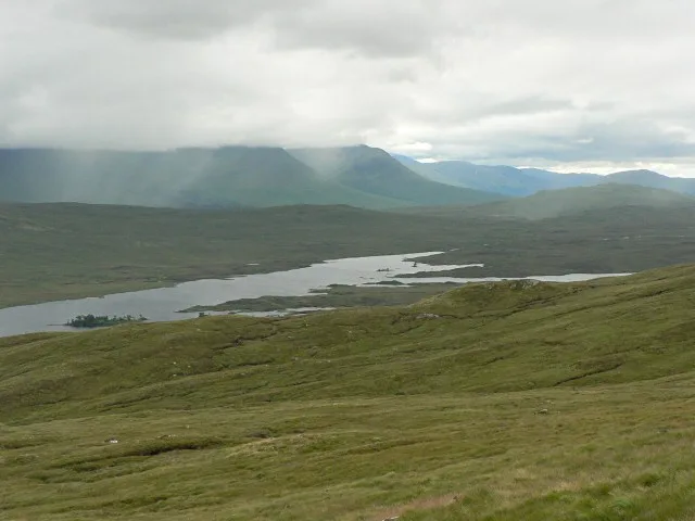
Loch Laidon
Natural landmarks · 4.4 km

Leathad Mòr
Mountains & hills · 4.4 km
Leathad Mor
Mountains & hills · 4.5 km

Gorton railway station
Farms (open to visitors) · 5.0 km

Loch Eigheach
Lakes · 5.0 km

Creag Riabhach
Mountains & hills · 5.2 km

Meall a' Ghortain
Mountains & hills · 5.2 km
Meall a' Ghortain
Mountains & hills · 5.2 km
Creag Riabhach
Mountains & hills · 5.2 km

Eas an Torre Mhoir
Natural landmarks · 5.4 km
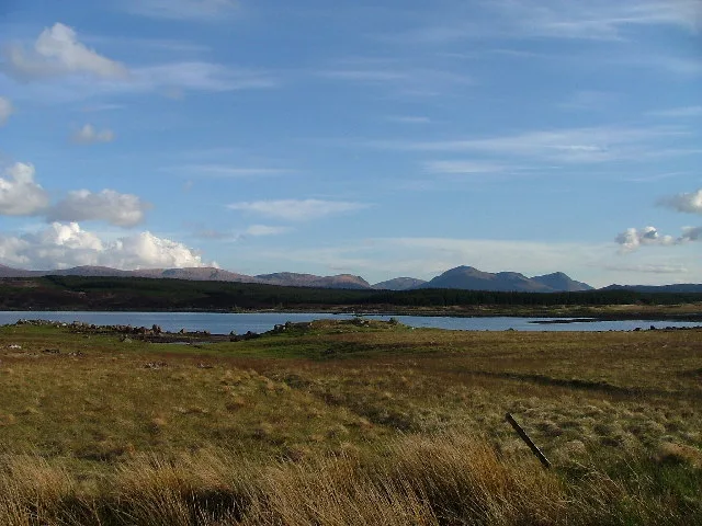
Loch Eigheach
Natural landmarks · 5.6 km

Meall Cruinn
Mountains & hills · 5.6 km
Nearby
📷 3Natural landmarks · Scottish Highlands
Loch Laidon
Loch Laidon — lake on the Perth and Kinross, and Highland border, Scotland, UK, outflows to the River Gaur.
📷 5Mountains & hills · Scottish Highlands
Leathad Mòr
Leathad Mòr — mountain in scotland highlands. Elevation: 547 m.
📷 5Mountains & hills · Scottish Highlands
Leathad Mor
Leathad Mor — a hill or mountain in scotland highlands.
📷 4Farms (open to visitors) · Central Scotland
Gorton railway station
Gorton railway station in Scotland Islands, United Kingdom.
📷 5📷 5Mountains & hills · Central Scotland
Creag Riabhach
Creag Riabhach — a hill or mountain in scotland highlands.
Where to eat & stay near The Soldiers' Trenches, Moor of Rannoch
Places to stay
 📷 5
📷 5Campsites · Scottish Highlands
Glencoe Mountain Resort
Glencoe Mountain Resort — a campsite in scotland highlands.
 📷 5
📷 5 📷 5
📷 5Hostels · Scottish Highlands
Loch Ossian Youth Hostel
Loch Ossian Youth Hostel — a hostel in scotland highlands.
 📷 5
📷 5Campsites · Central Scotland
Meggernie Outdoor Centre
Meggernie Outdoor Centre — a campsite in scotland highlands.
 📷 5
📷 5Hostels · Central Scotland
West Highland Way Sleeper
West Highland Way Sleeper — a hostel in scotland highlands.
 📷 5
📷 5Campsites · Scottish Highlands
Kilvrecht Caravan & Camping
Kilvrecht Caravan & Camping — a campsite in scotland highlands.
More places in this region
 📷 3
📷 3Other places · Scottish Highlands
The Eternal Present: Gneiss Granite Gabbro
The Eternal Present: Gneiss Granite Gabbro — Public artwork (sculpture) by Janet McEwan.
 📷 3
📷 3Other places · Scottish Highlands
The Gordon Highlanders
The Gordon Highlanders — Public artwork (statue) by Mark Richards.
 📷 4
📷 4Other places · Scottish Highlands
Central Library, Aberdeen
The Central Library is the principal public library for the city of Aberdeen, Scotland. It opened in 1892 and is operated by Aberdeen City Council as part of the Aberdeen City Libraries network.
 📷 3
📷 3Other places · Scottish Highlands
Craigendarroch Resort
The Craigendarroch Resort in Ballater, Scotland, is a resort complex close to the banks of the River Dee. It is located on a hillside just west of the village of Ballater, 42 miles west of Aberdeen an
Frequently asked questions
- Where is The Soldiers' Trenches, Moor of Rannoch?
- The Soldiers' Trenches, Moor of Rannoch is in the Scottish Highlands, United Kingdom.
- What is The Soldiers' Trenches, Moor of Rannoch?
- The Soldiers' Trenches, Moor of Rannoch in Scotland Islands, United Kingdom.
- How do I get to The Soldiers' Trenches, Moor of Rannoch?
- The nearest railway station is Rannoch, about 5.8 km away. Its coordinates are 56.6340°, -4.5740°.
- How do I get to The Soldiers' Trenches, Moor of Rannoch?
- The nearest railway station is Rannoch, about 5.8 km away.