
Cathedrals · South East England
The Parish Church of St Peter
In or near Tillington.
The Parish Church of St Peter is a cathedral in the United Kingdom.

Shazz — CC BY-SA 2.0 via Wikimedia Commons licence

Plan your visit
- Typical visit
- 1 h–2 h
- Best time of year
- Year-round
- Nearest railway station
- Stopham Road · 8.9 km
- Family-friendly
- Limited wheelchair access
Getting there & planning your visit
To visit The Parish Church of St Peter, the nearest railway station is Stopham Road, located 8.9 km away. The postcode for sat-nav is GU28 0NB. Accessibility is limited for wheelchair users.
About
The Parish Church of St Peter is a cathedral in england south east, United Kingdom — the principal church of its diocese. Cathedrals are seats of bishops in the Church of England, the Roman Catholic Church, and other Christian denominations across Britain.
Photo gallery
From the Wikipedia article
St Peter's Church is a protected Grade II listed Church of England parish church in the village of East Lavington, West Sussex, England. Situated on the northern slopes of the South Downs, the church is noted for its historic associations with the Oxford Movement and the Wilberforce family. The current structure was largely rebuilt between 1848 and 1850 by the Gothic Revival architect William Butterfield, commissioned by the then-Rector Henry Edward Manning. It remains an active place of worship within the United Benefice of Graffham with Upperton and East Lavington.
Excerpt from Wikipedia under CC BY-SA 4.0. See the source article linked in Sources below.
Background
Description
The church gained national significance in the 1830s and 1840s due to its association with the Oxford Movement (or Tractarianism). In 1833, Henry Edward Manning became the Rector of Lavington-with-Graffham following his marriage to Caroline Sargent, the daughter of the previous incumbent. During his tenure, Manning became a leading figure in the High Church movement, which sought to restore traditional Catholic liturgy and theology within the Anglican communion. Under his leadership, the parish became a focal point for these ecclesiastical changes.
Sourced from Wikipedia under CC BY-SA 4.0.
- Coordinates
- 50.9381, -0.6547
- County
- West Sussex
- District
- Chichester
- Parish
- East Lavington
- Postcode
- GU28 0NB
- Parliamentary constituency
- Arundel and South Downs
- Nearest railway station
- Stopham Road — 8.9 km
Sources
- wikidata: Q17532056 (CC0)
- wikipedia: St Peter's Church, East Lavington (CC BY-SA 4.0)
Other places nearby
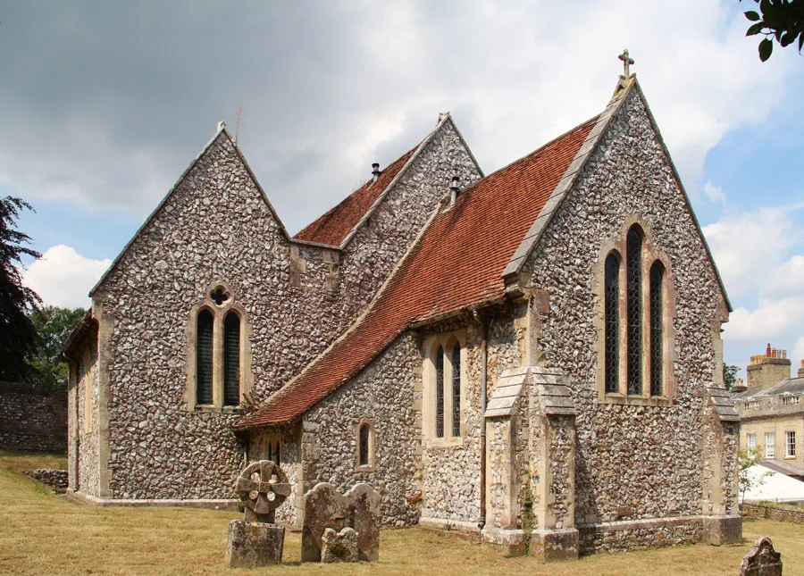
The Parish Church of St Peter
Abbeys & priories · 0.0 km

Dunction Hill
Viewpoints · 0.9 km

Littleton Down
Mountains & hills · 1.4 km

Littleton Farm Campsite
Campsites · 1.6 km

Barlavington Down
Mountains & hills · 1.7 km

Duncton
Villages · 1.7 km

Woodfire Camping
Campsites · 2.0 km

Graffham Down
Mountains & hills · 2.1 km

Graffham And East Lavington War Memorial
Memorials & monuments · 2.1 km

The Foresters Public House
Historic pubs · 2.1 km

Graffham
Villages · 2.3 km

Farm Hill
Mountains & hills · 2.3 km
Nearby
📷 5Abbeys & priories · South East England
The Parish Church of St Peter
The Parish Church of St Peter — church in East Lavington, West Sussex, England, UK.
📷 5Viewpoints · South East England
Dunction Hill
Dunction Hill is a viewpoint in the United Kingdom.
📷 5Mountains & hills · South East England
Littleton Down
Littleton Down — a hill or mountain in england south east.
📷 5Campsites · South East England
Littleton Farm Campsite
Littleton Farm Campsite — a campsite in england south east.
📷 5Mountains & hills · South East England
Barlavington Down
Barlavington Down — a hill or mountain in england south east.
📷 5Where to eat & stay near The Parish Church of St Peter
Places to stay
📷 5Campsites · South East England
Littleton Farm Campsite
Littleton Farm Campsite — a campsite in england south east.
📷 5Campsites · South East England
Woodfire Camping
Woodfire Camping — a campsite in england south east.
 📷 5
📷 5Campsites · South East England
Graffham Camping and Caravanning Club Site
Graffham Camping and Caravanning Club Site — a campsite in england south east.
 📷 5
📷 5Campsites · South East England
Newhouse Farm Camping
Newhouse Farm Camping — a campsite in england south east.
 📷 5📷 5
Places to eat & drink
📷 5Historic pubs · South East England
The Foresters Public House
The Foresters Public House in England South East, United Kingdom.
 📷 5
📷 5Historic pubs · South East England
The Hollist Arms Public House
The Hollist Arms Public House in England South East, United Kingdom.
 📷 5
📷 5Historic pubs · South East England
The Partridge Inn
The Partridge Inn in England South East, United Kingdom.
 📷 5
📷 5Historic pubs · South East England
Page's Stores The White Horse Inn
Page's Stores The White Horse Inn in England South East, United Kingdom.
 📷 7
📷 7Historic pubs · South East England
The Spur Public House
The Spur Public House in England South East, United Kingdom.
 📷 5
📷 5Historic pubs · South East England
The White Hart
The White Hart — Historic pub — listed building or notable heritage status.
More cathedrals in this region
 📷 5
📷 5Cathedrals · South East England
Old Minster
Old Minster — former Anglo-Saxon cathedral for the diocese of Wessex.
 📷 5
📷 5Cathedrals · South East England
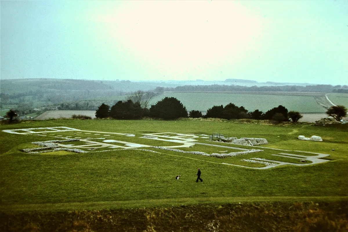
Old Sarum Cathedral
Old Sarum Cathedral — Grade I listed former cathedral in Salisbury, Wiltshire, England, UK.
 📷 5
📷 5 📷 5
📷 5Cathedrals · South East England
Robertsbridge Abbey
Robertsbridge Abbey is a cathedral in the United Kingdom.
Frequently asked questions
- Where is The Parish Church of St Peter?
- The Parish Church of St Peter is in West Sussex, South-East England, United Kingdom (postcode GU28 0NB), in the parish of East Lavington.
- What is The Parish Church of St Peter?
- The Parish Church of St Peter is a cathedral in the United Kingdom.
- How do I get to The Parish Church of St Peter?
- The nearest railway station is Stopham Road, about 8.9 km away. Drivers can use postcode GU28 0NB.
- How do I get to The Parish Church of St Peter?
- Drivers can navigate to postcode GU28 0NB. It sits within the Arundel and South Downs parliamentary constituency.