
Historic churches · South East England
The Parish Church of St Giles, Shermanbury
In or near Shermanbury.
The Parish Church of St Giles, Shermanbury — Grade II* listed building-listed church in england-south-east, United Kingdom.

Dave Spicer — CC BY-SA 2.0 via Wikimedia Commons licence

Plan your visit
- Typical visit
- 30 min–1 h
- Nearest railway station
- Hassocks · 9.6 km
- Free entry
Getting there & planning your visit
The Parish Church of St Giles in Shermanbury is located at postcode RH13 8HF. The nearest railway station is Hassocks, which is 9.6 km away. Entry to the church is free.
About
The Parish Church of St Giles, Shermanbury is a Grade II* listed building-listed church in england-south-east, United Kingdom, registered on the National Heritage List for England (NHLE entry 1194079). Listed status protects buildings and structures of special architectural or historic interest. See the linked Wikipedia article for further details.
Photo gallery
Heritage listing
St Giles' Church is a Church of England parish church in the small village of Shermanbury, West Sussex. Placed on the same site as a church recorded in Domesday Book, the present church was largely built in the 13th century but was heavily restored and partially rebuilt in the 18th and 19th centuries. English Heritage has listed it at Grade II* for its architectural and historical importance. The church historian John E. Vigar described it as "one of our Sussex gems" which he had "no hesitation in recommending...to all". Services for the parish continue and also cover the parishes of St Peter's, Henfield and St.
From the Historic England List Entry under OGL v3.
Official information
The Parish Church of St Giles in Shermanbury is part of the Church of England Parish of Henfield. It serves as a place for worship and community gatherings, welcoming individuals for services, weddings, christenings, and funerals.
Protected designations
- Area of Outstanding Natural Beauty: High Weald
Designations sourced from Natural England open data under OGL v3.
From the Wikipedia article
St Giles' Church is a Church of England parish church in the small village of Shermanbury, West Sussex. Placed on the same site as a church recorded in Domesday Book, the present church was largely built in the 13th century but was heavily restored and partially rebuilt in the 18th and 19th centuries. English Heritage has listed it at Grade II* for its architectural and historical importance. The church historian John E. Vigar described it as "one of our Sussex gems" which he had "no hesitation in recommending...to all". Services for the parish continue and also cover the parishes of St Peter's, Henfield and St. Peter's, Woodmancote, which form its united benefice.
Excerpt from Wikipedia under CC BY-SA 4.0. See the source article linked in Sources below.
Background
History
The mound on which the church and Shermanbury Place stands was doubtless also the site of the Anglo-Saxon burh, or fortification, which gives the village the second half of its name. The existence of an ecclesiola, or small church, at Salmonesberie in 1086 is mentioned by Domesday Book. Some 12th-century carved stones discovered c. 1900 may have been from this church, but the oldest parts of the present structure date from the 13th century. By 1288 it had a rector, presented by Robert de Buci in his capacity as lord of the manor of Shermanbury. Later lords of the manor continued to hold the advowson until the 20th century. St Giles was never a good living, being valued at £4 6s. 8d. in 1291…
Architecture
The church presents a mixture of styles. The rendered walls of the nave – there are no aisles – are largely 13th century, and feature on both the north and south sides blocked medieval doorways. The piscina is 13th century. The west end, however, including the wooden bell-turret, was rebuilt in either 1747 or 1836, and the porch front in 1885. The chancel in its present form is a product of the 1710 restoration, and the brick-built vestry dates from the 19th century. The gallery was built in 1748, and was altered in 1836 (probably) and 1927, the purpose of the 1927 work being to accommodate an organ. The church's windows, originally built as lancets, were given square heads in the 18th…
Description
In 1978 the parish of Shermanbury was united with those of Henfield and Woodmancote in a single benefice. The church was threatened with closure in 2002 but this danger has been fended off, partly with the help of the Friends of St Giles', Shermanbury, an organisation founded in December 2007 to promote the repair and renovation of the church building. The Friends have been responsible for, among other things, raising the funds needed to replace the wooden bell tower in 2011. Services are held at St Giles at 11.15 a.m. on the first and third Sundays of every month, but at other times the church is normally closed to visitors.
Sourced from Wikipedia under CC BY-SA 4.0.
- Coordinates
- 50.9562, -0.2726
- County
- West Sussex
- District
- Horsham
- Parish
- Shermanbury
- Postcode
- RH13 8HF
- Parliamentary constituency
- Horsham
- Phone
- 01273 493069
- Nearest railway station
- Hassocks — 9.6 km
- Official site
- henfield.org
Sources
- wikidata: Q17532740 (CC0)
- wikipedia: St Giles' Church, Shermanbury (CC BY-SA 4.0)
Other places nearby

Ewhurst Manor
Manor houses · 0.3 km
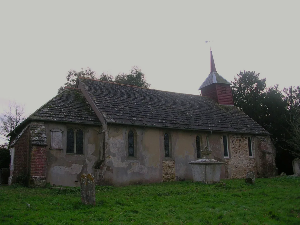
Shermanbury
Towns & cities · 1.0 km

Blacklands Farm Campsite
Campsites · 1.9 km

Dark Star Brewing Co.
Breweries · 2.2 km

Partridge Green
Villages · 2.5 km

Wantley Manor
Manor houses · 2.5 km
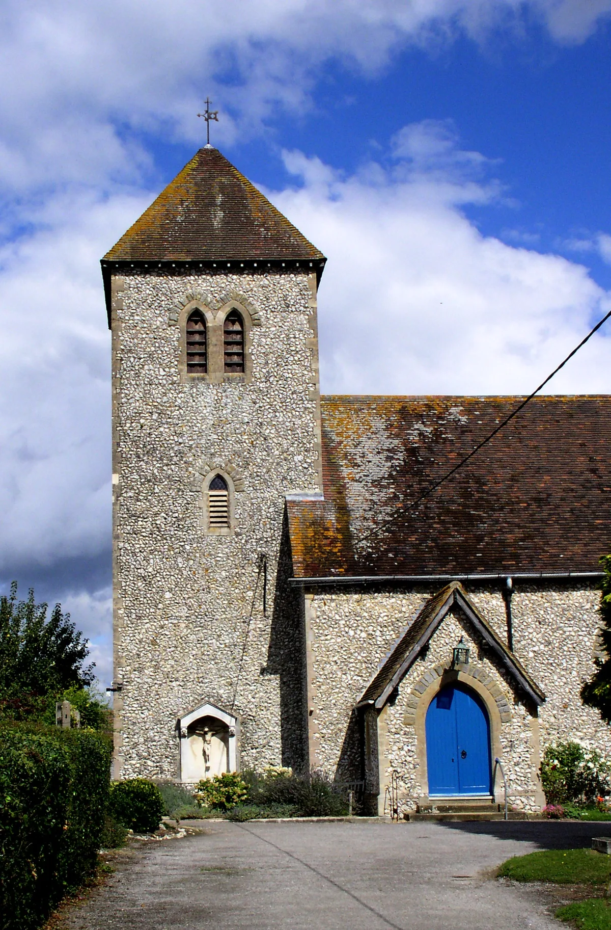
St Michael and All Angels Church, Partridge Green
Historic churches · 2.6 km
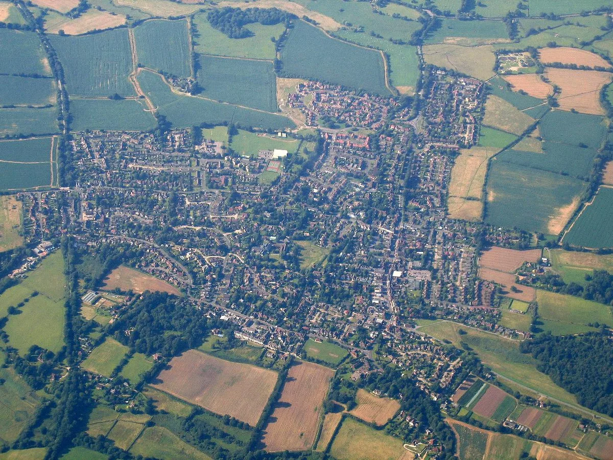
Henfield
Towns & cities · 2.6 km

St Peter's Church, Henfield
Historic churches · 2.7 km

Jolesfield Windmill (disused)
Windmills · 2.9 km

Henfield Museum
Museums · 2.9 km

Rus House
Historic houses · 3.0 km
Nearby
📷 5Manor houses · South East England
Ewhurst Manor
Ewhurst Manor — Grade II listed building-listed manor in england-south-east, United Kingdom.
Flagship📷 10Towns & cities · South East England
Shermanbury
Shermanbury — village in West Sussex, England, UK.
📷 5Campsites · South East England
Blacklands Farm Campsite
Blacklands Farm Campsite — a campsite in england south east.
📷 5Breweries · South East England
Dark Star Brewing Co.
Dark Star Brewing Co. — brewery in Partridge Green.
📷 5📷 5Manor houses · South East England
Wantley Manor
Wantley Manor — Grade II* listed building-listed manor in england-south-east, United Kingdom.
Where to eat & stay near The Parish Church of St Giles, Shermanbury
Places to stay
📷 5Campsites · South East England
Blacklands Farm Campsite
Blacklands Farm Campsite — a campsite in england south east.
 📷 5
📷 5Campsites · South East England
New Wharf Campsite
New Wharf Campsite — a campsite in england south east.
 📷 5
📷 5Caravan parks · South East England
Honeybridge Park
Honeybridge Park — a caravan park in england south east.
 📷 5
📷 5Campsites · South East England
Knepp Wildland Campsite
Knepp Wildland Campsite — a campsite in england south east.
 📷 5
📷 5Campsites · South East England
Hillside Scout Camp
Hillside Scout Camp — a campsite in england south east.
 📷 5
📷 5Places to eat & drink
 📷 5
📷 5 📷 5
📷 5Historic pubs · South East England
The Star Public House
The Star Public House in England South East, United Kingdom.
 📷 7
📷 7Historic pubs · South East England
The Selsey Arms Public House
The Selsey Arms Public House in England South East, United Kingdom.
 📷 5
📷 5Historic pubs · South East England
The Frankland Arms Public House
The Frankland Arms Public House in England South East, United Kingdom.
 📷 5
📷 5Historic pubs · South East England
The Jolly Tanners Public House
The Jolly Tanners Public House in England South East, United Kingdom.
 📷 5
📷 5Restaurants · South East England
Mekong House
Mekong House — a restaurant in england south east.
More places in this region
 📷 5
📷 5Historic churches · South East England
All Saints Church, Frindsbury
All Saints Church, Frindsbury — church in Medway, UK.
 📷 5
📷 5Historic churches · South East England
All Saints Church, Maidstone
All Saints Church, Maidstone — parish church associated with the Archbishop's Palace, Maidstone, Kent, England, UK.
 📷 5
📷 5Historic churches · South East England
All Saints Church, West Farleigh
All Saints Church, West Farleigh — Grade I listed church in West Farleigh, Maidstone, Kent, England, UK.
 📷 5
📷 5Historic churches · South East England
All Souls' Church, Sutton Green
All Souls' Church, Sutton Green — church in Guildford, England.
Frequently asked questions
- Where is The Parish Church of St Giles, Shermanbury?
- The Parish Church of St Giles, Shermanbury is in West Sussex, South-East England, United Kingdom (postcode RH13 8HF), in the parish of Shermanbury.
- What is The Parish Church of St Giles, Shermanbury?
- The Parish Church of St Giles, Shermanbury — Grade II* listed building-listed church in england-south-east, United Kingdom.
- How do I get to The Parish Church of St Giles, Shermanbury?
- The nearest railway station is Hassocks, about 9.6 km away. The nearest town is Shermanbury. Drivers can use postcode RH13 8HF.
- Is The Parish Church of St Giles, Shermanbury a listed building?
- The Parish Church of St Giles, Shermanbury is officially recognised as Grade II* listed building listed.
- Is The Parish Church of St Giles, Shermanbury a protected site?
- Yes — The Parish Church of St Giles, Shermanbury is part of the High Weald National Landscape (AONB).
- Is The Parish Church of St Giles, Shermanbury free to visit?
- Yes, The Parish Church of St Giles, Shermanbury is free to enter.
- How do I get to The Parish Church of St Giles, Shermanbury?
- Drivers can navigate to postcode RH13 8HF. It sits within the Horsham parliamentary constituency.