
Windmills · South West England
The Long Stone or Eddystone, standing stone 210m north east of Music Water
In or near St Mawgan.
The Long Stone or Eddystone, standing stone 210m north east of Music Water — a post mill in england-south-west, United Kingdom.

Lewis Clarke — CC BY-SA 2.0 via Wikimedia Commons licence

Plan your visit
- Typical visit
- 30 min–1 h
- Nearest railway station
- St. Columb Road · 9.1 km
- Free entry
- Family-friendly
- Dog-friendly
About
The Long Stone or Eddystone, standing stone 210m north east of Music Water is a post mill located in england-south-west, United Kingdom. Catalogued from Wikidata's UK heritage register; see the linked Wikipedia article for further details on its history, architecture and visiting information.
Photo gallery
Protected designations
- Area of Outstanding Natural Beauty: Cornwall
Designations sourced from Natural England open data under OGL v3.
Place summary
The Long Stone, also known as Eddystone, is a standing stone located 210 metres north-east of Music Water in South-West England. Its historical significance is underscored by its designation as a notable archaeological feature in the region.
AI-generated from the structured facts on this page (operator, designation, listing, era). Not a substitute for visiting.
- Coordinates
- 50.4805, -4.9536
- District
- Cornwall
- Parish
- St. Ervan
- Postcode
- PL27 7SJ
- Parliamentary constituency
- North Cornwall
- Nearest railway station
- St. Columb Road — 9.1 km
Sources
- wikidata: Q17677763 (CC0)
Other places nearby

Vertigo
Natural landmarks · 1.8 km
Clown Coaster
Natural landmarks · 1.8 km
Creeky's Water Rush
Natural landmarks · 1.8 km
Morgawr
Natural landmarks · 1.8 km
Raging Rivers
Natural landmarks · 1.8 km
Thunder Falls
Natural landmarks · 1.8 km
Pirate of the 7 Seas
Natural landmarks · 1.9 km
Air Bender
Natural landmarks · 1.9 km
Magic Dragon
Natural landmarks · 1.9 km
Show Arena
Natural landmarks · 1.9 km
Pony Express
Natural landmarks · 1.9 km
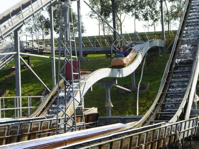
Camel Creek Adventure Park
Theme parks · 1.9 km
Nearby
📷 3Natural landmarks · South West England
Vertigo
Vertigo — a other in england-south-west, United Kingdom.
📷 3Natural landmarks · South West England
Clown Coaster
Clown Coaster — a other in england-south-west, United Kingdom.
📷 3Natural landmarks · South West England
Creeky's Water Rush
Creeky's Water Rush — a other in england-south-west, United Kingdom.
📷 3Natural landmarks · South West England
Morgawr
Morgawr — a other in england-south-west, United Kingdom.
📷 3Natural landmarks · South West England
Raging Rivers
Raging Rivers — a other in england-south-west, United Kingdom.
📷 3Natural landmarks · South West England
Thunder Falls
Thunder Falls — a other in england-south-west, United Kingdom.
Where to eat & stay near The Long Stone or Eddystone, standing stone 210m north east of Music Water
Places to stay
 📷 5
📷 5Caravan parks · South West England
Point Curlew Holiday Estate
Point Curlew Holiday Estate — a caravan park in england south west.
 📷 2
📷 2Campsites · South West England
Trewince Farm Holiday Park
Trewince Farm Holiday Park — a campsite in england south west.
 📷 3
📷 3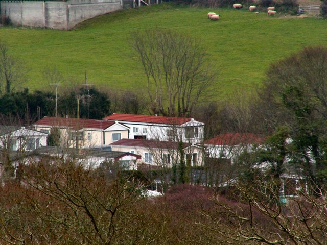 📷 2
📷 2Campsites · South West England
Trewan Hall Campsite
Trewan Hall Campsite — a campsite in england south west.
 📷 5
📷 5Caravan parks · South West England
St Merryn Holiday Village
St Merryn Holiday Village — a caravan park in england south west.
 📷 2
📷 2Caravan parks · South West England
Trevean Caravan & Camping Park
Trevean Caravan & Camping Park — a caravan park in england south west.
Places to eat & drink
 📷 6
📷 6Historic pubs · South West England
The Shipwrights
The Shipwrights in England South West, United Kingdom.
 📷 7
📷 7Restaurants · South West England
Slipway Hotel
Slipway Hotel — a restaurant in england south west.
 📷 7
📷 7Restaurants · South West England
Outlaws Fish Kitchen
Outlaws Fish Kitchen — a restaurant in england south west.
 📷 7
📷 7Restaurants · South West England
Nathan Outlaw
Nathan Outlaw — a restaurant in england south west.
 📷 7
📷 7Historic pubs · South West England
Methodist Chapel
Methodist Chapel in England South West, United Kingdom.
 📷 5
📷 5More windmills in this region
 📷 5
📷 5Windmills · South West England
Windmill Hill Neolithic Causewayed Enclosure
Windmill Hill Neolithic Causewayed Enclosure — a windmill in england-south-east, United Kingdom.
 📷 5
📷 5Windmills · South West England
East Knoyle Windmill
East Knoyle Windmill — Grade II listed building-listed windmill in england-south-east, United Kingdom.
 📷 5
📷 5Windmills · South West England
Windmill At Ngr Sy 69087138
Windmill At Ngr Sy 69087138 — Grade II listed building-listed windmill in england-south-east, United Kingdom.
 📷 5
📷 5Windmills · South West England
Windmill At Ngr Sy 69077128
Windmill At Ngr Sy 69077128 — Grade II listed building-listed windmill in england-south-east, United Kingdom.
Frequently asked questions
- Where is The Long Stone or Eddystone, standing stone 210m north east of Music Water?
- The Long Stone or Eddystone, standing stone 210m north east of Music Water is in South-West England, United Kingdom (postcode PL27 7SJ), in the parish of St. Ervan.
- What is The Long Stone or Eddystone, standing stone 210m north east of Music Water?
- The Long Stone or Eddystone, standing stone 210m north east of Music Water — a post mill in england-south-west, United Kingdom.
- How do I get to The Long Stone or Eddystone, standing stone 210m north east of Music Water?
- The nearest railway station is St. Columb Road, about 9.1 km away. Drivers can use postcode PL27 7SJ.
- Is The Long Stone or Eddystone, standing stone 210m north east of Music Water a protected site?
- Yes — The Long Stone or Eddystone, standing stone 210m north east of Music Water is part of the Cornwall National Landscape (AONB).
- Is The Long Stone or Eddystone, standing stone 210m north east of Music Water free to visit?
- Yes, The Long Stone or Eddystone, standing stone 210m north east of Music Water is free to enter.
- How do I get to The Long Stone or Eddystone, standing stone 210m north east of Music Water?
- Drivers can navigate to postcode PL27 7SJ. It sits within the North Cornwall parliamentary constituency.