
Castles · Scottish Lowlands
The Lands of Roughwood
In or near Lochwinnoch.
The Lands of Roughwood — castle in North Ayrshire, Scotland, UK.

Wikimedia Commons contributors — see linked file page for photographer and licence licence

Plan your visit
- Typical visit
- 1.5 h–3 h
- Nearest railway station
- Glengarnock · 2.4 km
- Family-friendly
- Limited wheelchair access
About
The Lands of Roughwood is a castle in the United Kingdom — fortified architecture from the medieval, Tudor, or Victorian-revival period. Wikidata describes it as: "castle in North Ayrshire, Scotland, UK". Coordinates: 55.7354°, -4.6364°.
Photo gallery
From the Wikipedia article
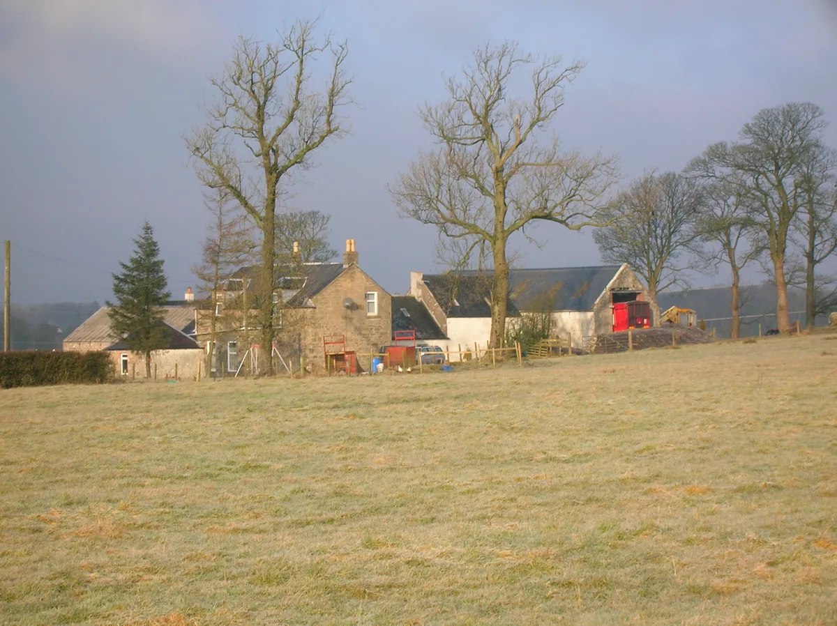
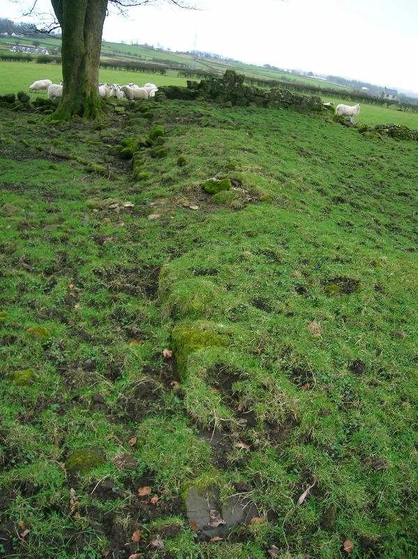
Roughwood once Ruchwood is a farm, originally an estate, possessing at one time a small tower castle. Roughwood is situated near to the town of Beith in North Ayrshire, Scotland; the lands lay within the old Lordship of Giffen.
Excerpt from Wikipedia under CC BY-SA 4.0. See the source article linked in Sources below.
Background
Description
The name 'Ruch' in Scot's relates to ground that is "difficult to traverse; broken, uneven; covered with tussocky vegetation or the like". The lands consisted of 160 acres in Beith parish and 85 in Dalry parish. No improvements had been made on these lands, mainly composed of moss and clay, since 1770 and they were in a very poor state, with no roads, farm-houses ruinous, and few enclosures when acquired by the Patricks.
Sourced from Wikipedia under CC BY-SA 4.0.
- Coordinates
- 55.7354, -4.6364
- District
- North Ayrshire
- Postcode
- KA15 1JR
- Parliamentary constituency
- North Ayrshire and Arran
- Nearest railway station
- Glengarnock — 2.4 km
Sources
- wikidata: Q12070868 (CC0)
- wikipedia: The Lands of Roughwood (CC BY-SA 4.0)
- commons: Roughwood Tower.jpg (CC BY-SA 4.0)
Other places nearby

Beith High Church, Kirk Road, Beith
Historic churches · 1.6 km

Old Parish Church, The Cross, Beith
Historic churches · 1.7 km

Dr Henry Faulds Memorial
Memorials & monuments · 1.8 km
Broadstone Castle and Barony
Castles · 1.8 km

Boys Brigade Hall, Head Street, Beith
Historic churches · 1.8 km

The Smugglers Tavern, 53, 55 Eglinton Street, Beith
Historic pubs · 1.9 km

R. C. Church, Mitchell Street, Beith
Historic churches · 1.9 km

War Memorial, Viewpark, Beith
Memorials & monuments · 2.1 km

Beith Trinity Church, Wilson Street, Beith
Historic churches · 2.2 km
Hill of Beith Castle
Castles · 2.3 km

David Colville and Sons Ltd War Memorial
Memorials & monuments · 2.4 km

Glengarnock Church Bell Tower
Memorials & monuments · 2.6 km
Nearby
📷 5Historic churches · Scottish Lowlands
Beith High Church, Kirk Road, Beith
Beith High Church, Kirk Road, Beith — category B listed building-listed church in scotland-highlands, United Kingdom.
📷 5Historic churches · Central Scotland
Old Parish Church, The Cross, Beith
Old Parish Church, The Cross, Beith — category C listed building-listed church in scotland-highlands, United Kingdom.
📷 3Memorials & monuments · Central Scotland
Dr Henry Faulds Memorial
Dr Henry Faulds Memorial — a memorial in scotland-highlands, United Kingdom.
📷 5Castles · Scottish Lowlands
Broadstone Castle and Barony
Broadstone Castle and Barony — castle in North Ayrshire, Scotland, UK.
📷 5Historic churches · Central Scotland
Boys Brigade Hall, Head Street, Beith
Boys Brigade Hall, Head Street, Beith — category B listed building-listed church in scotland-highlands, United Kingdom.
📷 5Historic pubs · Central Scotland
The Smugglers Tavern, 53, 55 Eglinton Street, Beith
The Smugglers Tavern, 53, 55 Eglinton Street, Beith in Scotland Central, United Kingdom.
Where to eat & stay near The Lands of Roughwood
Places to stay
 📷 5
📷 5 📷 5
📷 5Caravan parks · Scottish Lowlands
Viewfield Manor Leisure Park
Viewfield Manor Leisure Park — a caravan park in scotland highlands.
 📷 5
📷 5Campsites · Scottish Lowlands
Eglinton Camping and Touring Site
Eglinton Camping and Touring Site — a campsite in scotland highlands.
 📷 5
📷 5Caravan parks · Scottish Lowlands
Crosbie Towers
Crosbie Towers — a caravan park in scotland highlands.
 📷 5
📷 5 📷 5
📷 5Caravan parks · Scottish Lowlands
Sandylands Holiday Park
Sandylands Holiday Park — a caravan park in scotland highlands. Brand: Parkdean Resorts.
Places to eat & drink
📷 5Historic pubs · Central Scotland
The Smugglers Tavern, 53, 55 Eglinton Street, Beith
The Smugglers Tavern, 53, 55 Eglinton Street, Beith in Scotland Central, United Kingdom.
 📷 5
📷 5Historic pubs · Scottish Lowlands
The Auld Hoose Bar, 9 Main Street, Dalry
The Auld Hoose Bar, 9 Main Street, Dalry in Scotland Central, United Kingdom.
 📷 5
📷 5Restaurants · Scottish Lowlands
Braidwoods
Braidwoods — a restaurant in scotland highlands.
 📷 5
📷 5Historic pubs · Scottish Lowlands
Kingsway Bar, 26-28 Main Street, Kilwinning
Kingsway Bar, 26-28 Main Street, Kilwinning in Scotland Central, United Kingdom.
 📷 5
📷 5Historic pubs · Scottish Lowlands
Public House, Lawthorn, Irvine
Public House, Lawthorn, Irvine in Scotland Central, United Kingdom.
 📷 5
📷 5Historic pubs · Central Scotland
10 The Cross, Kilbarchan
10 The Cross, Kilbarchan in Scotland Central, United Kingdom.
More castles in this region
 📷 4
📷 4 📷 5
📷 5 📷 4
📷 4Castles · Scottish Lowlands
The Hirsel
The Hirsel in England North East, United Kingdom.
 📷 4
📷 4Frequently asked questions
- Where is The Lands of Roughwood?
- The Lands of Roughwood is in the Scottish Highlands, United Kingdom (postcode KA15 1JR).
- What is The Lands of Roughwood?
- The Lands of Roughwood — castle in North Ayrshire, Scotland, UK.
- How do I get to The Lands of Roughwood?
- The nearest railway station is Glengarnock, about 2.4 km away. Drivers can use postcode KA15 1JR.
- Does The Lands of Roughwood charge admission?
- The Lands of Roughwood typically charges admission. Check the official site for current ticket prices and opening hours.
- How do I get to The Lands of Roughwood?
- The nearest railway station is Glengarnock, about 2.4 km away. Drivers can navigate to postcode KA15 1JR.