Mountains & hills · Scottish Islands
The Hamars
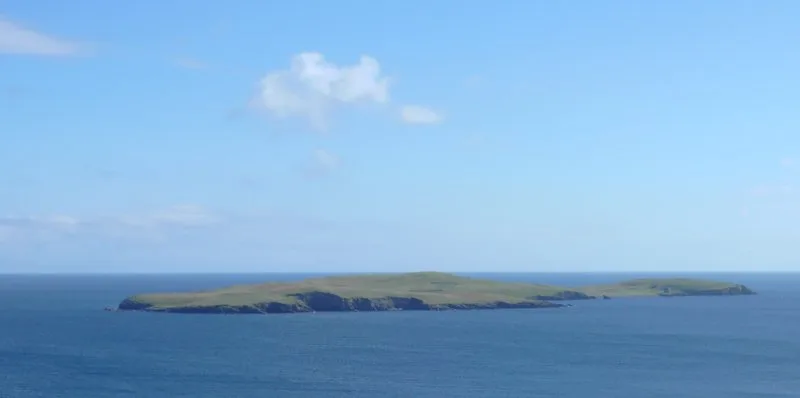
The Hamars — mountain in scotland islands. Elevation: 43 m.

Colin Smith — CC BY-SA 2.0 via Wikimedia Commons licence
Plan your visit
- Typical visit
- 3 h–8 h
- Best time of year
- Late spring – early autumn (May–Oct)
About
The Hamars is a mountain located in scotland islands. Elevation: 43 m. A named British peak recorded in OpenStreetMap. Peaks are typically named on Ordnance Survey 1:50k mapping.
Photo gallery
Place summary
The Hamars are a mountain range located in the Scottish Islands. Known for their rugged terrain and dramatic landscapes, they offer a range of outdoor activities for visitors. The area is characterised by its natural beauty and diverse wildlife, making it a notable destination for hikers and nature enthusiasts. Expect challenging trails and stunning views typical of Scotland's mountainous regions.
AI-generated from the structured facts on this page (operator, designation, listing, era). Not a substitute for visiting.
- Coordinates
- 60.0057, -1.1870
Sources
- osm: n3870147019 (ODbL)
Other places nearby
Loading nearby places…
Nearby
 ★ Iconic📷 3
Archaeological sites · Scottish Islands
Mousa Broch
Shetland's 13m Iron Age broch — the best-preserved in Scotland, 2,000 years old.
 📷 5
📷 5Memorials & monuments · Scottish Islands
Broch of Mousa
Broch of Mousa in Orkney + Shetland, United Kingdom.
 📷 5
📷 5Vineyards · Scottish Islands
Mousa,homestead 570m ENE of Broch of Mousa
Mousa,homestead 570m ENE of Broch of Mousa — a UK vineyard in scotland islands, producing English or Welsh wine from cool-climate grape varieties.
 Flagship📷 3
Islands · Scottish Islands
Mousa
Mousa — island on the east coast of South Mainland, Shetland Islands, Scotland, UK.
 📷 5
📷 5Natural landmarks · Scottish Islands
Wick of Sandsayre
Wick of Sandsayre — a natural feature in scotland islands.
 📷 3
📷 3Archaeological sites · Scottish Islands
Burraland, promontory fort
Burraland, promontory fort — a archaeological in scotland-islands, United Kingdom.
Where to eat & stay near The Hamars
Places to stay
 📷 5
📷 5Caravan parks · Scottish Islands
Cunningsburgh Touring Park
Cunningsburgh Touring Park — a caravan park in scotland islands.
 📷 5
📷 5Campsites · Scottish Islands
Levenwick Campsite
Levenwick Campsite — a campsite in scotland islands.
Hostels · Scottish Islands
Betty Mouat's Camping Böd
Betty Mouat's Camping Böd — a hostel in scotland islands.
 📷 5
📷 5Hostels · Scottish Islands
Islesburgh House Hostel
Islesburgh House Hostel — a hostel in scotland islands.
 📷 5
📷 5Caravan parks · Scottish Islands
Scalloway Caravan Park
Scalloway Caravan Park — a caravan park in scotland islands.
 📷 5
📷 5Campsites · Scottish Islands
Skeld Caravan Park and Campsite
Skeld Caravan Park and Campsite — a campsite in scotland islands.

More mountains in this region
 📷 3
📷 3Mountains & hills · Scottish Islands
Aikerness Bay
Aikerness Bay — bay in Orkney Islands, Scotland, UK.
 📷 3
📷 3Mountains & hills · Scottish Islands
Aith Hope
Aith Hope — bay in Orkney Islands, Scotland, UK.

Mountains & hills · Scottish Islands
Aith Voe
Aith Voe — bay on West Mainland, Shetland Islands, Scotland, UK.
 📷 3
📷 3Mountains & hills · Scottish Islands
Aith Voe
Aith Voe — bay on South Mainland, Shetland Islands, Scotland, UK.
Frequently asked questions
- Where is The Hamars?
- The Hamars is in the Scottish Islands, United Kingdom.
- What is The Hamars?
- The Hamars — mountain in scotland islands. Elevation: 43 m.
- How do I get to The Hamars?
- Its coordinates are 60.0057°, -1.1870°.