
Historic houses · Yorkshire & the Humber
The Hall
In or near Londonderry.
The Hall — Grade I listed building in Hambleton, United Kingdom.

Wikimedia Commons licence
Plan your visit
- Typical visit
- 1 h–2 h
- Nearest railway station
- Bedale · 6.2 km
- Family-friendly
- Limited wheelchair access
Getting there & planning your visit
To visit The Hall, the nearest railway station is Bedale, located 6.2 km away. The postcode for sat-nav is DL8 2PZ. Accessibility is limited for wheelchair users.
About
The Hall is a historic house in the United Kingdom — typically a country seat, manor, or town house with notable architecture or history. Heritage designation: Grade I listed building. Wikidata describes it as: "Grade I listed building in Hambleton, United Kingdom". Coordinates: 54.2332°, -1.5909°.
Photo gallery
Protected designations
- Area of Outstanding Natural Beauty: Nidderdale
Designations sourced from Natural England open data under OGL v3.
From the Wikipedia article
Well Hall is a historic building in Well, North Yorkshire, a village in England. The building was constructed in 1342 as the Hospital of St Richard, an almshouse in the form of a hall house. It had an undercroft, which may be 13th century. The building was heightened in the 17th century, to provide a third storey in the former attic, and at some point both the ground and first floors were divided into rooms. In 1758, the almshouse relocated to St Michael's Cottages, and a large east–west wing was added to the building, which became a private house. The building was grade I listed in 1952. The house has a T-shaped plan, with three storeys, the older part with fronts of two and three bays, and to the right is a recessed 18th-century range with four bays. There is a vaulted four-bay undercroft under the north wing. The house is built of stone with quoins and a stone slate roof. The windows are sashes, some horizontally sliding. Two in the Mediaeval wing are original pointed-arch openings. Inside, there is an early-18th century staircase, probably moved from its original location. There is also a straight stone staircase, which is supported by a tunnel and may be original 14th-century work.
Excerpt from Wikipedia under CC BY-SA 4.0. See the source article linked in Sources below.
- Coordinates
- 54.2332, -1.5909
- District
- North Yorkshire
- Parish
- Well
- Postcode
- DL8 2PZ
- Parliamentary constituency
- Thirsk and Malton
- Nearest railway station
- Bedale — 6.2 km
Sources
- wikidata: Q17538122 (CC0)
- wikipedia: Well Hall, North Yorkshire (CC BY-SA 4.0)
Other places nearby

Well
Villages · 0.5 km

The Freemasons Arms
Historic pubs · 1.8 km
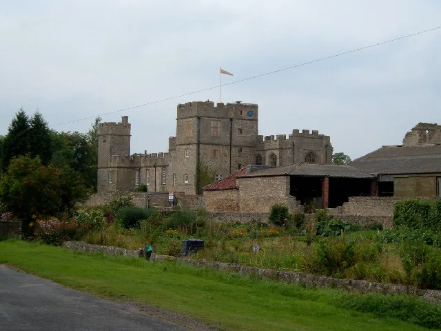
Snape Castle
Castles · 2.4 km
West Tanfield
Castles · 2.7 km

Thornborough Henges
Archaeological sites · 3.1 km

West Tanfield
Villages · 3.1 km

The Bruce Arms Inn
Historic pubs · 3.2 km

Thornborough Henges
Archaeological sites · 3.3 km

Marmion Tower
Historic houses · 3.3 km

Tanfield Castle
Literary houses · 3.3 km

Thorp Perrow Hall
Gardens · 3.5 km
Thorp Perrow Aboretum
Natural landmarks · 3.5 km
Nearby
📷 5📷 5Historic pubs · Yorkshire & the Humber
The Freemasons Arms
The Freemasons Arms in England Yorkshire, United Kingdom.
📷 3Castles · Yorkshire & the Humber
Snape Castle
Snape Castle — Grade I listed castle in North Yorkshire, England, UK.
📷 5📷 3Archaeological sites · Yorkshire & the Humber
Thornborough Henges
Thornborough Henges — a archaeological in england-yorkshire, United Kingdom.
📷 5Where to eat & stay near The Hall
Places to stay
 📷 5
📷 5Caravan parks · Yorkshire & the Humber
The Old Station Yard Caravan Site
The Old Station Yard Caravan Site — a caravan park in england yorkshire.
 📷 5
📷 5Campsites · Yorkshire & the Humber
Sleningford Watermill Caravan and Camping Park
Sleningford Watermill Caravan and Camping Park — a campsite in england yorkshire.
 📷 7
📷 7Hotels · Yorkshire & the Humber
King's Head Hotel
King's Head Hotel — a hotel in england yorkshire.
 📷 7
📷 7Hotels · Yorkshire & the Humber
Bay Horse
Bay Horse — a hotel in england yorkshire.
 📷 5
📷 5Caravan parks · Yorkshire & the Humber
Pheasant Hill Caravan Park
Pheasant Hill Caravan Park — a caravan park in england yorkshire.
 📷 5
📷 5Campsites · Yorkshire & the Humber
Bedale Camping & Caravan Park (C&CC CS)
Bedale Camping & Caravan Park (C&CC CS) — a campsite in england yorkshire.
Places to eat & drink
📷 5Historic pubs · Yorkshire & the Humber
The Freemasons Arms
The Freemasons Arms in England Yorkshire, United Kingdom.
📷 7Historic pubs · Yorkshire & the Humber
The Bruce Arms Inn
The Bruce Arms Inn in England Yorkshire, United Kingdom.
 📷 7
📷 7Historic pubs · Yorkshire & the Humber
Waggon And Horses
Waggon And Horses in England Yorkshire, United Kingdom.
 📷 6
📷 6Historic pubs · Yorkshire & the Humber
The Three Coopers
The Three Coopers in England Yorkshire, United Kingdom.
 📷 7
📷 7Historic pubs · Yorkshire & the Humber
Ye Hornblower Tavern
Ye Hornblower Tavern in England Yorkshire, United Kingdom.
 📷 7
📷 7More historic houses in this region
 📷 3
📷 3Historic houses · Yorkshire & the Humber
213, Chestergate
213, Chestergate — Grade II listed house in Stockport, Greater Manchester, England, UK.
 📷 3
📷 3Historic houses · Yorkshire & the Humber
96, Churchgate
96, Churchgate — Grade II listed house in Stockport, Greater Manchester, England, UK.
 📷 3
📷 3Historic houses · Yorkshire & the Humber
Broadbottom Hall
Broadbottom Hall — Grade II* listed house in Broadbottom, Tameside, Greater Manchester, England, UK.
.jpg?width=1200) 📷 3
📷 3Historic houses · Yorkshire & the Humber
Charles Head House
Charles Head House — house in Rainow, Cheshire East, England, UK.
Frequently asked questions
- Where is The Hall?
- The Hall is in Yorkshire, United Kingdom (postcode DL8 2PZ), in the parish of Well.
- What is The Hall?
- The Hall — Grade I listed building in Hambleton, United Kingdom.
- How do I get to The Hall?
- The nearest railway station is Bedale, about 6.2 km away. Drivers can use postcode DL8 2PZ.
- Is The Hall a listed building?
- The Hall is officially recognised as Grade I listed building listed.
- Is The Hall a protected site?
- Yes — The Hall is part of the Nidderdale National Landscape (AONB).
- How do I get to The Hall?
- The nearest railway station is Bedale, about 6.2 km away. Drivers can navigate to postcode DL8 2PZ.